
|
|
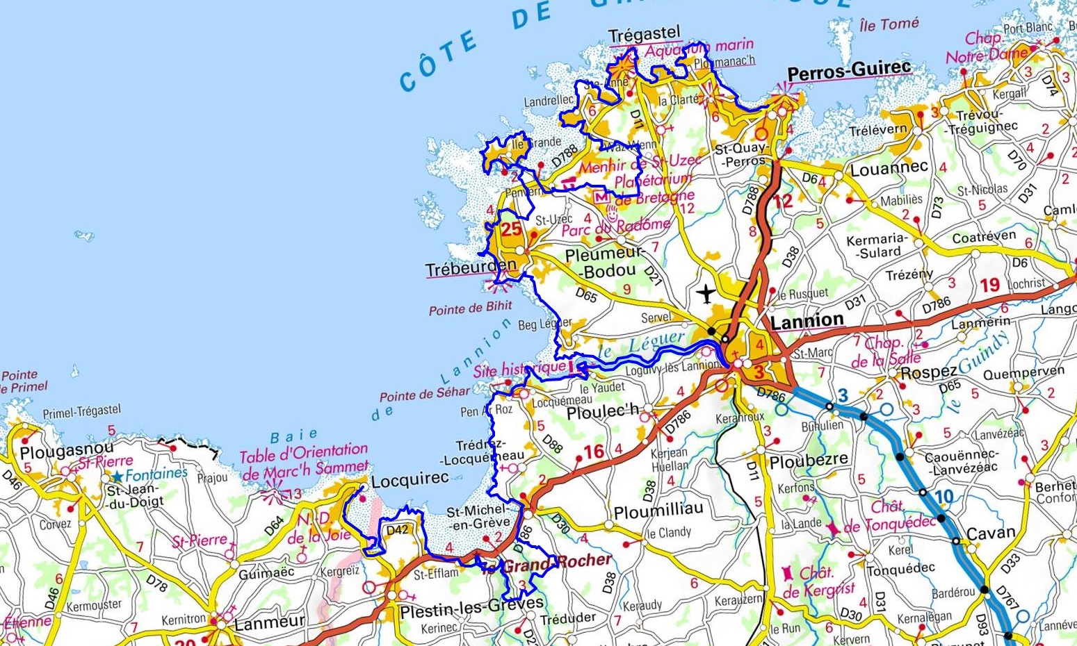
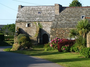
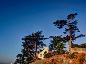
Hike in Brittany on the GR®34, Customs trail, through Cotes-d'Armor and Finistere department from Perros-Guirec to Locquirec via Barnabanec, Trebeurden, Beg-Leguer, Lannion, Tredrez-Locquemeau,Treduder and Plestin-les-Greves. Guest House, Bed and Breakfast, Hotel, Camping, Shelter, Inn, Shops. |

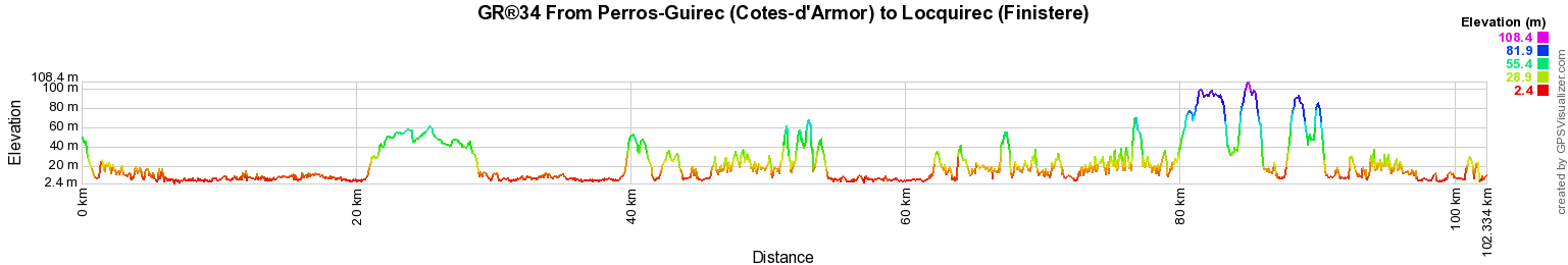
102Km
|
 © GPX Private use only |
Distance: 102km, Elevation maximum: 105m, Elevation minimum: 0m, Elevation gain uphill: 1600m
IGN Maps: Morlaix Plestin-les-Greves Carantec (0615ET). Lannion Perros-Guirec Les Sept iles Cote de Granit Rose (0714OT). Lannion Trebeurden (0715O).
Registration Accommodation or business owner on or near a GR®, you can appear on GR-INFOS For your registration, you can send me by email (papadimitriou4@gmail.com): your address and phone number, your website (Facebook page), a brief description with 5 beautiful photos of your establishment. Registration price : € 100 per GR® or GRP® for 5 years. Renewable. |
|
GR®34 Customs trail
From Mont Saint Michel (Manche) to Dinard (Ille-et-Vilaine)
From Dinard (Ille-et-Vilaine) to Pleneuf-Val-Andre (Cotes-d'Armor)
From Pleneuf-Val-Andre to Paimpol (Cotes-d'Armor)
From Paimpol to Perros-Guirec (Cotes-d'Armor)
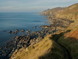
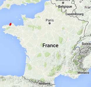
From Perros-Guirec (Cotes-d'Armor) to Locquirec (Finistere)
From Locquirec to Santec (Finistere)
From Santec to Broennou (Finistere)
From Broennou to Tregana (Finistere)
From Tregana to Camaret-sur-Mer (Finistere)
From Camaret-sur-Mer to Douarnenez (Finistere)
From Douarnenez to Trunvel (Finistere)
From Trunvel to Concarneau (Finistere)
From Concarneau to Doelan (Finistere)
From Doelan (Finistere) to Quiberon (Morbihan)
From Quiberon to Vannes (Morbihan)
From Vannes to Le Tour-du-Parc (Morbihan)
From Le Tour-du-Parc (Morbihan) to Pont d'Arm (Loire-Atlantique)
From Pont d'Arm to St Nazaire (Loire-Atlantique)
GR®34A From Brehec to Perros-Guirec (Cotes-d'Armor)
GR®34C From Neal pond (Cotes-d'Armor) to Dinard (Ille-et-Vilaine)
GR®34E From Pont de Saint-Maurice (Finistere) to Pont Neuf (Morbihan)
Around Crozon peninsula (Finistere)
Around Pays Bigouden (Finistere)

![]() It is advisable to follow the beacons all along your hike and to bring you the FFRandonnee topo-guide. You
will also find information on MonGR.fr.
It is advisable to follow the beacons all along your hike and to bring you the FFRandonnee topo-guide. You
will also find information on MonGR.fr.
GR®, PR®, GRP®, and the corresponding signs of markings (white / red, yellow and yellow / red) are trademarks of the French Federation of Hiking. They may not be reproduced without permission. The French Federation of Hiking, state-approved, includes organizations that create and maintain hiking routes on GR®, PR® and GRP®. It publishes guides these topo hiking routes.
With your donations, support the actions of the thousands of volunteer markers of the FFRandonnee.
GR-Infos.com is an editorial partner of MonGR.fr.
| Return |

Old romantic Hotel, L'Etoile Guest-House is a mountain retreat in the South of France. With a beautiful park along the Allier River, L'Etoile Guesthouse is located in La Bastide-Puylaurent between Lozere, Ardeche and Cevennes. Many hiking trails like GR®7, GR®70 Stevenson trail, GR®72, GR®700 Regordane way, Cevenol, GR®470 Allier river, Margeride, Ardechoise. Many hiking loops. The right place to relax.
Copyright©gr-infos.com (Authorization for private use only)