|
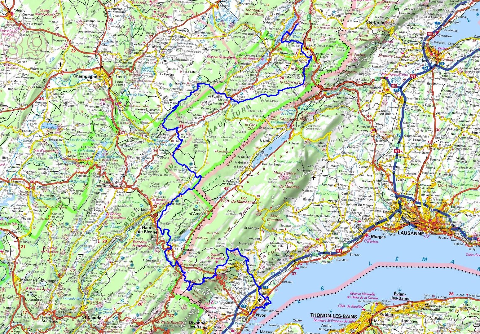
Hike on the GR®5 through le Doubs and la Haute-Savoie from Montperreux to Nyon (Leman Lake-Switzerland) via Les Hopitaux-Neufs, Les Villedieu, Mout, Chaux-Neuvehe, Chapelle-des-Bois, Les Rousses, La Cure, Saint-Cergue, Bassins, Begnins, Vich, Gland and Prangins. Guest House, Bed and Breakfast, Hotel, Camping, Shelter, Inn, Shops.
|

|

GR®5
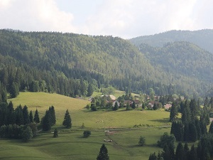
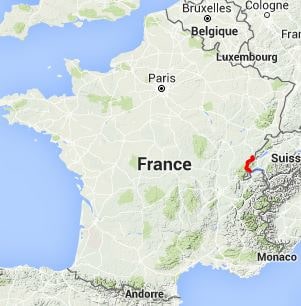
From Montperreux (Doubs) to Nyon (Leman Lake-Switzerland)
Luxembourg to Mediterranean sea
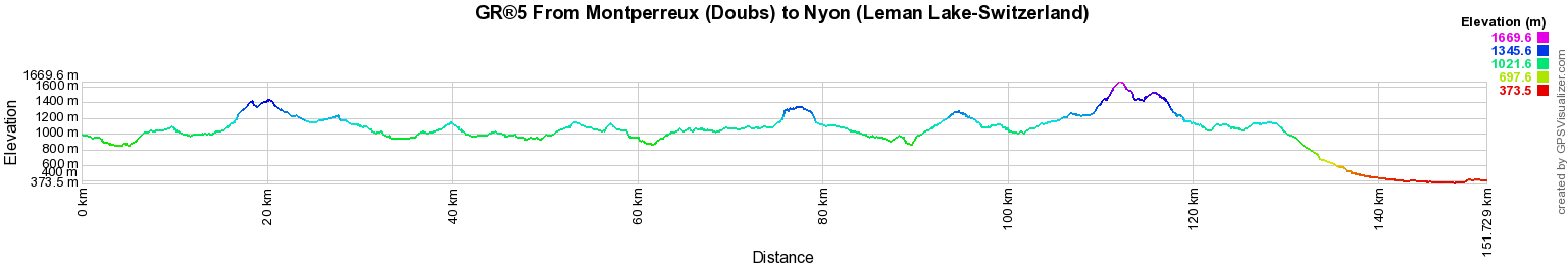
151km
Google Maps - Google Earth

© GPX Private use only |
Distance: 151km, Elevation maximum: 1670m, Elevation minimum: 374m, Elevation gain uphill: 3988m
IGN Maps: Sainte-Croix (1182). Mouthe (1201). Orbe (1202). Le Sentier (1221). Les Rousses (1240). Nyon (1261). Thonon (1262). ChampagnoLac de Chalain Pic de l'Aigle (3326ET). Morez Les Rousses Faucille Pass (3327ET). Pontarlier Levier Lac de St-Point (3425OT). Mouthe Metabief le Mont d'Or (3426OT).

Registration
Accommodation or business owner on or near a GR®, you can appear on GR-INFOS
For your registration, you can send me by email (papadimitriou4@gmail.com): your address and phone number, your website (Facebook page), a brief description with 5 beautiful photos of your establishment.
Registration price : € 100 per GR® or GRP® for 5 years. Renewable. |
|
GR®5 From Luxembourg to the Mediterranean
From Schengen (Luxembourg) to Bayonville-Sur-Mad (Meurthe-et-Moselle)
From Bayonville-Sur-Mad (Meurthe-et-Moselle) to Dieuze (Moselle)
From Dieuze (Moselle) to Andlau (Bas-Rhin)
From Andlau (Bas-Rhin) to Thann (Haut-Rhin)
From Thann (Haut-Rhin) to Soulce-Cernay (Doubs)
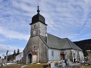
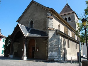
From Soulce-Cernay to Montperreux (Doubs)
From Montperreux (Doubs) to Nyon (Leman Lake-Switzerland)
From Thonon-les-Bains to Les Houches (Haute-Savoie)
From Les Houches (Haute-Savoie) to Bessans (Savoie)
From Bessans (Savoie) to Montgenevre (Hautes-Alpes)
From Montgenevre (Hautes-Alpes) to St Dalmas-le-Selvage (Alpes-Maritimes)
From St Dalmas-le-Selvage to Nice (Alpes-Maritimes)
GR®5B From the Pastoral Hut of Thures to the Oratory of Saint Roch (Hautes-Alpes)
GR®5C From Nevache to Briancon (Hautes-Alpes)
GR®5E From Bonneval-sur-Arc to Modane (Savoie)
GR®5F Moselle Valley
GR®5G From Saarbrücken (Germany) to Metz (Moselle)

|
 It is advisable to follow the beacons all along your hike and to bring you the FFRandonnee topo-guide. You
will also find information on MonGR.fr.
It is advisable to follow the beacons all along your hike and to bring you the FFRandonnee topo-guide. You
will also find information on MonGR.fr.
GR®, PR®, GRP®, and the corresponding signs of markings (white / red, yellow and yellow / red) are trademarks of the French
Federation of Hiking. They may not be reproduced without permission. The French Federation of Hiking, state-approved, includes organizations that create and maintain hiking routes on GR®, PR® and
GRP®. It publishes guides these topo hiking routes.
With your donations, support the actions of the thousands of volunteer markers of the FFRandonnee.
GR-Infos.com is an editorial partner of MonGR.fr.

Old romantic Hotel, L'Etoile Guest-House is a mountain retreat in the South of France. With a beautiful park along the Allier River, L'Etoile Guesthouse is located in La Bastide-Puylaurent between Lozere, Ardeche and Cevennes. Many hiking trails like GR®7, GR®70 Stevenson trail, GR®72, GR®700 Regordane way, Cevenol, GR®470 Allier River Springs and Gorges, Margeride, Ardechoise. Many hiking loops. The right place to relax.
Copyright©gr-infos.com (Authorization for private use only)