|
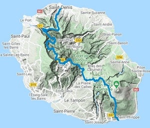
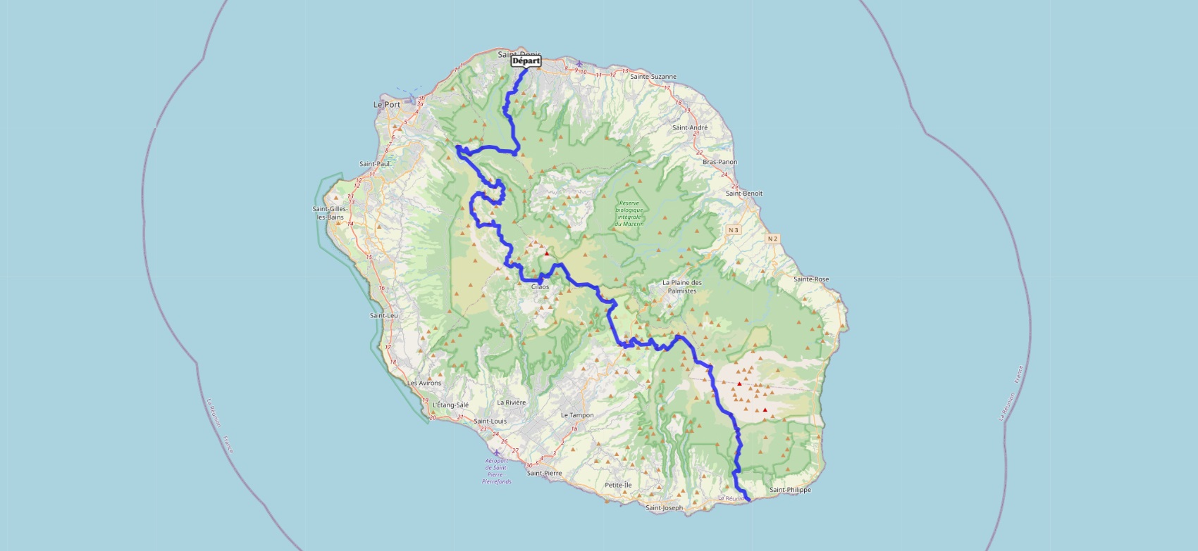
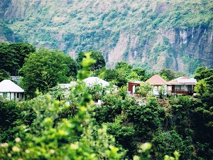
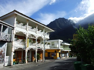
Hike on the GRR2 across Reunion Island from Saint Denis to Le Baril (Saint-Philippe) via Bellepierre, Le Brule, La Roche Ecrite, Dos d'Ane, Aurere, Cayenne, Roche-Plate, Marla, le Col de Taïbit, Ilet des Salazes, la Cascade du Bras Rouge, Cilaos, La Plaine des Cafres and le Piton de la Fournaise. Guest House, Bed and Breakfast, Hotel, Camping, Shelter, Inn, Shops.
|

|

GR®R2
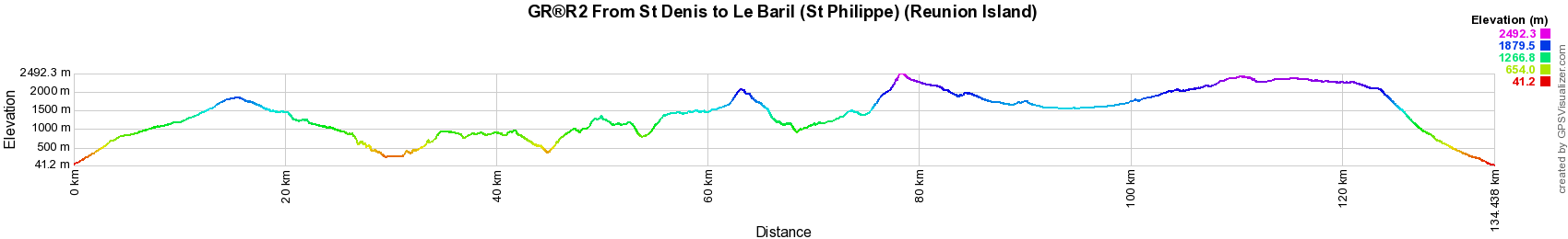
From St Denis to Le Baril (St Philippe) (Reunion Island)
134km
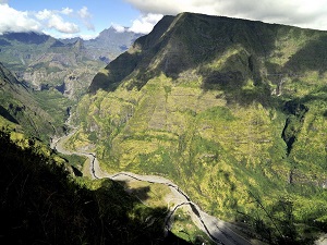
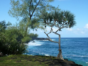
Reunion Island was discovered by the Portuguese in 1513. It was then colonized by the French, Dutch and English before becoming definitively French in 1810. Colonization left a deep mark on the island, both both culturally and socially. African slaves, French settlers and Indian workers all helped shape Reunion's identity. Reunion Island has a very diverse fauna and flora. It is home to a wide variety of endemic species, including the green lizard, the pink pigeon and the red palmetto. Reunion is also known for its magnificent landscapes, with its volcanoes, waterfalls and black sand beaches.
Google Maps - Google Earth

© GPX Private use only |
Distance: 134km, Elevation maximum: 2496m, Elevation minimum: 41m, Elevation gain uphill: 10122m
IGN Maps: St-Denis Cirques de Mafate et de Salazie (4402RT). Saint-Pierre (4405RT).

Registration
Accommodation or business owner on or near a GR®, you can appear on GR-INFOS
For your registration, you can send me by email (papadimitriou4@gmail.com): your address and phone number, your website (Facebook page), a brief description with 5 beautiful photos of your establishment.
Registration price : 100€/5 years per GR® or GRP®. Renewable. |
GR®R1 Around Piton des Neiges
GR®R2 From St Denis to Le Baril (St-Philippe)
GR®R3 Around Mafate Circus
 It is advisable to follow the beacons all along your hike and to bring you the FFRandonnee topo-guide. You
will also find information on MonGR.fr.
It is advisable to follow the beacons all along your hike and to bring you the FFRandonnee topo-guide. You
will also find information on MonGR.fr.
GR®, PR®, GRP®, and the corresponding signs of markings (white / red, yellow and yellow / red) are trademarks of the French
Federation of Hiking. They may not be reproduced without permission. The French Federation of Hiking, state-approved, includes organizations that create and maintain hiking routes on GR®, PR® and
GRP®. It publishes guides these topo hiking routes.
With your donations, support the actions of the thousands of volunteer markers of the FFRandonnee.
GR-Infos.com is an editorial partner of MonGR.fr.

Old romantic Hotel, L'Etoile Guest-House is a mountain retreat
in the South of France. With a beautiful park along the Allier River, L'Etoile Guesthouse is located in La Bastide-Puylaurent between Lozere, Ardeche and Cevennes. Many hiking
trails like GR®7, GR®70 Stevenson trail, GR®72, GR®700 Regordane way, Cevenol, GR®470 Allier River Springs and Gorges, Margeride, Ardechoise. Many hiking loops. The
right place to relax.
Copyright©gr-infos.com (Authorization for private use only)