|
|
A unique land shared between Aveyron, Cantal and Lozère, which meet at the Cross of the Three Bishops, Aubrac is a high granite plateau |
Volcanic Massif of 40 km long and 4 to 18 km wide, spread over 450 km2 along a northwest-southeast axis, Aubrac is one of the middle mountains, with rugged features, the most typical of the Massif Central. It culminates at the Signal de Mailhebiau, at 1,469 m above sea level.
Image de Signal de Mailhebiau, AubracS'ouvre dans une nouvelle fenêtre
This high massif is composed of an accumulation of basaltic flows that rest on a dissymmetric crystalline basement. In the southwest, short and steep slopes allow you to go from the top of the Aubrac to the Lot valley in a few kilometers. The incisions of the many torrents (the Boraldes) deeply dissect this slope. Thus, the Boralde de Saint-Chély-d'Aubrac which rises around 1,340 m, is only 800 m in the village of Saint-Chély located only 8.5 km from the summits. The eastern slope, by contrast, is a vast plateau with heavy and monotonous forms, with a rolling topography, which allows you to pass without a clear transition, to the low plateaus of Margeride in the region of Aumont-Aubrac and Saint-Chély-d'Apcher.
Basaltic flows on the Aubrac are linked to fissured volcanism. Between the basalt flows, pyroclastic formations abound. These materials (mostly cineritic) constitute half of the volume of the edifice, but this volume is not distributed in a series of individualized edifices; most of it is arranged in regular alternation with basalts. Most of the pyroclastic materials present very red levels, visible along the summit roads and at the whim of the few existing incisions. These red levels have sometimes been interpreted as elements of paleosols, witnesses of warm climates; in fact, they result from cooking phenomena due to the arrival of high-temperature flows.
It has long been assumed that the volcanism of the Aubrac dates from the Villafranchian; recent work suggests that it occurred between the operation of the Cantal and the installation of the basaltic points of the Causse de Séverac-le-Château. The volcanic outpourings of Aubrac would therefore have occurred much earlier, between 8 and 7.5 million years ago, and short manifestations took place again around 5.8 million years ago. Volcanic phenomena occurred on a basement that had already been fractured by Hercynian faults, and it was along these faults that volcanism manifested itself.
The examination of the Aubrac cannot be complete without the study of its basement borders. In the North-North-East, granite dominates widely while metamorphic material is observed in the South and South-West of the basaltic axis, where the steep and well-dissected landscape appears by the Boraldes.
The North-North-East granite belongs to the southwestern termination of the Margeride massif; it is predominantly porphyroid but it is also accompanied, at Saint-Rémy-de-Chaudesaignes and north of Laguiole, by a two-mica granite, with finer grains.
The volcanic plateaus of the Aubrac and their basement border were covered with ice during the Quaternary, forming a small ice cap. The ice originated from the volcanic axis and covered the entire Aubrac plateau. Short tongues of ice escaped from the ice cap itself, following the main valleys. The valleys on the southern slope retain few unambiguous inheritances due to the active cleaning by melting waters. On the other hand, glaciation was more important in the northeast, or at least the inheritances are better preserved there.
The ice cap was relatively thin, with an estimated thickness of 150-250 meters. As a result, the erosive role of the ice was reduced. The ice was installed on a shallowly sloping substrate, and it moved slowly. It was only where tongues of ice formed that the action of the ice was more marked. The granites in the region of Pont-de-Gournier on the Bès, north of Nasbinals, retain well-visible polishes on polished rocks.
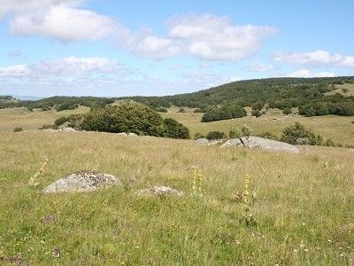
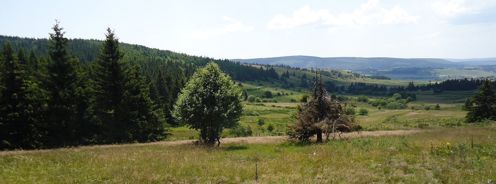
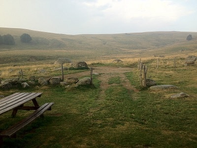
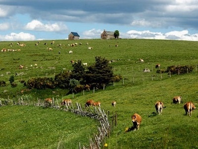
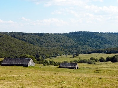
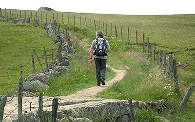
The plateaus of Aubrac, rugged, beaten by the winds, are treeless. Nowhere in mountainous Auvergne does the forest hold so little place. It is found only between the villages of Aubrac, Saint-Urcize and Laguiole and on the southwest slope of the massif. Everywhere else, the hilly plateau, which rises gently to just over 1,400 meters above sea level, is covered with a uniform grassy carpet: monotonous horizons of Aubrac where the landscape is punctuated by dry-stone walls that enclose vast plots of land, run along the mountain sides, and frame sunken paths that wind their way deep into the countryside. Farms are rare, isolated or gathered together, especially in the northern part, in small hamlets. They are built in a block, low, seeking shelter from the wind, from the "burle" that whistles over the plateau. In the highest part, in a triangle Marchastel, Aubrac, Saint-Urcize, you can still see burons, often abandoned.
The impression that prevails first is that of isolation: few people, no cities, one is here confronted with nature which imposes harsh living conditions. The winter is harsh and it is long. The snow is abundant, the long poles stuck in the ground that line the roads remind us of this, and a sign advises travelers against taking the Nasbinals-Aubrac road in case of storm.
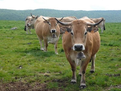
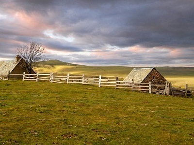 The unity of Aubrac and its landscapes is real. This massif is nevertheless divided between three departments (Cantal, Lozère, Aveyron) belonging to three different regions. Isolated, rugged, the high plateau of Aubrac is also a land of borders. The landscape, with its meadows and its immense pastures, the farm with its livestock buildings, the burons on the slopes of the heavy ridges, all indicate an agricultural economy based on livestock and pastoral life; and it is true that Aubrac, like Cantal, has practiced cattle breeding for milk production, this latter being used to make a cheese in the buron, the "laguiole", practically identical to the Cantal fourme. This traditional breeding was based on the Aubrac breed, with a light coat, certainly the most rustic of the Massif Central, which like the Salers breed, provided milk, meat, and work. The pastures often belonged to large landowners to whom the small peasants entrusted their animals for the summer. This situation has led to two types of consequences. Aubrac has welcomed herds of transhumants from Languedoc to its high pastures for the summer season. The low hay production forced the sale of part of the livestock, which is why the fairs have multiplied in the small centers of the mountains. It must be said that the presence of plateaus at sub-equal altitudes, the absence of beautiful valleys very deeply incised similar to those offered by Cantal, explain that there are not two floors of grass here: meadows for the winter hay and summer pastures. Aubrac is closer to Cézallier or the plateau located between Meygal and Mézenc. If the meadows for haymaking are lacking, the pastures are immense. The statistics of the Lozère Aubrac indicate that meadows occupy only 30% of the SAU, while grazing, pastures account for nearly 69% (which leaves 1% of the SAU for a few crops, mainly potatoes).
The Aubrac livestock system is complex; milk and cheese are produced, but like in Cantal, calves are also sold.
Small farms, as well as large-scale farms, have experienced a significant wave of abandonment. Depopulation has been severe and many people from Aubrac live in Paris. This very clear demographic decline explains the low densities of today and this feeling of immensity, solitude, and weak human presence. But the people of Aubrac have resisted, first looking to improve the productivity of their herds; for a long time, they have practiced crossbreeding the local breed with the Charolais breed, in order to have both milk and well-shaped animals for butchery. They adopt animals that are more "performing" than Aubrac cows. However, crossbreeding with Charolais almost caused the pure Aubrac breed to disappear, a breed that is now being re-evaluated as being more adapted and less fragile than others.
The Laguiole cheese (40 to 50 kg), originally made on farms in burons, saw its production decline due to the strong rural exodus and the scarcity of labor. Production of 600 tonnes in 1928 had fallen to 25 tonnes in 1958. Since that date, Laguiole has been awarded an AOC (Appellation d'Origine Contrôlée), the criteria of which were redefined in 1976 (cheese made between May 25 and October 30 with milk produced on pastures located at an altitude of more than 800 meters and aged for 120 days). The AOC area covers 24 communes. This cheese is now mainly produced in dairies, under the impetus of a cooperative born in the west of Aubrac, whose production is constantly increasing. Attempts are being made to relaunch the cheese made in the buron through an experiment carried out near Saint-Urcize. We are looking for new outlets for a "typical" product of the "terroir".
In addition to the intensification of dairy production and the organization of producers, beef farming has developed within the framework of fairly large farms. Young animals are sent to market after one or more seasons of grazing: an evolution towards an extensive type, which accommodates a smaller workforce and benefits from the vast areas available. For the only communes of the Lozère Aubrac (in the east), statistics indicate that meat production is becoming almost exclusive - which is not the case in the west - within the framework of farms that, for about half, exceed 50 hectares. Outside of agriculture, the small centers of Aubrac, Nasbinals, Saint-Urcize, and Laguiole are orienting themselves towards tourism.
Old romantic Hotel, L'Etoile Guest-House is a mountain retreat in the South of France. With a beautiful park along the Allier River, L'Etoile Guesthouse is located in La Bastide-Puylaurent between Lozere, Ardeche and Cevennes. Many hiking trails like GR®7, GR®70 Stevenson trail, GR®72, GR®700 Regordane way, Cevenol, GR®470 Allier River Springs and Gorges, Margeride, Ardechoise. Many hiking loops. The right place to relax.
Copyright©gr-infos.com