
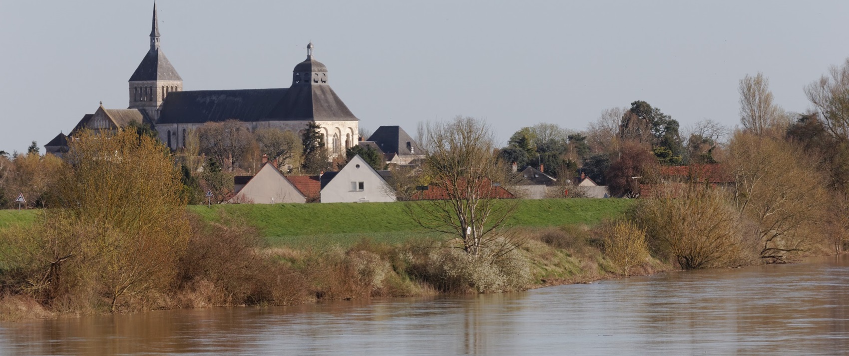
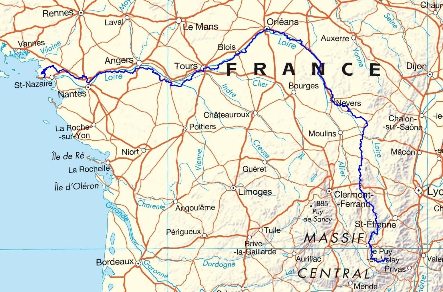
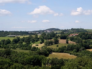
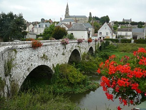
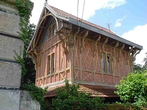
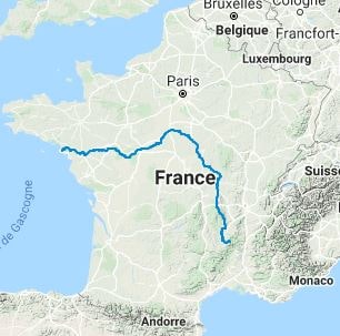
The GR®3, also known as the Sentier de la Loire, holds the distinction of being the first officially marked long-distance hiking trail in France. It traces the course of the Loire, Europe’s last great wild river, from its source at Mont Gerbier-de-Jonc in the Ardèche all the way to its estuary at the Porte Saint-Michel of the fortified city of Guérande, in the Loire-Atlantique. In a recent development, the trail has been extended to the port city of La Baule, taking hikers through the picturesque salt marshes. Spanning a distance of 1,300 km, the trail meanders through 3 regions and 12 departments, offering hikers a chance to immerse themselves in the wild landscapes of the river, the diverse flora and fauna of the parks and reserves, and the vast forests. Moreover, it showcases the splendor of the numerous gardens and castles of the Loire, which have earned a place on UNESCO’s World Heritage list. The GR®3 is more than just a hiking trail; it’s a journey through history. As you traverse the route, you’ll come across a series of historic towns such as Orléans, Tours, Nantes, Saumur, Gien, Nevers, and Le Puy-en-Velay. The trail also offers the unique opportunity to explore the intoxicating vineyards of the Loire Valley.

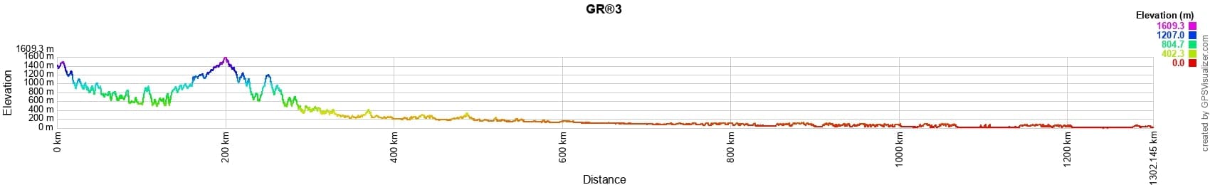
 Distance: 1300km, Elevation maximum: 1609m, Elevation minimum: 0m, Elevation gain uphill: 15823m
![]() It is advisable to follow the beacons all along your hike and to bring the FFRandonnee topo-guide. You will also find information on MonGR.fr.
It is advisable to follow the beacons all along your hike and to bring the FFRandonnee topo-guide. You will also find information on MonGR.fr.
GR®, PR®, GRP®, and the corresponding signs of markings (white/red, yellow and yellow/red) are trademarks of the French Federation of Hiking. They may not be reproduced without permission. The French Federation of Hiking, state-approved, includes organizations that create and maintain hiking routes on GR®, PR® and GRP®. It publishes guides for these topo hiking routes. With your donations, support the actions of the thousands of volunteer markers of the FFRandonnee.
GR-Infos.com is an editorial partner of MonGR.fr.
| Return |

Former holiday hotel with a garden along the Allier, L'Etoile Guest House is located in La Bastide-Puylaurent between Lozere, Ardeche, and the Cevennes in the mountains of Southern France. At the crossroads of GR®7, GR®70 Stevenson Path, GR®72, GR®700 Regordane Way, GR®470 Allier River springs and gorges, GRP® Cevenol, Ardechoise Mountains, Margeride. Numerous loop trails for hiking and one-day biking excursions. Ideal for a relaxing and hiking getaway.
Copyright©gr-infos.com (Authorization for private use only)
To help us maintain and improve GR-Infos.com, a €2 contribution is appreciated via Wero or bank transfer. Thank you!