

GR®532
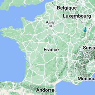
From Lutzelbourg (Moselle) to Liepvre (Haut-Rhin)
Vosges crest and high valleys
132km
|
132km
|
|
 © GPX Private use only |
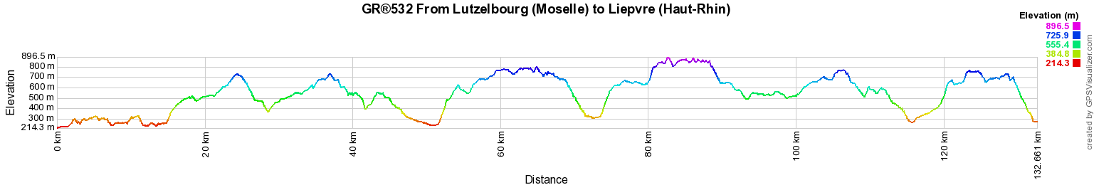
Distance: 132km, Elevation maximum: 896m, Elevation minimum: 214m, Elevation gain uphill: 4582m
IGN Maps: 3616OT - LAC DE PIERRE-PERCÉE ABRESCHVILLER LE DONON. 3617OT - SAINT-DIÉ-DES-VOSGES SENONES FRAIZE. 3715ET - SAVERNE WASSELONNE ROCHER DE DABO. 3715OT - SARREBOURG PHALSBOURG PAYS DES ÉTANGS. 3716ET - LE DONON OBERNAI LE MONT SAINT-ODILE VALLÉE DE LA BRUCHE. 3717ET - BARR LE HOHWALD VILLÉ HAUTE VALLÉE DE LA BRUCHE. 3718OT - SÉLESTAT COL DU BONHOMME SAINTE-MARIE-AUX-MINES KAYSERSBERG RIQUEWIHR.
Registration Accommodation or business owner on or near a GR®, you can appear on GR-INFOS For your registration, you can send me by email (papadimitriou4@gmail.com): your address and phone number, your website (Facebook page), a brief description with 5 beautiful photos of your establishment. Registration price : 25€/year or 100€/5 years per GR® or GRP®. Renewable. |
|
GR®532 Vosges crest and high valleys
From Wissembourg (Bas-Rhin) to Lutzelbourg (Moselle)
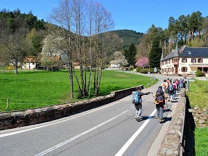
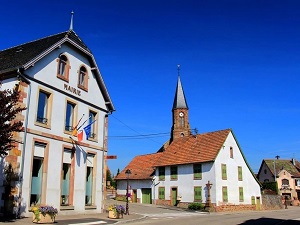
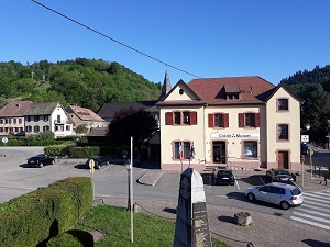
From Lutzelbourg (Moselle) to Liepvre (Haut-Rhin)
From Liepvre (Haut-Rhin) to Etueffont (Territoire de Belfort)
From Etueffont (Territoire de Belfort) to Mulhouse (Haut-Rhin)
![]() It is advisable to follow the beacons all along your hike and to bring you the FFRandonnee topo-guide. You
will also find information on MonGR.fr.
It is advisable to follow the beacons all along your hike and to bring you the FFRandonnee topo-guide. You
will also find information on MonGR.fr.
GR®, PR®, GRP®, and the corresponding signs of markings (white / red, yellow and yellow / red) are trademarks of the French Federation of Hiking. They may not be reproduced without permission. The French Federation of Hiking, state-approved, includes organizations that create and maintain hiking routes on GR®, PR® and GRP®. It publishes guides these topo hiking routes.
With your donations, support the actions of the thousands of volunteer markers of the FFRandonnee.
GR-Infos.com is an editorial partner of MonGR.fr.

|
| Return |
Old romantic Hotel, L'Etoile Guest-House is a mountain retreat in the South of France. With a beautiful park along the Allier River, L'Etoile Guesthouse is located in La Bastide-Puylaurent between Lozere, Ardeche and Cevennes. Many hiking trails like GR®7, GR®70 Stevenson trail, GR®72, GR®700 Regordane way, Cevenol, GR®470 Allier River Springs and Gorges, Margeride, Ardechoise. Many hiking loops. The right place to relax.
Copyright©gr-infos.com (Authorization for private use only)
