|
Hike on the GR®653 Via Tolosana (Way of Arles) towards Santiago de Compostela through Bouches-du-Rhone, Gard and Herault department from Arles to Montarnaud via Saint-Gilles, Vauvert, Gallargues-le-Montueux, Baillargues, Castelnau-le-Lez, Montpellier and Grabels. Guest House, Bed and Breakfast, Hotel, Camping, Shelter, Inn, Shops.
|

|

GR®653
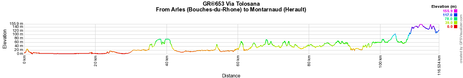
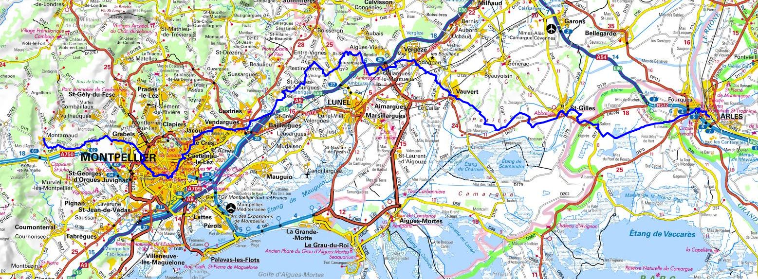
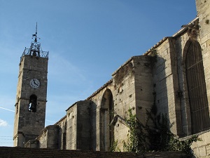
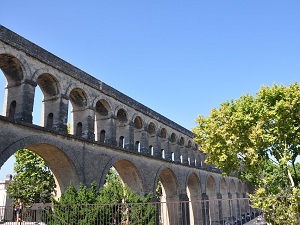
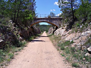
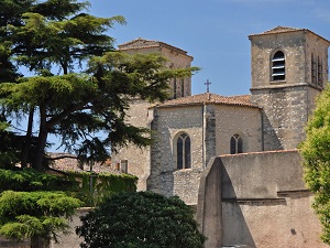
From Arles (Bouches-du-Rhone) to Montarnaud (Herault)
Via Tolosana - Way of Arles
Santiago de Compostela
116km
Google Maps - Google Earth

© GPX Private use only |
Distance: 116km, Elevation maximum: 155m, Elevation minimum: 1m, Elevation gain uphill: 692m
IGN Maps: Clermont-l'Herault (2643E). Montpellier Palavas-les-Flots (2743ET). Aigues-Mortes
la Grande-Motte (2843OT). Arles PNR de Camargue (2943ET). St-Gilles Vauvert (2943O).

Registration
Accommodation or business owner on or near a GR®, you can appear on GR-INFOS
For your registration, you can send me by email (papadimitriou4@gmail.com): your address and phone number, your website (Facebook page), a brief description with 5 beautiful photos of your establishment.
Registration price : 25€/year or 100€/5 years per GR® or GRP®. Renewable. |
GR®653 Via Tolosana - Way of Arles
From Arles (Bouches-du-Rhone) to Montarnaud (Herault)
From Montarnaud to Castanet-le-Haut (Herault)
From Castanet-le-Haut (Herault) to Dourgne (Tarn)
From Dourgne (Tarn) to Toulouse (Haute-Garonne)
From Toulouse (Haute-Garonne) to Auch (Gers)
From Auch (Gers) to Morlaas (Pyrenees-Atlantiques)
From Morlaas to Somport Pass (Pyrenees-Atlantiques)
 It is advisable to follow the beacons all along your hike and to bring you the FFRandonnee topo-guide. You
will also find information on MonGR.fr.
It is advisable to follow the beacons all along your hike and to bring you the FFRandonnee topo-guide. You
will also find information on MonGR.fr.
GR®, PR®, GRP®, and the corresponding signs of markings (white / red, yellow and yellow / red) are trademarks of the French
Federation of Hiking. They may not be reproduced without permission. The French Federation of Hiking, state-approved, includes organizations that create and maintain hiking routes on GR®, PR® and
GRP®. It publishes guides these topo hiking routes.
With your donations, support the actions of the thousands of volunteer markers of the FFRandonnee.
GR-Infos.com is an editorial partner of MonGR.fr.

Old romantic Hotel, L'Etoile Guest-House is a mountain retreat
in the South of France. With a beautiful park along the Allier River, L'Etoile Guesthouse is located in La Bastide-Puylaurent between Lozere, Ardeche and Cevennes. Many hiking
trails like GR®7, GR®70 Stevenson trail, GR®72, GR®700 Regordane way, Cevenol, GR®470 Allier River Springs and Gorges, Margeride, Ardechoise. Many hiking loops. The
right place to relax.
Copyright©gr-infos.com (Authorization for private use only)