
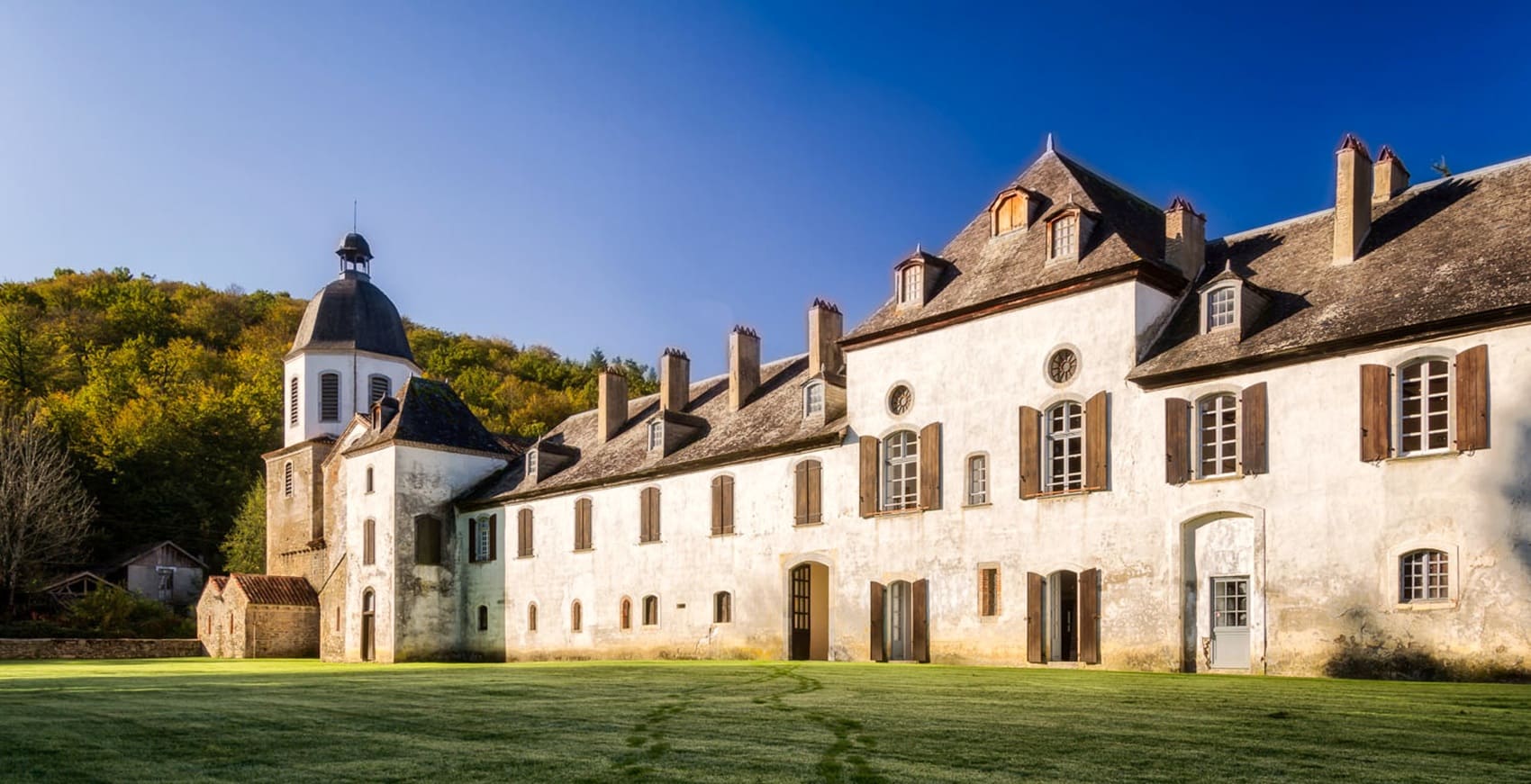
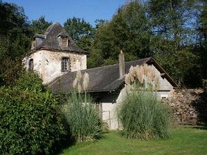
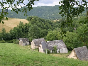
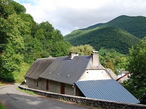
Starting in Uzer, this hike through the heart of the Baronnies de Bigorre reveals a carefully preserved area of the Hautes-Pyrénées, often nicknamed the "Little Amazon" for its extraordinarily lush forests of boxwood and moss. The trail quickly leads to the Escaladieu Abbey, a magnificent 12th-century Cistercian gem, before passing through charming, unspoiled villages like Bonnemazon and Bourg-de-Bigorre, where the traditional rural stone architecture remains beautifully intact. Climbing steadily towards Esparros, hikers will discover a fascinating geological heritage, most notably the Gouffre d'Esparros—a spectacular chasm famous for its unique and delicate aragonite deposits. The surrounding landscape is composed of verdant, rolling hills and hidden, quiet valleys where nature fully reclaims its territory between Bioussa and Asque. Ultimately, this route offers a striking and memorable contrast between gentle, open meadows and the deeply mystical atmosphere found within the dense undergrowth of the Gourgue d'Asque.
Nestled in the heart of the Hautes-Pyrénées, the Baronnies de Bigorre form a beautifully preserved haven where time seems to stand still between the rolling plains and the high mountains. This foothill region is distinguished by its secluded, undulating landscape, meticulously sculpted by centuries of traditional pastoralism and a bountiful natural environment where ancient boxwood and beech forests vigorously flourish. Its rich historical heritage is vividly marked by the imposing silhouette of Mauvezin Castle, a robust medieval fortress restored by Gaston Fébus, which watches protectively over authentic villages topped with classic slate roofs. The geology of the area is truly spectacular, featuring the Esparros chasm—a veritable underground crystal garden—and the Labastide Prehistoric Site, which bears profound witness to millennia of human occupation. The landscapes, gracefully alternating between vibrant, verdant meadows and stark limestone ridges, offer completely unique and sweeping panoramas of the majestic Pyrenees mountain range.
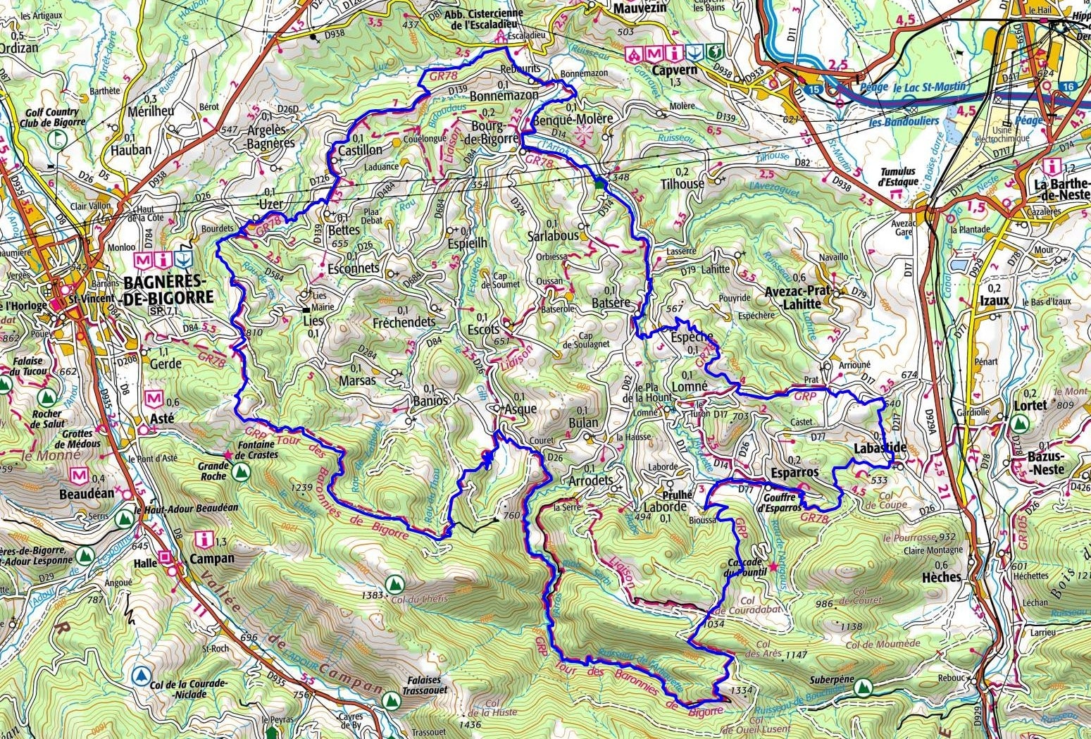
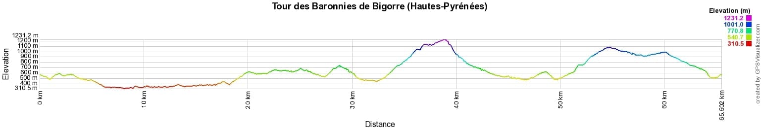

 Distance: 65km, Elevation maximum: 1230m, Elevation minimum: 316m, Elevation gain uphill: 2662m
IGN Maps: Tournay - Capvern - 1746E. Bagneres-De-Bigorre Pic du Midi de Bigorre Vallee de Campan - 1747ET.
Nearby paths:
![]() It is advisable to follow the beacons all along your hike and to bring the FFRandonnée topo-guide. You will also find information on MonGR.fr.
It is advisable to follow the beacons all along your hike and to bring the FFRandonnée topo-guide. You will also find information on MonGR.fr.
GR®, PR®, GRP® and the corresponding markings are trademarks of the French Federation of Hiking. They may not be reproduced without permission. The French Federation of Hiking, state-approved, includes organizations that maintain hiking routes. It publishes guides for these routes. With your donations, support the actions of the thousands of volunteer markers of the FFRandonnée.
GR-Infos.com is an editorial partner of MonGR.fr.
| Return |

Former holiday hotel with a garden along the Allier, L'Etoile Guest House is located in La Bastide-Puylaurent between Lozere, Ardeche, and the Cevennes in the mountains of Southern France. At the crossroads of GR®7, GR®70 Stevenson Path, GR®72, GR®700 Regordane Way, GR®470 Allier River springs and gorges, GRP® Cevenol, Ardechoise Mountains, Margeride. Numerous loop trails for hiking and one-day biking excursions. Ideal for a relaxing and hiking getaway.
Copyright©gr-infos.com (Authorization for private use only)
To help us maintain and improve GR-Infos.com, a contribution of 2€ is desired via Wero or bank transfer. Thank you!