
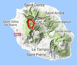
Hike the GR®R3 trail in Reunion Island, looping around the Mafate Cirque from Piton Marmite. The route passes through Col des Bœufs, Plaine des Tamarins, Ilet Georges, Maison Laclos, Marla, Trois Roches, Roche Plate, Ilet des Orangers, Lataniers, Aurère, Ilet à Malheur, and Grand Rein. Along the way, you will find various accommodations including guest houses, bed and breakfasts, hotels, campsites, shelters, and inns, as well as local shops.

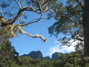
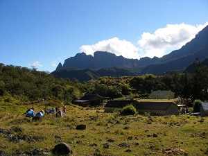
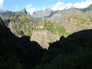
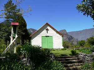
The GR®R3, the Tour of the Mafate Cirque, is a unique long-distance hiking experience in the heart of Réunion Island, a UNESCO World Heritage Site. The landscape is spectacularly beautiful, entirely bordered by vertiginous volcanic ramparts and dotted with isolated hamlets, accessible only by trails. The history of this cirque is that of a refuge: it was once inhabited by runaway slaves, the "Maroon Blacks," who established a unique Creole culture there. The flora is exceptionally rich in endemic species, with hyper-humid forests of native woods and tree ferns. The fauna is adapted to this isolation, including endemic birds, requiring special attention to biodiversity. The trail offers a complete immersion in the lives of the Mafate people and the living history of the highlands.
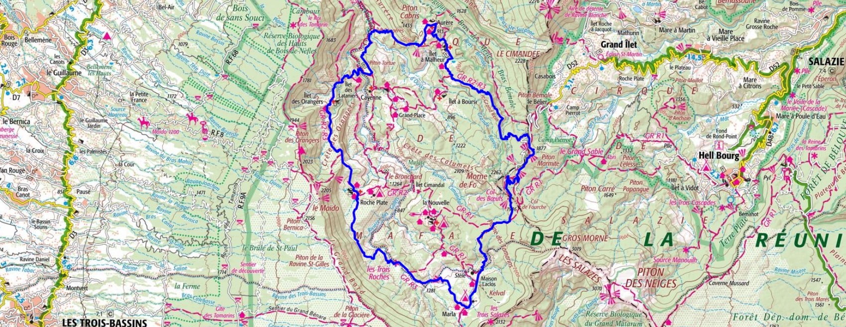
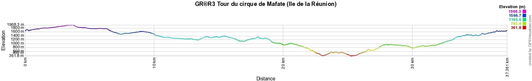

 Distance: 37km, Elevation maximum: 1964m, Elevation minimum: 320m, Elevation gain uphill: 3729m
IGN Maps: St-Denis Cirques de Mafate et de Salazie (4402RT).
Nearby paths:
![]() It is advisable to follow the beacons all along your hike and to bring the FFRandonnée topo-guide. You will also find information on MonGR.fr.
It is advisable to follow the beacons all along your hike and to bring the FFRandonnée topo-guide. You will also find information on MonGR.fr.
GR®, PR®, GRP® and the corresponding markings are trademarks of the French Federation of Hiking. They may not be reproduced without permission. The French Federation of Hiking, state-approved, includes organizations that maintain hiking routes. It publishes guides for these routes. With your donations, support the actions of the thousands of volunteer markers of the FFRandonnée.
GR-Infos.com is an editorial partner of MonGR.fr.
| Return |

Former holiday hotel with a garden along the Allier, L'Etoile Guest House is located in La Bastide-Puylaurent between Lozere, Ardeche, and the Cevennes in the mountains of Southern France. At the crossroads of GR®7, GR®70 Stevenson Path, GR®72, GR®700 Regordane Way, GR®470 Allier River springs and gorges, GRP® Cevenol, Ardechoise Mountains, Margeride. Numerous loop trails for hiking and one-day biking excursions. Ideal for a relaxing and hiking getaway.
Copyright©gr-infos.com (Authorization for private use only)
To help us maintain and improve GR-Infos.com, a contribution of 2€ is desired via Wero or bank transfer. Thank you!