
|
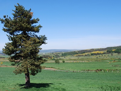
From the summit of Moure de la Gardille, the view is exceptional: to the North and East, you can distinguish the Mézenc, the High Ardèche, Lake Charpal, the Goulet and the ridges of Mont Lozère.
|
|
The Allier’s springs on the Moure de la Gardille
 A summit peaking at 1503 m, which can be located ‘south of Cheylard l’Evêque’, or ‘west of La Bastide-Puylaurent’, small localities that are reached from Langogne. Thank you, Mr. Scholar. 200,000 visitors per year, it is said, on the fairground parking lot of Gerbier, maybe a few dozen at the source of Moure de la Gardille. Vexing. Of course, the Allier does not have the prestige of the ‘longest river in France’, the ‘river of Kings’, but, in regard to the length and volume of the two watercourses, downstream of Nevers, some - especially in Limagne - ask the question of which is the river, which is the tributary… Geographers have decided, even if the salmon, they think differently, who always turn right at the beak of Allier, 400 km from the sources.
Regarding the latter, if there is injustice as to their notoriety, it also holds a problem of access: while four tarmacked roads converge at Gerbier, only a few forest tracks and paths in the heather allow access to Moure.
 Here is the domain of all kinds of hikers, hunters, and gatherers: a grandiose no man’s land including the 10,000 hectares of the immense forest of the former Mercoire Abbey, a rather soft relief with an endless and panoramic ridge line, traveled by the GR®7, the Vosges - Pyrenees long-distance hiking trail, among the most famous in France.
From the summit of Moure de la Gardille, the view is exceptional: to the North and East, you can distinguish the Mézenc, the High Ardèche, Lake Charpal, to the South two parallel chains: the Goulet in the foreground, the ridges of Lozère that block the horizon line. We are on the tip of the roof of France: 1500 meters from the source of the Allier, that of the Chassezac, which brings its waters to the Rhône, and on a reverse of the Goulet mountain, that of the Lot, which will join… the Garonne.
This panorama alone would justify the hike (to be undertaken only in great weather), but today our goal is the source. We want to discover this first trickle of water from the Allier, and drink it as one drinks the Loire by splashing at the pipe of a ‘bachat’ in the stable of Gerbier.
 Three hundred meters higher is the ridge track that we will follow to the Moure de la Gardille. We get a feast for the eyes, and along the way we cross about thirty walkers accompanied by three pack donkeys.
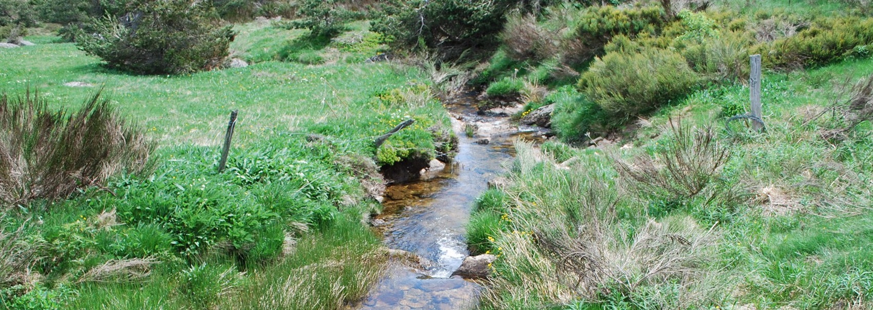
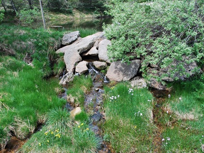
At the ‘goose foot’ of point 5 of the topoguide, at the very foot of the Moure, the announced arrow is indeed there, a modest engraved pine board, indicating the direction of the source, 150 m ‘off circuit’, Chasseradès side. We will go on foot because from the first slope, the mountain folds into a semblance of a ravine, which sinks under the dark vault of the beech grove. We walk in the wadding of a carpet of dead leaves, the eye on the lookout. Suddenly, in the hollow of the thalweg, a tiny cairn of dry stones - 50 cm high at most - and under the base stone forming a vault, a trickle of water, and a sheet the size of a basin. The sun dances in the water and trembles through the leaves of the beeches stirred by the wind: it’s beautiful, a newborn Allier.
 But is this really our source? On the topoguide, there is a photo of a pretty enamel plaque that was supposed to have been installed here to commemorate the unusual adventure of three young people from Langeac who, in 1992, walked up the Allier in 12 days, from Langeac ‘to its sources’.
This plural intrigues us, but with rivers, you have to get used to it: whether it’s the Loire, the Nile, or the Mekong, there have always been controversies. We could have done without this kind of hassle, but here there is no trace of the plaque. However, on the trunk of a beech tree, painted the same yellow as the markers of the access path, the mention ALLIR, not Allier, Allir. Is this a dialectal spelling or a spelling mistake?
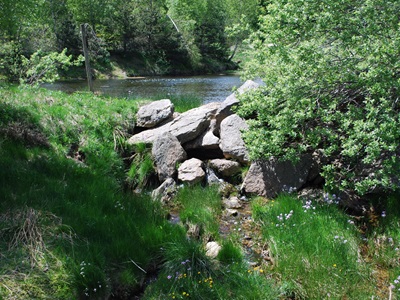
Let’s think. Of all those that appear with a tiny blue circle on the IGN map, next to the mention ‘Sources de l’Allier’, this one, which we locate between the contour lines 1440 and 1450, seems to be the highest in altitude, and therefore, for us, the real one. Was the plaque placed near another source, more abundant but lower, or in a more accessible place? To be sure, we get on our bikes, direction Chasseradès, 7 km downhill before crossing the valley at 1216 m: at the ‘pont de l’Allier’, the first of its name on the Allier, here become a stream: it’s clear on the map. We go back up to Chasseradès and pay a direct visit to Mr. Mayor who runs a hotel at the entrance of the village.
 If there was a plaque, there must have been an inauguration, and the mayor must have been there. Indeed, he was there, in 1995, he tells us, with representatives of the SMAT, including the president Guy Vissac. Re-consultation of the map: it’s there, in one of the contour lines that tighten and jostle, sign of a steep slope, there is a small masonry dam and the access track is almost drivable. But it’s much lower, about 1300 m, that ‘our’ source is located.
Treasure Hunt. As soon as you leave Chasseradès, planted askew on the edge of a roof, finally a sign, a real one, like new, with the logo of Chamina: PR circuit (short hike) of the sources of the Allier, 12 km, 4 hours, green marking, mountain bike level: easy. We’re burning, we’ve got our plaque!
Poor us. The marking quickly becomes symbolic, then downright fanciful. An ‘Allier sources’ arrow in a somewhat suspicious blue and then a yellow ‘PR’ sign lead us into a dead end in the middle of the woods. Another path goes back up to the Moure, where we were this morning. Back to the crossroads of the blue sign. We disobey it and turn right. It’s the right plan: 500 m… after the crossroads, a new arrow, this time green and white, tied to a fence post: ‘sources of the Allier’.
Another kilometer, this time it’s there, here is the small concrete dam of Mr. Mayor, the first of course on the Allier. We’ve got the plaque, we’re preparing the camera.
Disappointment: if it’s still there, it’s well hidden; after five minutes of fruitless searching, we give up; back to Mr. Mayor’s, this time with the idea of having a well-deserved beer. We’ve decided to laugh about it, the excellent man too: after all, the plaque is anecdotal. But he’s going to find out: maybe it was stolen? We quickly console ourselves by realizing that, where the plaque was supposed to be, relatively accessible, it’s definitely the Allier, already captured (!) at this place, but surely not ‘the’ source. That one you have to go look for higher up, in the hair of all these streams that converge towards the Allier.
***
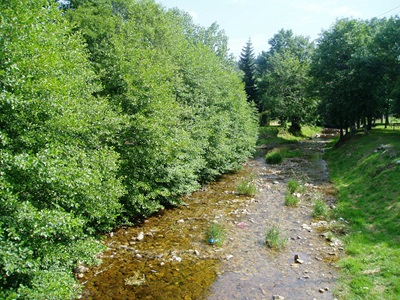
 La Bastide, between the Cévennes and Margeride, is a watershed line. The communal territory is located on a dividing line between two large watersheds: the Rhône-Mediterranean basin and the Loire-Brittany basin. The hydrographic network of the commune is therefore very dense: there are many streams and valats (a term used in the Cévennes to designate a steep stream) among which are the Rieufrais stream, the Gouttes stream, etc. On the Loire-Brittany watershed, the Allier will join the gorges of the Allier then the Loire while the southern tributaries serve towards the Chassezac to join the Ardèche on the Rhône-Mediterranean basin La Bastide-Puylaurent.
The presence of this hydrographic wealth has allowed the construction of a dam at the place called Puylaurent but it also constitutes a major hazard. because our territory is regularly the source of heavy rains ‘Cévennes episodes’ causing floods. Note that it is to the west of La Bastide, near the Moure de la Gardille in the historic commune of Chasseradès, that the Allier takes its source: indeed it is here that the first trickle of water from this 420-kilometer long river is born.
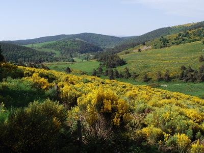
 It is on this same mountain that the Chassezac also finds its source. And yet, remarkably, these two rivers do not feed the same basin since the Allier flows into the Loire and then the Atlantic Ocean while the Chassezac descends towards the Ardèche then the Rhône to flow into the Mediterranean. La Bastide is therefore one of the roofs of France for the water divide.
A Greek Sage. And to hell with the plaque. Our balance sheet is not so bad: 50 km on the counter of an astonishing treasure hunt marked with arrows of all kinds and colors, sublime landscapes, a source found, which is worth another, a nice sunburn.
A day finally very positive, especially since we are going to extend it pleasantly in the company of two hikers met on the terrace: they are doing the Stevenson Trail GR 70 from Monastier sur Gazeille to Saint-Jean-du-Gard, and they tell us all the good they think of the last two stage lodges, that of Cheylard l’Evêque and that of La Bastide-Puylaurent.
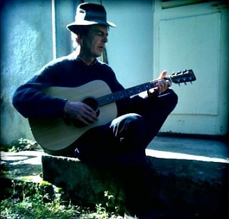
Here the boss made a strong impression on them: half Greek, half Belgian, singer, guitarist, pianist at times, on the road at 14, he bummed around in Australia, panned for gold in California, crossed France on horseback…
A modern cowboy, Philippe Papadimitriou prides himself on having read only five books in his life. A ‘field’ guy who will certainly inform us about the source. We stop at his place on the way back. The giant stares at us with his big clear eyes surprised. The source of the Allier? If I know it? No, but what does it matter?
Indeed. Well seen the Greek. The trickle of water up there under the beech trees is enough for us. The real, the geographical, the authentic, the official, the true, we don’t care. The sun is shining, the Lozère is superb, life is beautiful!
Old romantic Hotel, L'Etoile Guest-House is a
mountain retreat in the South of France. With a beautiful park along the Allier River, L'Etoile Guesthouse is located in La Bastide-Puylaurent between Lozere, Ardeche and Cevennes. Hiking trails: GR®70 Stevenson trail, GR®700 Regordane way (St Gilles trail), GR®7, GR®72, GR®470 Allier river trail. Hiking loops: Cevenol, Ardechoise, Margeride. The right place to relax.
Copyright©gr-infos.com