
|
La Bastide-Puylaurent at the time (Lozère). Hiking trails: GR®7, GR®70 Stevenson Trail, GR®72, GR®470 Gorges de l'Allier, GR®700 Voie Régordane, GRP Le Cévenol, Tour of the Ardéchoise Mountain and Margeride.
|
|
Tourism in the era of La Bastide-Puylaurent
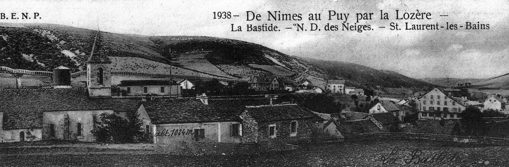
In the early 16th century, La Bastide was a hamlet consisting of seven or eight houses situated on the right bank of the Allier River. In the Gévaudan region, there was a farmhouse that had been inhabited by the Bastide family for several centuries (some believe this family gave the village its name), also known as “Trouillas.” To the south of La Bastide stood a chapel named Saint-Thomas de la Souche. Today, its location is marked only by a rustic cross, facing the current cemetery. The chapel was built to facilitate religious practices for travelers who followed the Régordane route.
Near La Bastide, in the Allier Valley, one could find the Huttes farmstead. In the valley of the Trappe stream, there were a few individual cottages. An inn known as “La Grande-Halte” played the role of a roadside relay station, providing rest for pilgrims, traders, and transhumant travelers following the Régordane path.
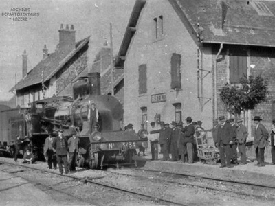
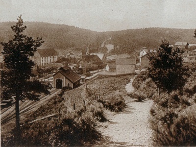
The arrival of the railway in 1870, followed by the establishment of the Notre-Dame-des-Neiges monastery a few years later, as well as the emergence of the thermal spa town of Saint-Laurent-les-Bains, significantly contributed to the development of the village. What was once merely a stopping point has now become a small mountain tourist destination. Over time, the town was built from scratch, and its unique history explains its current location: straddling the regions of Occitanie and Auvergne-Rhône-Alpes, spanning Lozère and Ardèche.
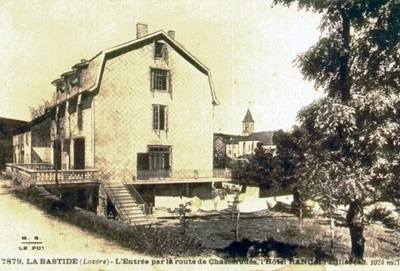 La Bastide at 1,018 meters; SNCF railway, buses to Saint-Laurent-les-Bains (Ardèche); Hôtel des Pins with 30 rooms; Hôtel du Parc (currently Maison d’hôtes L’Etoile) with 22 rooms; Terminus, located at the train station, offers 20 rooms. La Bastide-Puylaurent (population 1,289) is a popular summer destination for families from the Midi region. It is situated near the snow-covered bald and rounded peaks of the Cévennes watershed, with beautiful ski fields now frequented in winter. Due to its altitude and location on the watershed line, La Bastide always enjoys refreshing coolness during the summer.
Excursions around La Bastide-Puylaurent:
- Sources de l’Allier (to the west; 4 hours and 30 minutes on foot). Take the train on the Mende line to the Chasseradès station. From there, a path to the northwest leads to the sources of the Allier River, at the foot of the wooded slopes of Mourre de la Gardille (1,501 meters), which can be easily climbed in 45 minutes. Enjoy a beautiful view of Mont Lozère and the Causses. Return directly to La Bastide by following an eastward ridge at an altitude of 1,300 meters.
- Palet du Thort (dolmen), located 4 kilometers to the south via the ridges.
- Trappe de Notre-Dame-des-Neiges (3.5 kilometers east on the road). A path diverges 2.5 kilometers to the left from the road to Saint-Laurent-les-Bains. Descend through a beautiful forest of pine, spruce, and beech trees to reach Trappe de Notre-Dame-des-Neiges (1,110 meters). Founded in 1850 on a domain of the former Chambons Abbey, this monastery is situated in a secluded valley where its stream joins the Allier River at La Bastide-Puylaurent. The monastery was rebuilt after a fire in 1912.
 From La Trappe, one can walk 3 km to Saint Laurent les Bains, ascending a valley to the northeast. Along the way, you pass near the Felgère farm and reach the Col du Pal, descending to the east while passing to the left of the old tower that overlooks Saint Laurent les Bains.
Now, let’s explore the route from La Bastide to Mende:
- By train (48 km) or by road (49 km in the west-southwest direction), crossing the Montbel plateau. After crossing the Allier River, follow road C. 6 to ascend the upper valley of the river for approximately 7 km. Then, at an altitude of 1,175 meters, the road intersects with the railway line, transitioning from the upper Allier Valley to the Chassezac Valley.
- Chasseradès (at 1,150 m.) is a point from where you can reach the source of the Allier River in just 1 hour and 15 minutes. Here, you’ll find a Romanesque church with a defensive tower.
- Continuing the journey, the road ascends further to Belvezet, following the upper Chassezac Valley. Along the way, you’ll pass under the beautiful Mirandol Viaduct (12.5 km). To the left, a small road branches off and leads through the woods to Goulet Mountain (at 1,499 m.). It’s a 6.5 km drive to the road terminus, followed by a 30-minute walk.
- Leaving Saint-Frézal-d’Albuges (which has a Romanesque church) to the right, you’ll reach Belvezet (at 1,197 m.), a village nestled amidst cultivated hills near the Chassezac Springs. From here, it takes approximately 1 hour and 33 minutes to ascend Mourre de la Gardille (at 1,501 m.). The road continues across the causse (plateau) to Montbel (at 1,224 m.), a village with 399 inhabitants, situated on the same plateau.
 The Montbel plateau represents a promontory thrust by the Jurassic rocks of the Gausses into the ancient rocks of Gévaudan. It is a plateau in its initial stage, where water has not yet carved its underground galleries and caverns, although there are a few aven formations. The Montbel plateau, often referred to as the “roof of France,” plays a crucial hydrographic role: its waters flow southeastward toward the Chassezac and the Rhône, northward toward the Allier and the Loire, and westward toward the Lot, the Truyère, and the Garonne. This triple watershed boundary is extended to the northeast and southeast by the Cévennes, and to the northwest by the Plateau du Roi and the Margeride Mountains. The climate on this plateau is harsh, and its resources are primarily pastoral: around 50,000 sheep, transhumant from the Languedoc via its ancient paths known as “drailles,” graze on the fine, short, and dry grass of its plateaus.
To the west of Montbel, road C. 6 joins the N. 88 (27 km). At Col de la Pierre Plantée (1,264 m.), which is 28 km away, you can continue to Mende via road N. 88.
 From La Bastide-Puylaurent to Les Vans (a picturesque and rugged 44 km route to the southeast; automobile service available to Saint-Laurent), you leave La Bastide via road N. 106 in the southeast direction. Then, at 0.5 km, take the D. 4 road that ascends eastward along the desolate ridge of the Cévennes, overlooking the deep ravines of the Borne River to the south. The view is magnificent, with wooded chestnut crests and, in the distance, the Mont Lozère.
At 2.5 km, a statue of the Virgin Mary marks the entrance to the path leading to La Trappe de Notre Dame des Neiges on the left. The road continues to climb until it reaches a threshold at 1,150 meters, from where it descends through winding turns for 5 km into the deep valley of the Borne River.
8 kilometers from Saint-Laurent-les-Bains (at an elevation of 840 meters), there is a thermal station nestled in the gorge of a small tributary of the Borne River, deep within a true abyss that plunges 500 meters below the surface. This natural chasm opens beneath the Cévennes mountain range. The ruins of an ancient square tower crown a steep rock, rising 110 meters above the valley. The thermal waters, with a temperature of 53.5°C, are rich in sodium bicarbonate and are used for general rheumatism treatment. The Grande Source feeds a public fountain and the remaining Roman pool at the thermal establishment.
 From Saint Laurent les Bains, you can ascend Trépaloup (to the north) in approximately 2 hours and descend in 1 hour and 15 minutes. To reach the Cévennes ridge, take a mule path to the west and then follow the ridge northeastward. From the summit of Trépaloup (at 1,408 meters), you’ll enjoy a stunning panorama that includes views of Mont Lozère, Mézenc, and, on clear days, even Ventoux. Returning via Borne and a picturesque path along the upper gorges of the Borne River makes for a beautiful circuit (total duration: 4 hours and 30 minutes).
Another scenic route, spanning 17 kilometers to the east, takes a grand detour southward along the edge of the Liche-Chaude torrent gorges, connecting Saint-Laurent to Loubaresse on the road from Le Puy en Velay to Largentière.
From Saint Laurent les Bains, road D. 4 continues its descent, crossing the gorge of the Liche-Chaude torrent. It then ascends steeply through fir forests. Afterward, it descends more gradually on the Chassezac side, traversing an almost deserted landscape. At 29 kilometers, you’ll reach Peyre, a junction where you leave road D. 4 to follow road D. 10 to descend into the Chassezac Valley.
 At 42.5 kilometers, you’ll pass Chambonas on the left—a loop of the Chassezac dominated by a restored feudal castle with a park attributed to Le Nôtre. The Romanesque church here houses a sculpted frieze. Crossing the Chassezac, you continue beyond La Bastide on road N. 106, ascending through winding turns.
85 km from La Garde-Guérin (875 m), there is a very picturesque hamlet located at the northern end and on the edge of a plateau that drops almost vertically to the right bank of the Chassezac River. The view from there is splendid.
In the past, this place was the seat of a curious community of twenty-seven noble peers, founded by the bishops of Mende. Their role was to escort and protect travelers on the GR®700 Voie Régordane, an ancient Gallic and Roman road that started from Nîmes, crossed the Villefort pass, passed through the old hamlet of Bayard, climbed a steep slope, and traversed the plateau known as Serre des Mulets. This route served as a transhumance trail to Lozère and Aubrac and remained the sole communication link between Languedoc and Auvergne throughout the Middle Ages.
La Garde-Guérin still preserves the remains of the fortifications that once surrounded its twenty-seven strong houses, as well as a large square tower from the ancient castle dating back to the 10th and 11th centuries. There is also a restored Romanesque church.
The road, incredibly picturesque, now descends diagonally along the edge of the intriguing plateau of La Garde-Guérin, overlooking the scenic gorges of the Altier. It then makes a wide curve to the north before heading south again at the bottom of a ravine. At the base of this descent, you reach the left bank of the Altier River. To the right, you’ll see Route N. 101 passing under the beautiful Bayard Viaduct, a two-tiered arcade structure that stands 72 meters high and carries the Nîmes railway line. Turning left, you cross the Altier River via the Louis-Philippe Bridge and pass through the Bayard Tunnel, which is 200 meters long, into the Palhères valley.
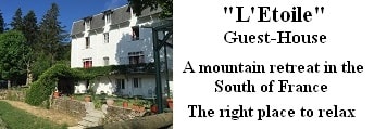
Old romantic Hotel, L'Etoile Guest-House is a
mountain retreat in the South of France. With a beautiful park along the Allier River, L'Etoile Guesthouse is located in La Bastide-Puylaurent between Lozere, Ardeche and Cevennes. Hiking trails: GR®70 Stevenson trail, GR®700 Regordane way (St Gilles trail), GR®7, GR®72, GR®470 Allier river trail. Hiking loops: Cevenol, Ardechoise, Margeride. The right place to relax.
Copyright©gr-infos.com