|
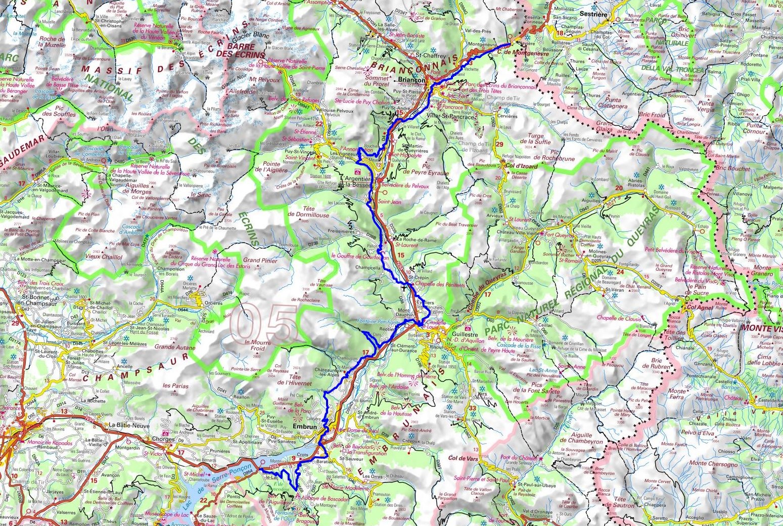
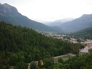
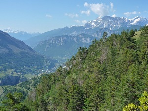
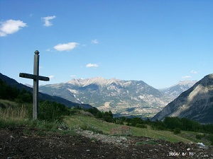
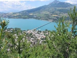
Hike on the GR®653D Via Domitia - Way of Saint James - Santiago de Compostela through Hautes-Alpes department from Montgenevre to Savines-le-Lac via Briancon, Villar-Saint-Pancrace, Saint-Martin-de-Queyrieres,
Saint-Martin-de-Queyrieres, Les Vigneaux, Argentiere-la-Bessee, Freissinieres, Pinfol, Chateauroux-les-Alpes, Embrun and Baratier. Guest House, Bed and Breakfast, Hotel, Camping, Shelter, Inn, Shops.
|

|

GR®653D
From Montgenevre to Savines-le-Lac (Hautes-Alpes)
Via Domitia
Way of St. James - Santiago de Compostela
105km
Google Maps - Google Earth

© GPX Private use only |
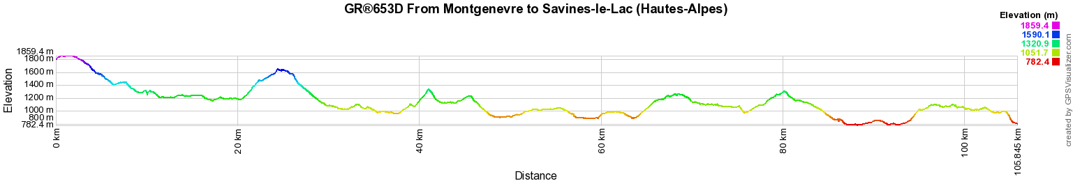
Distance: 105km, Elevation maximum: 1859m, Elevation minimum: 782m, Elevation gain uphill: 3055m
IGN Maps: Orcieres-Merlette Sirac Mourre Froid PN des ecrins (3437ET). Embrun Les Orres Lac
de Serre-Poncon (3438ET). Briancon Serre-Chevalier Montgenevre (3536OT). Guillestre Vars Risoul PNR du Queyras (3537ET). Briancon - Sestriere (ASF10).

Registration
Accommodation or business owner on or near a GR®, you can appear on GR-INFOS
For your registration, you can send me by email (papadimitriou4@gmail.com): your address and phone number, your website (Facebook page), a brief description with 5 beautiful photos of your establishment.
Registration price : 25€/year or 100€/5 years per GR® or GRP®. Renewable. |
GR®653D Via Domitia
From Montgenevre to Savines-le-Lac (Hautes-Alpes)
From Savines-le-Lac (Hautes-Alpes) to St Geniez (Alpes de Haute-Provence)
From St Geniez to Cereste (Alpes de Haute-Provence)
From Cereste (Alpes-de-Haute-Provence) to Arles (Bouches-du-Rhone)
 It is advisable to follow the beacons all along your hike and to bring you the FFRandonnee topo-guide. You
will also find information on MonGR.fr.
It is advisable to follow the beacons all along your hike and to bring you the FFRandonnee topo-guide. You
will also find information on MonGR.fr.
GR®, PR®, GRP®, and the corresponding signs of markings (white / red, yellow and yellow / red) are trademarks of the French
Federation of Hiking. They may not be reproduced without permission. The French Federation of Hiking, state-approved, includes organizations that create and maintain hiking routes on GR®, PR® and
GRP®. It publishes guides these topo hiking routes.
With your donations, support the actions of the thousands of volunteer markers of the FFRandonnee.
GR-Infos.com is an editorial partner of MonGR.fr.

Old romantic Hotel, L'Etoile Guest-House is a mountain retreat in the South of France. With a
beautiful park along the Allier River, L'Etoile Guesthouse is located in La Bastide-Puylaurent between Lozere, Ardeche and Cevennes. Many hiking trails like
GR®7, GR®70 Stevenson trail, GR®72, GR®700 Regordane way, Cevenol, GR®470 Allier river,
Margeride, Ardechoise. Many hiking loops. The right place to relax.
Copyright©gr-infos.com (Authorization for private use only)