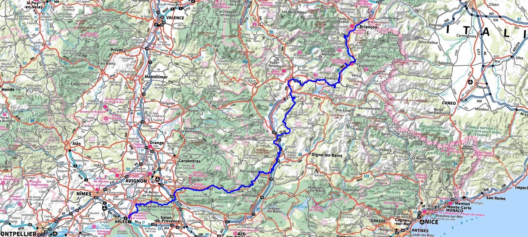
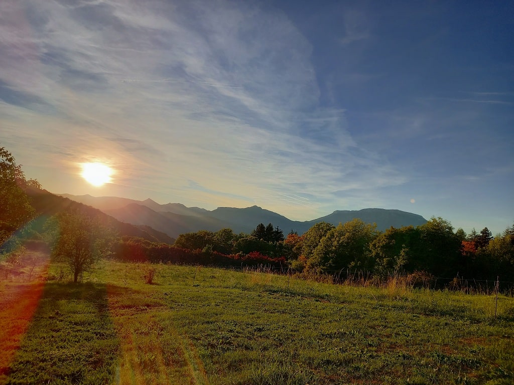
GR France. Long Hiking Trails. Long Distance Footpaths

Hike on the GR®653D Via Domitia - Way of Saint James - Santiago de Compostela through Hautes-Alpes, Alpes de Haute-Provence and Bouches-du-Rhone department. Guest House, Bed and Breakfast, Hotel, Camping, Shelter, Inn, Shops.

Chemins de Grandes Randonnees


Long Hiking Trails / Long Distance Footpaths

GR®653D

Via Domitia

From Montgenevre (Hautes-Alpes) to Arles (Bouches-du-Rhone)

Way of St. James - Santiago de Compostela

433km

The Via Domitia, constructed in 118 BC, is the oldest Roman road and was the first road built by the Romans in Gaul. It was commissioned by Gnaeus Domitius Ahenobarbus, whose name it bears. The road was initially a military route to Spain, but quickly became a great communication route for information and trade. The Via Domitia linked Italy and Hispania through Gallia Narbonensis, across what is now Southern France. The route that the Romans regularised and paved was ancient when they set out to survey it, and traces the mythic route travelled by Heracles. The road crossed the Alps at the easiest passage, the Col de Montgenevre (1850 m), followed the valley of the Durance, crossed the Rhone at Beaucaire, passed through Nîmes (Nemausus) then followed the coastal plain along the Gulf of Lion. At Narbonne, it met the Via Aquitania (which led toward the Atlantic Ocean through Toulouse and Bordeaux). In between the cities that it linked, the Via Domitia was provided with a series of mansiones at distances of a day’s journey for a loaded cart, at which shelter, provender and fresh horses could be obtained for travellers on official business. Today, a path that follows close to the ancient road provides the vital link between the St James Way network and the via Francigena allowing pilgrims to walk between Santiago de Compostela and Rome. This makes it an important secondary route for pilgrims on their journey to Santiago de Compostela. In conclusion, the Via Domitia is not just an ancient Roman road but a living testament to history. It continues to serve as a vital link for communication, trade, and pilgrimage. Walking along its path is like stepping back in time, tracing the footsteps of ancient Romans, medieval pilgrims, and countless others who have journeyed along this historic route.

Google Maps - Google Earth

IGN


Elevation


GR653D Via Domitia 3GR653D Via Domitia 4GR653D Via Domitia 5GR653D Via Domitia 6GR653D Via Domitia 7

qrcode
© GPX Private use only

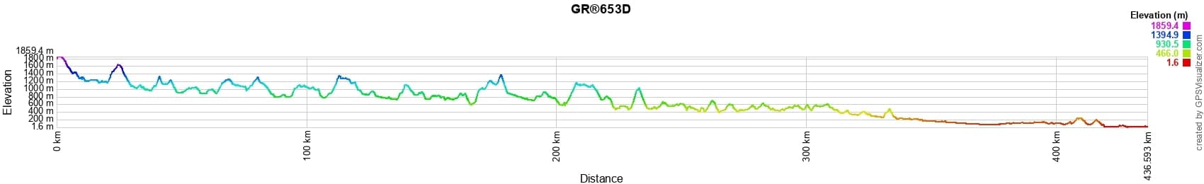
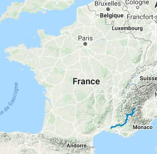
Distance: 433km, Elevation maximum: 1859m, Elevation minimum: 2m, Elevation gain uphill: 10502m


Blanchet (Venterol): La Meridienne Guest House, Valerie & Emmanuel, 04 92 54 18 51, Email, Instagram, Facebook.
After your hike, relax in one of the sun loungers available in the garden and also enjoy our heated swimming pool from June 15 to the end of September. Our table d'hotes will offer you, if you wish, a meal with local products adapted to the season and a small glass of wine also from local vineyards.
Blanchet (Venterol): La Méridienne Guest House 1Blanchet (Venterol): La Méridienne Guest House 2Blanchet (Venterol): La Méridienne Guest House 3Blanchet (Venterol): La Méridienne Guest House 4Blanchet (Venterol): La Méridienne Guest House 5


Accommodation GR GRP

Registration

Accommodation or business owner on or near a GR®, you can appear on GR-INFOS

For your registration, you can send me by email (papadimitriou4@gmail.com): your address and phone number, your website (Facebook page), a brief description with 5 beautiful photos of your establishment.

Registration price : € 100 per GR® or GRP® for 5 years. Renewable.


GR653D Via Domitia 10

GR®653D Via Domitia
GR®653D From Montgenevre to Savines-le-Lac (Hautes-Alpes)
GR®653D From Savines-le-Lac (Hautes-Alpes) to St Geniez (Alpes de Haute-Provence)
GR®653D From St Geniez to Cereste (Alpes de Haute-Provence)
GR®653D From Cereste (Alpes-de-Haute-Provence) to Arles (Bouches-du-Rhone)

Nearby paths:
Around Vaucluse Monts
Around Lure mountain (Alpes-de-Haute-Provence, Drome)
Around Buech (Hautes-Alpes, Drome)
Around Buech and Meouge Valley (Drome, Hautes-Alpes)
Pre-Alps Great Crossing (Alpes-de-Haute-Provence, Hautes-Alpes)
GR®5 From Luxembourg to Mediterranean sea
GR®5C From Roubion (Nevache) to Briançon (Hautes-Alpes)
GR®6 From Gironde to Alpes-de-Haute-Provence
GR®9 From Jura to Mediterranean sea
GR®42 Rhone Balconies
GR®50 Around Ecrins National Park (Hautes-Alpes, Isere)
GR®93 Crossing Vercors
Around Luberon (Vaucluse, Alpes-de-Haute-Provence)
GR®406 Napoleon way
GR®653 Via Tolosana - Way of Arles
GR®653A Via Aurelia


Mon GRIt is advisable to follow the beacons all along your hike and to bring you the FFRandonnee topo-guide. You will also find information on MonGR.fr.

GR®, PR®, GRP®, and the corresponding signs of markings (white / red, yellow and yellow / red) are trademarks of the French Federation of Hiking. They may not be reproduced without permission. The French Federation of Hiking, state-approved, includes organizations that create and maintain hiking routes on GR®, PR® and GRP®. It publishes guides these topo hiking routes.

With your donations, support the actions of the thousands of volunteer markers of the FFRandonnee.

GR-Infos.com is an editorial partner of MonGR.fr.

Facebook GR-Infos Long Distance Footpaths


Return


L'Etoile Guest-House

Old romantic Hotel, L'Etoile Guest-House is a mountain retreat in the South of France. With a beautiful park along the Allier River, L'Etoile Guesthouse is located in La Bastide-Puylaurent between Lozere, Ardeche and Cevennes. Many hiking trails like GR®7, GR®70 Stevenson trail, GR®72, GR®700 Regordane way, Cevenol, GR®470 Allier river, Margeride, Ardechoise. Many hiking loops. The right place to relax.

Copyright©gr-infos.com (Authorization for private use only)