
|
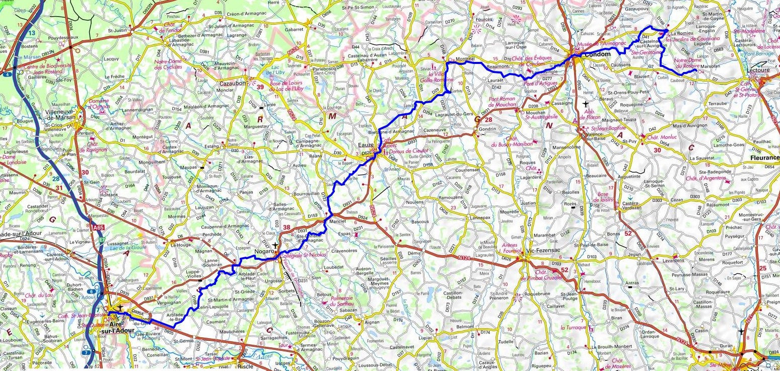
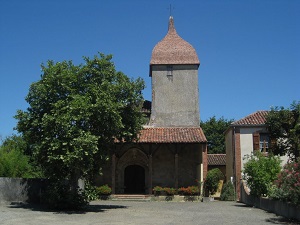
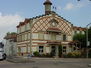
Hike on the GR®65, Via Podiensis towards Santiago de Compostela through Gers and Landes department from Marsolan to Aire-sur-l'Adour via La Romieu, Le Baradieu, Condom, Montreal-du-Gers, Eauze, Mancier, Nogaro and
Barcelonne-du-Gers. Guest House, Bed and Breakfast, Hotel, Camping, Shelter, Inn, Shops.
|

|

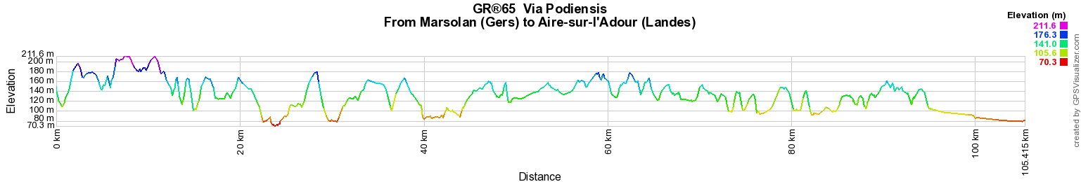
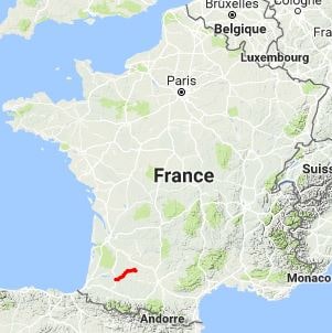
GR®65
Via Podiensis
From Marsolan (Gers) to Aire-sur-l'Adour (Landes)
Santiago de Compostela
105Km
Google Maps - Google Earth


© GPX Private use only |
Distance: 105km, Elevation maximum: 212m, Elevation minimum: 70m, Elevation gain uphill: 1305m
IGN Maps: Riscle (1643E). Aire-sur-l'Adour (1643O). Mezin Montreal (1741E). Eauze (1742O). Lectoure (1841E). Condom (1841O).

Registration
Accommodation or business owner on or near a GR®, you can appear on GR-INFOS
For your registration, you can send me by email (papadimitriou4@gmail.com): your address and phone number, your website (Facebook page), a brief description with 5 beautiful photos of your establishment.
Registration price : 25€/year or 100€/5 years per GR® or GRP®. Renewable. |
|
GR®65 Santiago de Compostela Way
Via Gebennensis
From Geneva (Switzerland) to St Genix-sur-Guiers (Savoie)
From St Genix-sur-Guiers (Savoie) to Maclas (Loire)
From Maclas (Loire) to Le Puy-en-Velay (Haute-Loire)
Via Podiensis
From Puy-en-Velay (Haute-Loire) to Nasbinals (Lozere)
From Nasbinals (Lozere) to Montredon (Lot)
From Montredon to Labastide-Marnhac (Lot)
From Labastide-Marnhac (Lot) to Marsolan (Gers)
From Marsolan (Gers) to Aire-sur-l'Adour (Landes)
From Aire-sur-l'Adour (Landes) to Larribar-Sorhapuru (Pyrenees-Atlantiques)
From Larribar-Sorhapuru (Pyrenees-Atlantiques) to Roncesvalles (Spain)
 It is advisable to follow the beacons all along your hike and to bring you the FFRandonnee topo-guide. You
will also find information on MonGR.fr.
It is advisable to follow the beacons all along your hike and to bring you the FFRandonnee topo-guide. You
will also find information on MonGR.fr.
GR®, PR®, GRP®, and the corresponding signs of markings (white / red, yellow and yellow / red) are trademarks of the French
Federation of Hiking. They may not be reproduced without permission. The French Federation of Hiking, state-approved, includes organizations that create and maintain hiking routes on GR®, PR® and
GRP®. It publishes guides these topo hiking routes.
With your donations, support the actions of the thousands of volunteer markers of the FFRandonnee.
GR-Infos.com is an editorial partner of MonGR.fr.


Old romantic Hotel, L'Etoile Guest-House is a mountain retreat in the South of France. With a beautiful park along the Allier River, L'Etoile Guesthouse is located in La Bastide-Puylaurent between Lozere, Ardeche and Cevennes. Many hiking trails like GR®7, GR®70 Stevenson trail, GR®72, GR®700 Regordane way, Cevenol, GR®470 Allier River Springs and Gorges, Margeride, Ardechoise. Many hiking loops. The right place to relax.
Copyright©gr-infos.com (Authorization for private use only)