
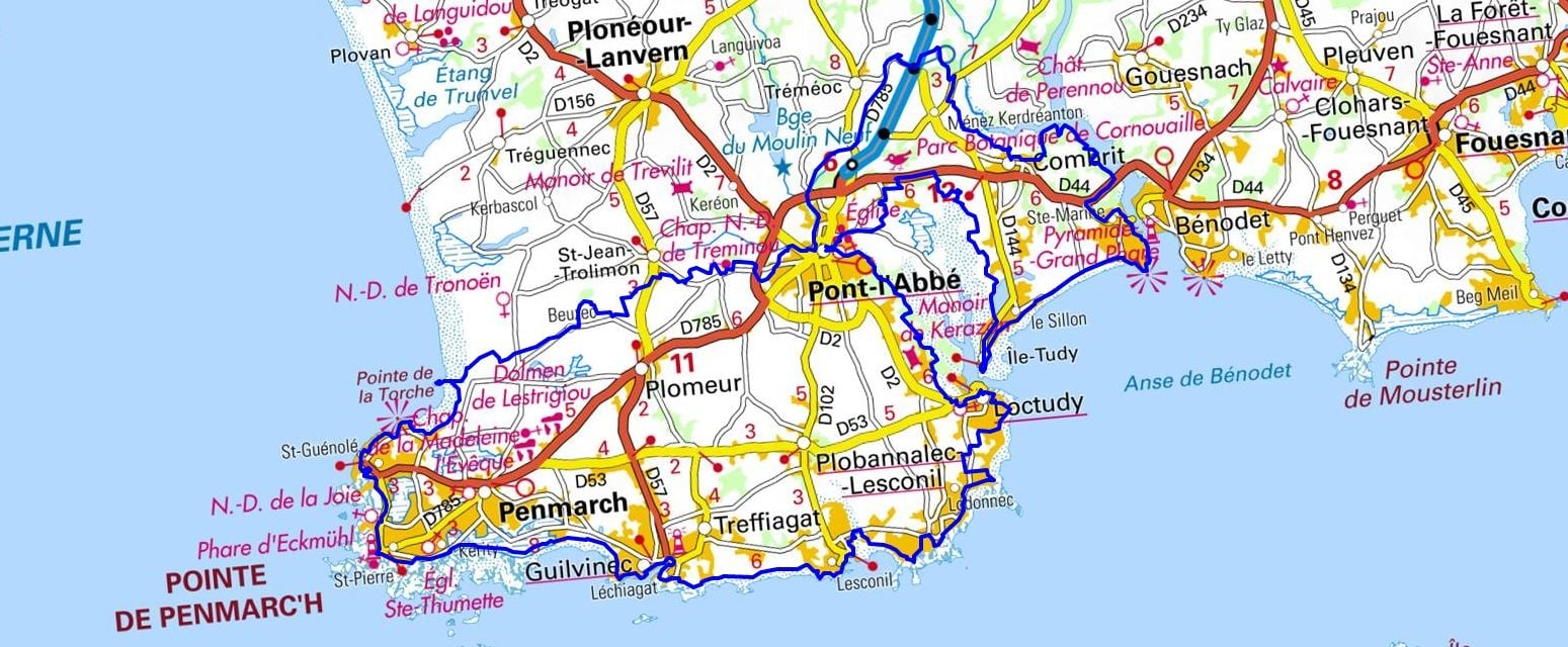
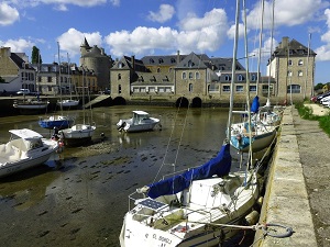
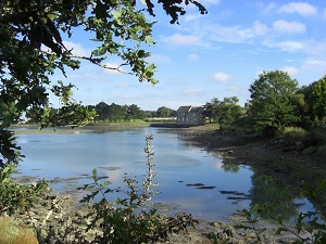
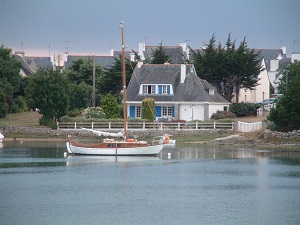
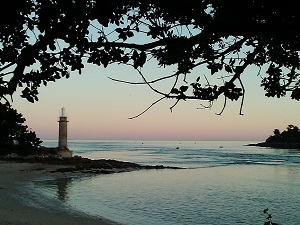
Starting in Pont-l'Abbé, the historic capital, this journey takes you straight to the heart of the Pays Bigouden region. The path follows the river toward Loctudy and its elegant manor houses, then continues to the lively fishing ports of Lesconil and Le Guilvinec, where the daily return of the trawlers sets the rhythmic pace of local life. In Penmarch, the towering Eckmühl lighthouse overlooks a rugged, wild coastline where nature bravely withstands the sea spray, while the Pointe de la Torche in Plomeur reveals endless sandy beaches highly popular with surfers. Passing through Saint-Jean-Trolimon, the region's religious heritage is powerfully expressed through monumental calvaries, standing as testaments to an ancient and deep devotion. The return inland via Tréméoc offers a peaceful, wooded transition before reaching the sheltered shores of Combrit Sainte-Marine. Finally, passing through Île-Tudy, a former fishing village renowned for its charmingly narrow streets, beautifully completes this ecologically rich coastal loop.
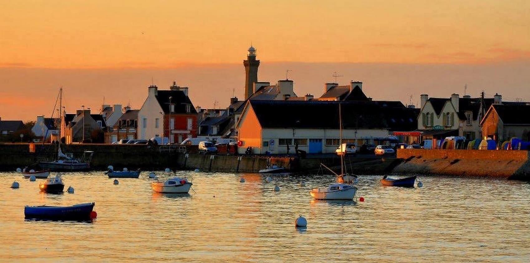
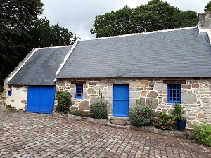
The Pays Bigouden, situated at the southern tip of Finistère, unfolds between bustling artisanal fishing ports and traditional festivals famously accompanied by the sound of bombardes (a distinct type of Breton bagpipe). From the Pointe de la Torche and its wild dunes to the sculpted, dramatic rocks of Saint-Guénolé, nature expresses itself here with a raw, briny force. This territory is deeply marked by a centuries-old maritime history, punctuated daily by the return of trawlers to the port of Guilvinec and watched over by the protective silhouette of the Eckmühl lighthouse. The built heritage is equally remarkable, seamlessly blending sturdy granite chapels, intricately carved calvaries, and renowned inland manor houses. However, it is in its vibrant culture that the Pays Bigouden truly finds its unique character, highlighted by its famous tall, embroidered headdresses, which remain proud symbols of elegance and strength. Finally, the Pen-Enez marshes and the broad Bay of Audierne provide precious, tranquil havens for a rich and diverse birdlife.
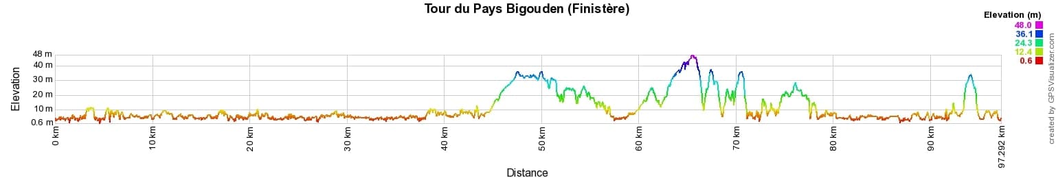
 Distance: 97km, Elevation maximum: 48m, Elevation minimum: 1m, Elevation gain uphill: 259m
IGN Maps: 0519OT - PONT-L'ABBE / POINTE DE PENMARC'H. 0519ET - QUIMPER / CONCARNEAU / ILES DE GLENAN.

Nearby paths:
![]() It is advisable to follow the beacons all along your hike and to bring the FFRandonnée topo-guide. You will also find information on MonGR.fr.
It is advisable to follow the beacons all along your hike and to bring the FFRandonnée topo-guide. You will also find information on MonGR.fr.
GR®, PR®, GRP® and the corresponding markings are trademarks of the French Federation of Hiking. They may not be reproduced without permission. The French Federation of Hiking, state-approved, includes organizations that maintain hiking routes. It publishes guides for these routes. With your donations, support the actions of the thousands of volunteer markers of the FFRandonnée.
GR-Infos.com is an editorial partner of MonGR.fr.
| Return |

Former holiday hotel with a garden along the Allier, L'Etoile Guest House is located in La Bastide-Puylaurent between Lozere, Ardeche, and the Cevennes in the mountains of Southern France. At the crossroads of GR®7, GR®70 Stevenson Path, GR®72, GR®700 Regordane Way, GR®470 Allier River springs and gorges, GRP® Cevenol, Ardechoise Mountains, Margeride. Numerous loop trails for hiking and one-day biking excursions. Ideal for a relaxing and hiking getaway.
Copyright©gr-infos.com (Authorization for private use only)
To help us maintain and improve GR-Infos.com, a contribution of 2€ is desired via Wero or bank transfer. Thank you!