
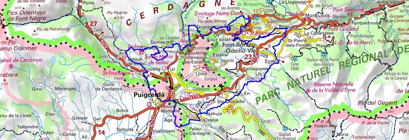
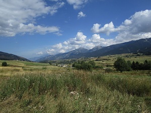
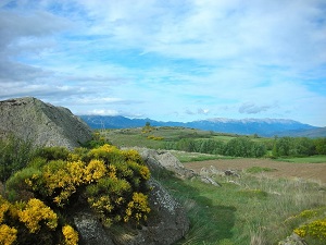
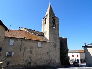
Starting from Font-Romeu, the trail descends towards Bolquère and Eyne, famous for its nature reserve with exceptional biodiversity, before reaching the Llo Gorge and the distinctive bell towers of Err and Osséja. Crossing the border leads to Puigcerdà, the historic Catalan capital with its vibrant medieval heritage, illustrating centuries of cross-border exchange. The return journey takes you through Enveitg and Dorres, renowned for its open-air Roman baths, facing the magnificent panorama of the Cadí mountain range. The landscape transforms between Targassonne and its spectacular granite boulders, before ending in Égat. This route is a sun-drenched natural balcony, where the Romanesque heritage of mountain churches stands alongside unspoiled nature of mountain pines and alpine meadows.
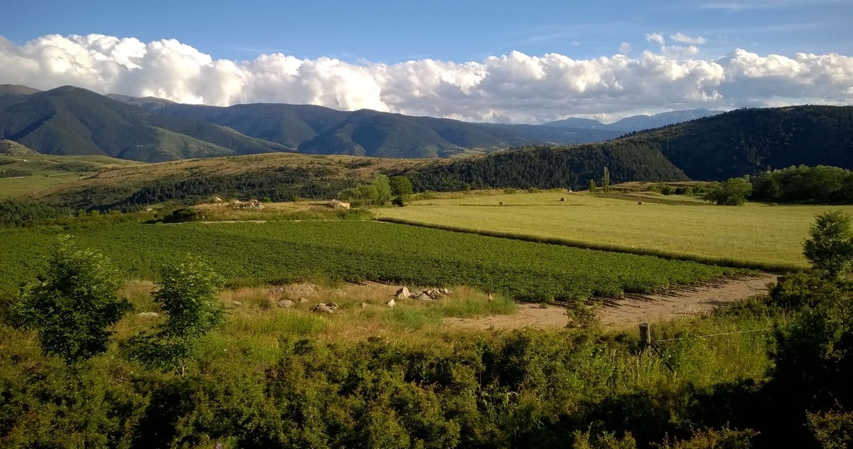
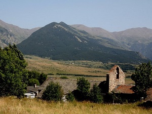
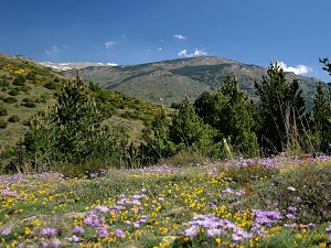
Cerdanya, a vast high plateau nestled in the heart of the Pyrenees, offers a unique natural spectacle where the sun shines more than 300 days a year. Shared between France and Spain since the Treaty of the Pyrenees in 1659, this Catalan land retains a strong cross-border identity, exemplified by the Spanish enclave of Llívia. Its architectural heritage is revealed through superb Romanesque churches built of granite and the famous Odeillo Solar Furnace, a symbol of a modernity reaching for the peaks. The landscapes, framed by the Carlit massif and the Sierra del Cadí, alternate between vast summer pastures and mountain pine forests. It is a paradise for biodiversity, where chamois and marmots can be seen near the glacial lakes of Bouillouses. The famous Little Yellow Train traverses these rugged terrains, linking Vauban citadels like Mont-Louis to the Iberian valleys.
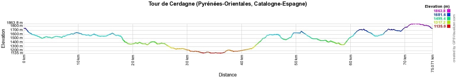
 Distance: 75km, Elevation maximum: 1863m, Elevation minimum: 1135m, Elevation gain uphill: 1923m
IGN Maps: 2249ET - FONT-ROMEU / CAPCIR. 2249OT - BOURG-MADAME / PIC CARLIT / COL DE PUYMORENS. 2250ET - BOURG-MADAME / MONT-LOUIS / COL DE LA PERCHE.

Nearby paths:
![]() It is advisable to follow the beacons all along your hike and to bring the FFRandonnée topo-guide. You will also find information on MonGR.fr.
It is advisable to follow the beacons all along your hike and to bring the FFRandonnée topo-guide. You will also find information on MonGR.fr.
GR®, PR®, GRP® and the corresponding markings are trademarks of the French Federation of Hiking. They may not be reproduced without permission. The French Federation of Hiking, state-approved, includes organizations that maintain hiking routes. It publishes guides for these routes. With your donations, support the actions of the thousands of volunteer markers of the FFRandonnée.
GR-Infos.com is an editorial partner of MonGR.fr.
| Return |

Former holiday hotel with a garden along the Allier, L'Etoile Guest House is located in La Bastide-Puylaurent between Lozere, Ardeche, and the Cevennes in the mountains of Southern France. At the crossroads of GR®7, GR®70 Stevenson Path, GR®72, GR®700 Regordane Way, GR®470 Allier River springs and gorges, GRP® Cevenol, Ardechoise Mountains, Margeride. Numerous loop trails for hiking and one-day biking excursions. Ideal for a relaxing and hiking getaway.
Copyright©gr-infos.com (Authorization for private use only)
To help us maintain and improve GR-Infos.com, a contribution of 2€ is desired via Wero or bank transfer. Thank you!