
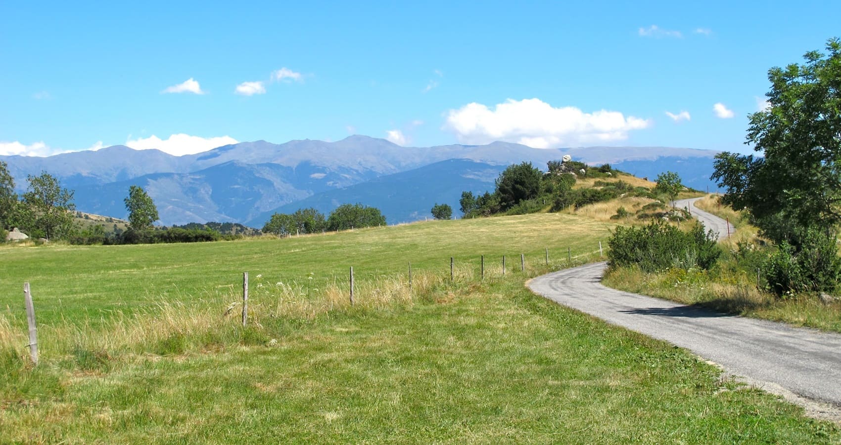
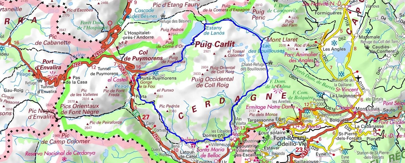
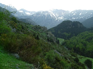
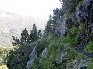
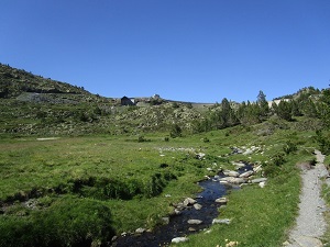
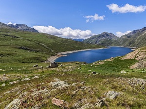
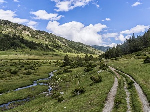
Starting from the picturesque village of Dorres, highly famous for its soothing open-air Roman baths, this hike ventures boldly into the expansive high plateau of Cerdagne to ultimately reach the pastoral hamlet of Brangoly. The trail carefully crosses rugged landscapes of stark granite and windswept, high-altitude moorland before crossing the mountain pass towards Porté-Puymorens, serving as a genuinely wild gateway to the high peaks. The route then climbs vigorously towards Lake Lanoux, famously the largest body of water in the entire French Pyrenees, nestled perfectly at the foot of the dramatic Carlit massif. This imposing stone giant, serving as the highest point in the department, proudly overlooks a stunning high-mountain landscape where nimble chamois and playful marmots find a safe refuge in the deeply unspoiled wilderness. Descending gently onto the eastern slope, hikers are delighted to discover the Bouillouses plateau, beautifully dotted with a vast constellation of small, sparkling glacial lakes. This unique landscape, meticulously shaped by ancient glaciers, clearly boasts exceptional biodiversity, wonderfully transitioning from vibrant alpine meadows to dense forests of mountain pines.
Pic Carlit, standing tall as the highest peak in the Pyrénées-Orientales at a commanding 2,921 meters, is the undisputed, majestic king of the entire Cerdagne region. The rigorous ascent from the historic Bouillouses dam carefully takes you past a stunning string of twelve sparkling, interconnected glacial lakes, offering a completely unique alpine tundra landscape entirely unlike any other found in Southern Europe. This wild area is a safe home to iconic mountain wildlife, where the agile Pyrenean chamois and the hearty marmot beautifully thrive amidst the resilient mountain pines. The profound history of the massif is deeply marked by long centuries of resilient pastoralism and the epic, transformative development of hydroelectric power, of which the impressive Bouillouses dam remains a major, enduring technological testament from the early 20th century. At the lofty summit, the sweeping panorama fully opens onto a stark granite desert, offering a truly breathtaking, clear view stretching from the sacred Canigou all the way to the jagged peaks of the Ariège. The region's local heritage can be clearly glimpsed below, warmly nestled between the sturdy Romanesque churches of Cerdagne and the ancient, meandering transhumance trails that continually crisscross the deep valleys.
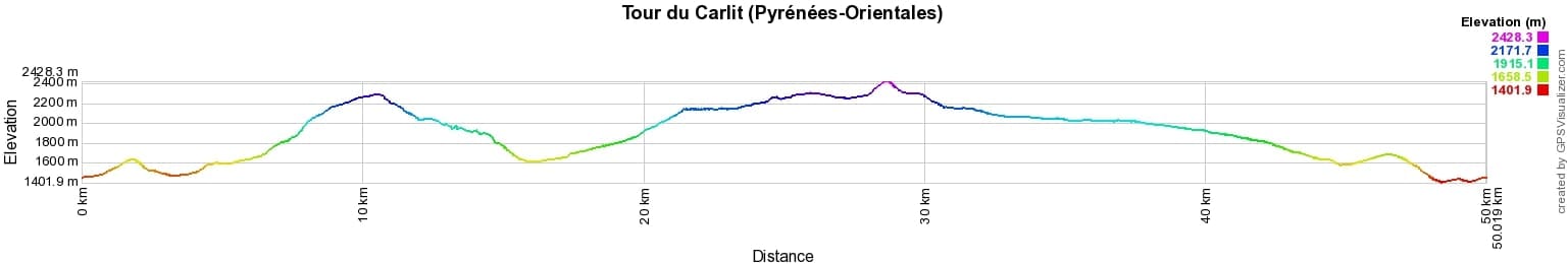
 Distance: 50km, Elevation maximum: 2433m, Elevation minimum: 1406m, Elevation gain uphill: 2220m
IGN Maps: 2249ET - FONT-ROMEU / CAPCIR. 2249OT - BOURG-MADAME / PIC CARLIT / COL DE PUYMORENS. 2250ET - BOURG-MADAME / MONT-LOUIS / COL DE LA PERCHE.

Nearby paths:
![]() It is advisable to follow the beacons all along your hike and to bring the FFRandonnée topo-guide. You will also find information on MonGR.fr.
It is advisable to follow the beacons all along your hike and to bring the FFRandonnée topo-guide. You will also find information on MonGR.fr.
GR®, PR®, GRP® and the corresponding markings are trademarks of the French Federation of Hiking. They may not be reproduced without permission. The French Federation of Hiking, state-approved, includes organizations that maintain hiking routes. It publishes guides for these routes. With your donations, support the actions of the thousands of volunteer markers of the FFRandonnée.
GR-Infos.com is an editorial partner of MonGR.fr.
| Return |

Former holiday hotel with a garden along the Allier, L'Etoile Guest House is located in La Bastide-Puylaurent between Lozere, Ardeche, and the Cevennes in the mountains of Southern France. At the crossroads of GR®7, GR®70 Stevenson Path, GR®72, GR®700 Regordane Way, GR®470 Allier River springs and gorges, GRP® Cevenol, Ardechoise Mountains, Margeride. Numerous loop trails for hiking and one-day biking excursions. Ideal for a relaxing and hiking getaway.
Copyright©gr-infos.com (Authorization for private use only)
To help us maintain and improve GR-Infos.com, a contribution of 2€ is desired via Wero or bank transfer. Thank you!