
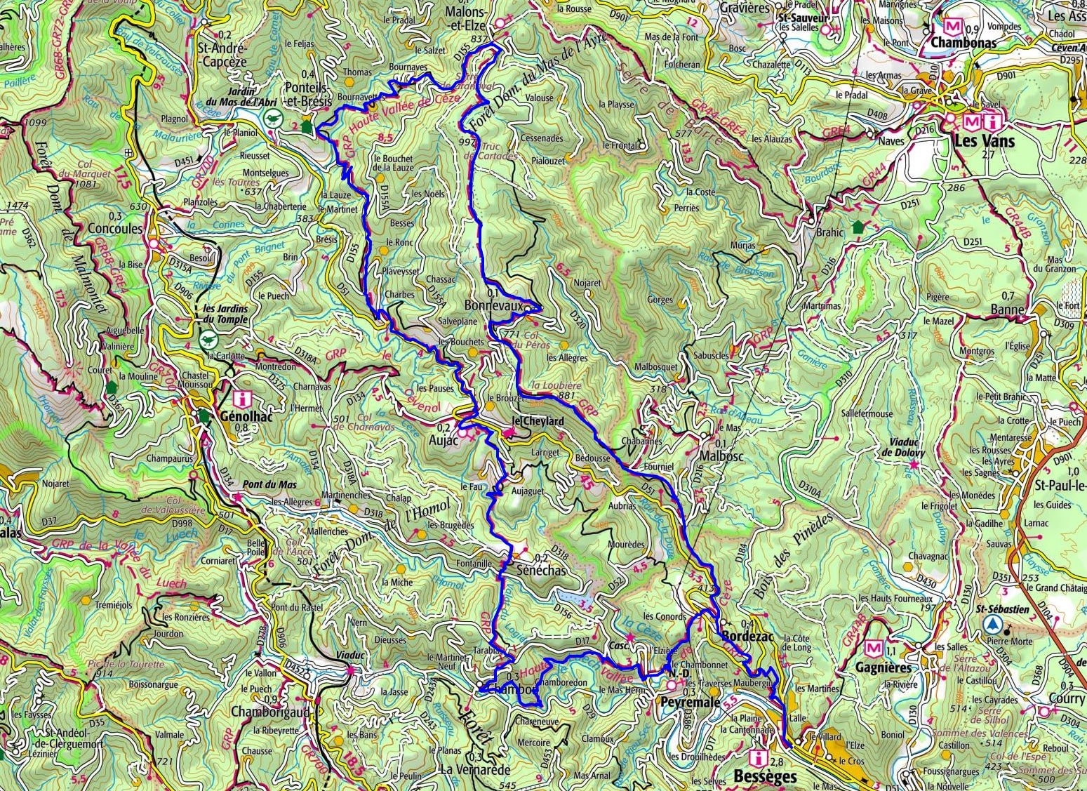
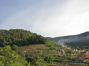
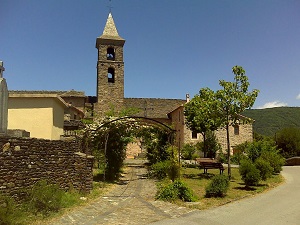
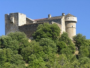
Starting from Bessèges, the trail climbs towards Bordezac and Peyremale, revealing a heritage of schist and discreet Romanesque churches nestled in the maquis. Passing through Sénéchas and Aujac, hikers discover the iconic Château du Cheylard, a medieval sentinel overlooking valleys of ancient chestnut trees. The route then winds through landscapes of ridges and dense forests towards Ponteils-et-Brésis, where the tranquility of the Cèze River accompanies walkers. Nature here is preserved, alternating between the steep slopes of the Cévennes and the limestone plateaus of Malons-et-Elze. The passage through Bonnevaux showcases authentic rural architecture, with its stone houses clinging to the hillside and its ancient terraced orchards.
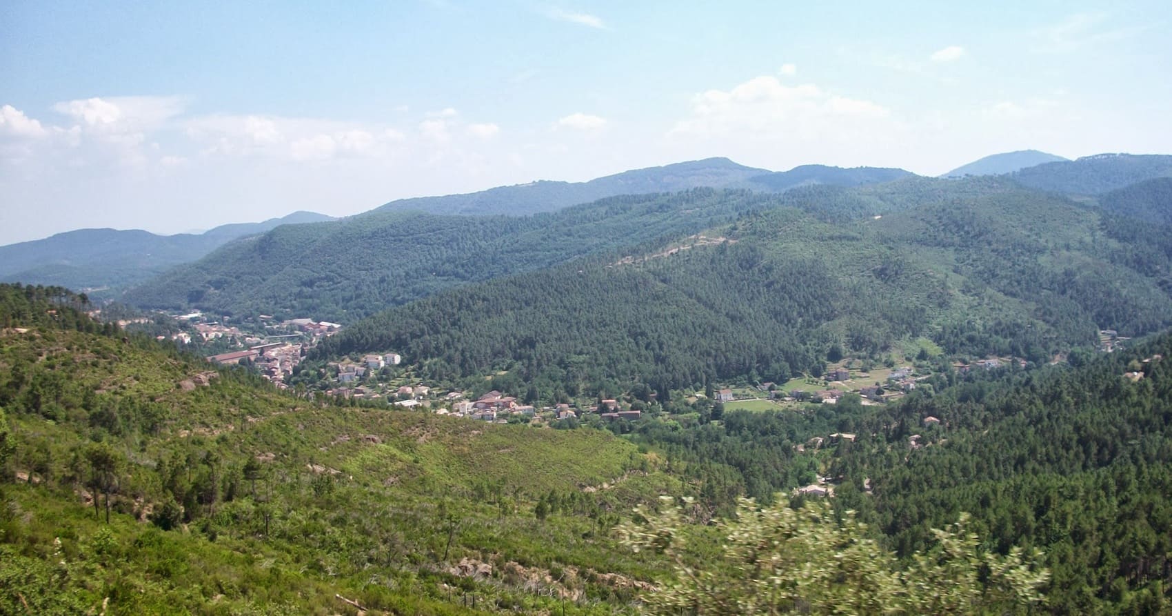
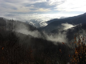
The Upper Cèze Valley, a wild link between the Gard and Ardèche departments, is a land of schist and crystal-clear rivers nestled at the foot of the Cévennes mountains. Its history is marked by the ancient exploitation of coal mines and silk production, as evidenced by the magnificent grey stone silkworm farms. The built heritage is exceptional, with charming villages like Banne, overlooking the plain, or Saint-Ambroix with its legendary rock. Nature expresses itself with raw power, notably through the Cèze Gorges and the Sautadet waterfalls, true masterpieces of limestone erosion. The landscapes alternate between garrigue fragrant with thyme and dense chestnut forests, offering refuge to a protected fauna, from the European beaver to golden eagles.
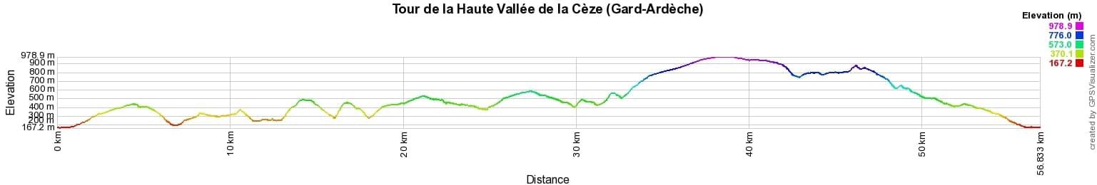
 Distance: 57km, Elevation maximum: 978m, Elevation minimum: 167m, Elevation gain uphill: 2273m
IGN Maps: 2839OT - BESSEGES / LES VANS / VALLEE DU CHASSEZAC. 2840OT - ALES.
Nearby paths:
![]() It is advisable to follow the beacons all along your hike and to bring the FFRandonnée topo-guide. You will also find information on MonGR.fr.
It is advisable to follow the beacons all along your hike and to bring the FFRandonnée topo-guide. You will also find information on MonGR.fr.
GR®, PR®, GRP® and the corresponding markings are trademarks of the French Federation of Hiking. They may not be reproduced without permission. The French Federation of Hiking, state-approved, includes organizations that maintain hiking routes. It publishes guides for these routes. With your donations, support the actions of the thousands of volunteer markers of the FFRandonnée.
GR-Infos.com is an editorial partner of MonGR.fr.
| Return |

Former holiday hotel with a garden along the Allier, L'Etoile Guest House is located in La Bastide-Puylaurent between Lozere, Ardeche, and the Cevennes in the mountains of Southern France. At the crossroads of GR®7, GR®70 Stevenson Path, GR®72, GR®700 Regordane Way, GR®470 Allier River springs and gorges, GRP® Cevenol, Ardechoise Mountains, Margeride. Numerous loop trails for hiking and one-day biking excursions. Ideal for a relaxing and hiking getaway.
Copyright©gr-infos.com (Authorization for private use only)
To help us maintain and improve GR-Infos.com, a contribution of 2€ is desired via Wero or bank transfer. Thank you!