
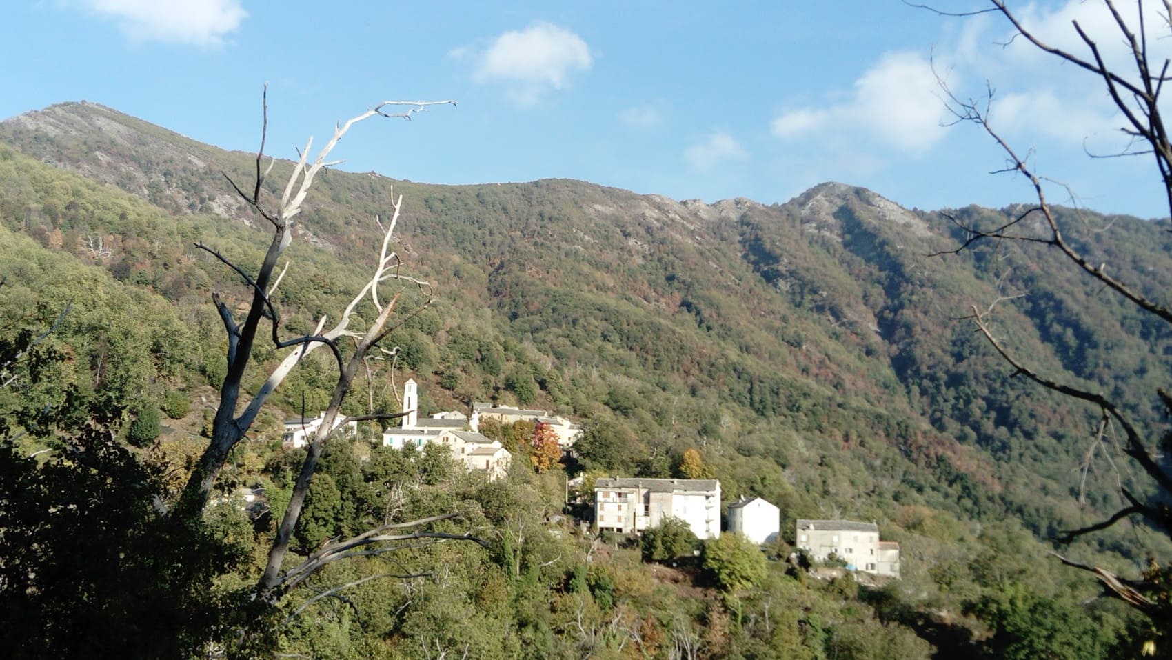
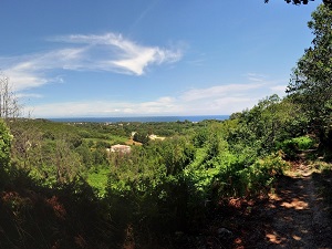
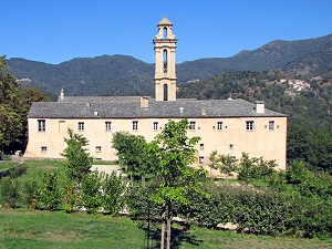
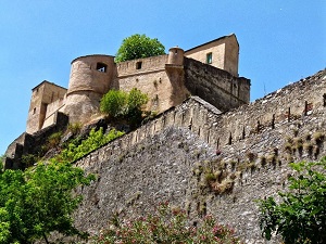
Starting from San-Nicolao, the trail winds through the dense chestnut groves of the Castagniccia, a land steeped in history and resistance, passing through Pianellu and Alando where Romanesque chapels and convents tell the story of island piety. The heart of the route beats in Corte, the historical and cultural capital, dominated by its citadel perched atop a granite outcrop. Climbing towards Lozzi, at the foot of Monte Cinto, and crossing the Niolu region via Casamaccioli, hikers discover a raw, pastoral landscape, its rhythm dictated by transhumance and snow-capped peaks. The descent then begins towards the Golo Valley, before crossing the Vergio Pass to reach Evisa, nestled between Corsican pine forests and ancient chestnut trees. The landscape then changes dramatically: the red rocks of the calanques appear on the horizon as you pass through Marignana. The path finally descends towards Cargèse, the "Greek city" with its two churches.
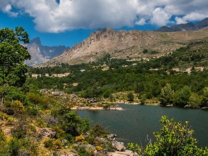
Northern Corsica, or Haute-Corse, is a land of striking contrasts where the snow-capped peaks of Monte Cinto plunge into the Mediterranean. Its heritage is deeply rooted, from the Genoese citadel of Bastia to the proud hilltop villages of the Balagne region, nicknamed the "garden of Corsica" for its centuries-old olive groves. On the nature front, the Agriates Desert offers a wild expanse of fragrant maquis bordered by the idyllic beaches of Saleccia. History is etched in the coastal towers of Cap Corse, this narrow peninsula where the houses of American settlers bear witness to past migratory epics. Biodiversity is exceptional, protected by the Regional Natural Park which shelters a preserved endemic fauna. Between schist cliffs and Laricio pine forests, the north of the Isle of Beauty exudes a powerful character and an untamed, wild beauty.
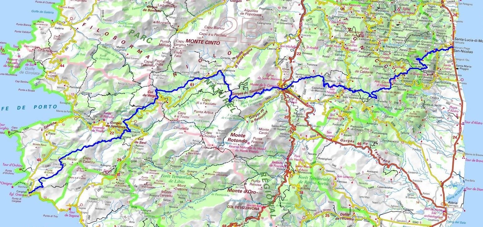


 Distance: 139km, Elevation maximum: 1592m, Elevation minimum: 4m, Elevation gain uphill: 7739m
IGN Maps: 4349OT - VESCOVATO / CASTAGNICCA. 4351OT - CERVIONE / PNR DE LA CORSE. 4250OT - CORTE / MONTE-CINTO / PNR DE LA CORSE. 4251OT - MONTE-D'ORO / MONTE-ROTONDO / PNR DE LA CORSE. 4150OT - PORTO / CALANCHE DE PIANA / PNR DE LA CORSE. 4151OT - VICO / CARGESE / GOLFE DE SAGONE.

Transhumance:
Mare e Monti:
Mare to Mare:
![]() It is advisable to follow the beacons all along your hike and to bring the FFRandonnée topo-guide. You will also find information on MonGR.fr.
It is advisable to follow the beacons all along your hike and to bring the FFRandonnée topo-guide. You will also find information on MonGR.fr.
GR®, PR®, GRP® and the corresponding markings are trademarks of the French Federation of Hiking. They may not be reproduced without permission. The French Federation of Hiking, state-approved, includes organizations that maintain hiking routes. It publishes guides for these routes. With your donations, support the actions of the thousands of volunteer markers of the FFRandonnée.
GR-Infos.com is an editorial partner of MonGR.fr.
| Return |

Former holiday hotel with a garden along the Allier, L'Etoile Guest House is located in La Bastide-Puylaurent between Lozere, Ardeche, and the Cevennes in the mountains of Southern France. At the crossroads of GR®7, GR®70 Stevenson Path, GR®72, GR®700 Regordane Way, GR®470 Allier River springs and gorges, GRP® Cevenol, Ardechoise Mountains, Margeride. Numerous loop trails for hiking and one-day biking excursions. Ideal for a relaxing and hiking getaway.
Copyright©gr-infos.com (Authorization for private use only)
To help us maintain and improve GR-Infos.com, a contribution of 2€ is desired via Wero or bank transfer. Thank you!