
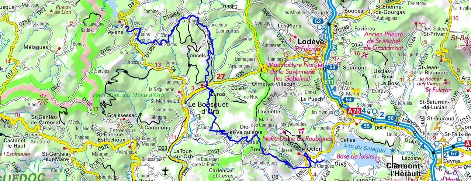
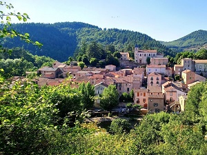
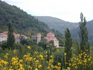
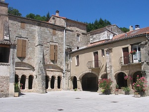
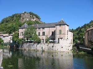
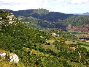
This hike in the Hérault region is a geological and historical journey, beginning on the wooded shores of Lake Avène, nestled in the Espinouse mountains. Following the Orb River, the trail leads to Joncels, a medieval gem home to a thousand-year-old Benedictine abbey, before reaching Lunas, a charming village where the waters of the Gravezon River irrigate a rich architectural heritage. The route becomes more challenging towards Dio-et-Valquières, dominated by its imposing red sandstone castle, then crosses the arid lands of Brenas, offering breathtaking views of the rocky outcrops. The journey concludes with the descent to Octon, gateway to Lake Salagou, whose "ruffes" (red volcanic soils) create a striking contrast with the azure water. This unique natural landscape, designated a Grand Site de France, blends feudal remains with lunar landscapes shaped by millions of years of erosion.
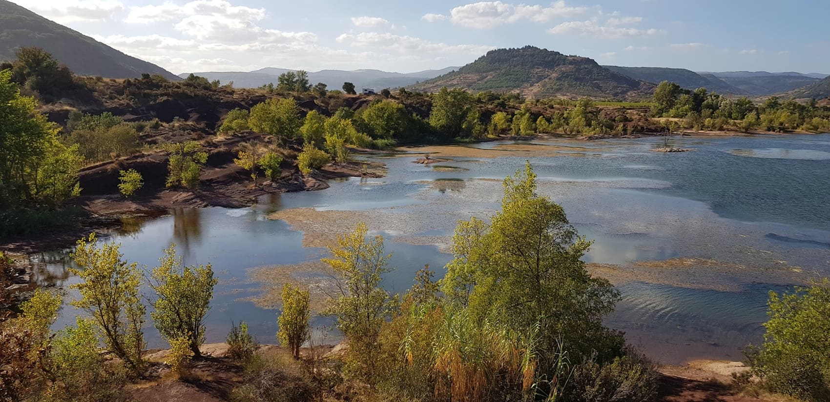
The Entre-Deux-Lacs region, stretching from Lake Avène to Lake Salagou, offers a striking geological contrast in the heart of the Hérault department. To the north, Lake Avène nestles in the wooded hills of the Orb mountains, a verdant haven renowned for its curative thermal waters and beech forests. Heading south, the landscape shifts dramatically towards the vibrant red of the "ruffes", the arid rock that surrounds Lake Salagou. This protected site, reminiscent of an African canyon, is home to charming villages like Octon and the abandoned hamlet of Celles, testaments to a rural history disrupted by the construction of the dam. The built heritage is revealed through isolated Romanesque churches and mining remains, while nature displays exceptional biodiversity between Mediterranean scrubland and wetlands.
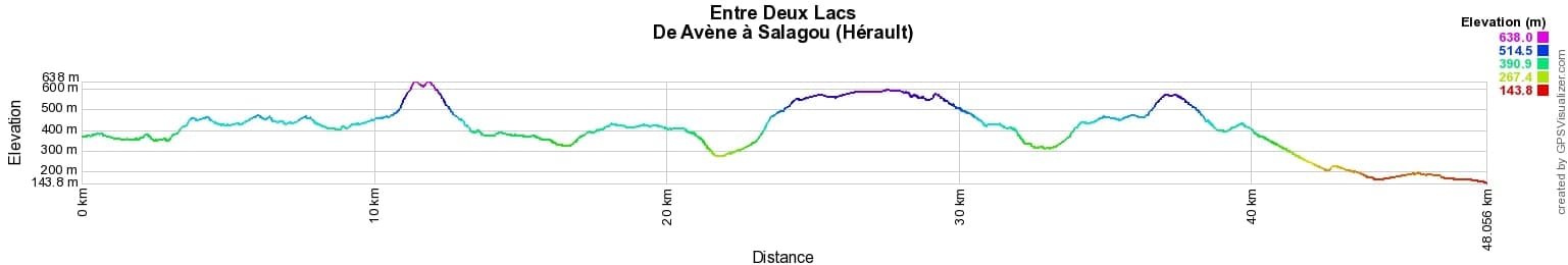
 Distance: 48km, Elevation maximum: 647m, Elevation minimum: 144m, Elevation gain uphill: 1315m
IGN Maps: 2542OT - CAMARÈS / AVÈNE. 2642OT - LE CAYLAR / LA COUVERTOIRADE. 2643OT - LODÈVE / BÉDARIEUX / LAC DU SALAGOU.

Nearby paths:
![]() It is advisable to follow the trail markers all along your hike and to bring the FFRandonnée topo-guide. You will also find information on MonGR.fr.
It is advisable to follow the trail markers all along your hike and to bring the FFRandonnée topo-guide. You will also find information on MonGR.fr.
GR®, PR®, GRP® and the corresponding markings are trademarks of the French Federation of Hiking. They may not be reproduced without permission. The French Federation of Hiking, state-approved, includes organizations that maintain hiking routes. It publishes guides for these routes. With your donations, support the actions of the thousands of volunteer markers of the FFRandonnée.
GR-Infos.com is an editorial partner of MonGR.fr.
| Return |

Former holiday hotel with a garden along the Allier, L'Etoile Guest House is located in La Bastide-Puylaurent between Lozere, Ardeche, and the Cevennes in the mountains of Southern France. At the crossroads of GR®7, GR®70 Stevenson Path, GR®72, GR®700 Regordane Way, GR®470 Allier River springs and gorges, GRP® Cevenol, Ardechoise Mountains, Margeride. Numerous loop trails for hiking and one-day biking excursions. Ideal for a relaxing and hiking getaway.
Copyright©gr-infos.com (Authorization for private use only)
To help us maintain and improve GR-Infos.com, a contribution of 2€ is desired via Wero or bank transfer. Thank you!