
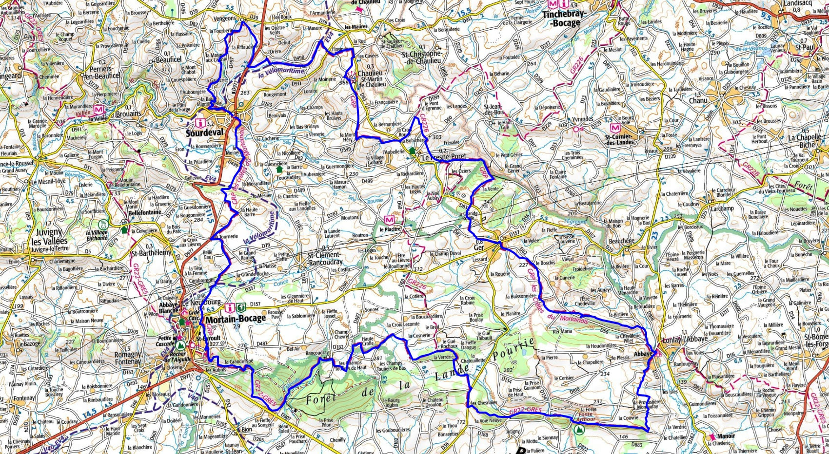
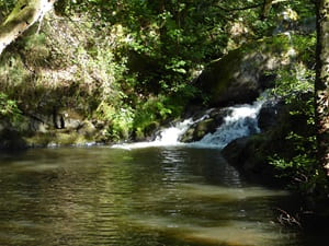
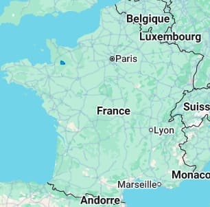
Starting from Sourdeval, the trail heads toward Fresne-Poret, crossing preserved bocage countryside and sunken lanes steeped in rural history. The route then reaches the village of Ger, famous for its pottery past, before dipping into the Egrentonne valley. In Lonlay-l'Abbaye, the local heritage takes center stage with its 11th-century Benedictine abbey, nestled in a lush green setting. The terrain becomes steeper toward Mortain-Bocage, where sandstone rock formations carve out distinct ridgelines. Nature is at its most powerful here, with the "Grandes et Petites Cascades" (Great and Small Waterfalls), the highest in Western France. From the small Saint-Michel chapel, perched on its promontory, the panorama extends on a clear day all the way to Mont-Saint-Michel. This land, marked by legends and the geological resistance of Armorican sandstone, alternates between heather-covered moors and dense forests.
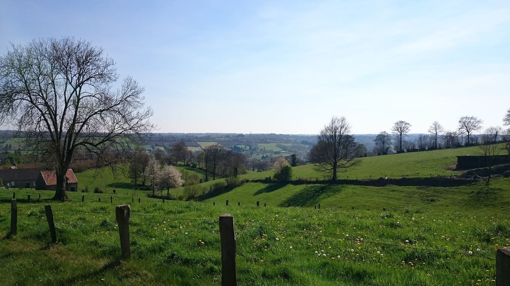
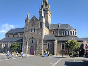
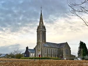
The Mortainais, on the borders of Manche and Orne, is a land of legends and contrasts where the Armorican Massif shapes a landscape known as "Little Norman Switzerland." At the heart of this preserved bocage, the town of Mortain overlooks deep gorges, famous for its waterfalls—the most impressive in the West—where water churns between walls of Armorican sandstone. This rugged terrain offers spectacular views, particularly from the Saint-Michel Chapel, from which the eye can see as far as Mont-Saint-Michel on a clear day. The spiritual heritage is exceptional, featuring the Abbaye Blanche, a 12th-century Cistercian marvel, and the Saint-Évroult collegiate church, a jewel of Norman Gothic art. The history of the Mortainais is also marked by the intensity of World War II, notably during the Counter-attack of Mortain in 1944, whose traces are still visible along the ridges. Nature flourishes through dense forests, heather moors, and centuries-old pear orchards, the birthplace of the famous Domfront Perry (Poiré). Between the steep paths of the Normandie-Maine Regional Natural Park and the swift rivers of the Sée and Sélune.
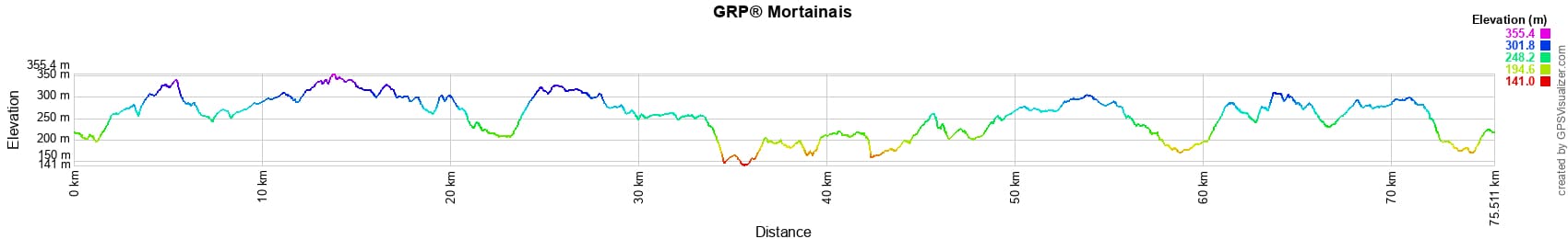
 Distance: 75km, Maximum altitude: 353m, Minimum altitude: 141m, Total ascent: 1270m
Nearby trails:
![]() It is advisable to follow the beacons all along your hike and to bring the FFRandonnée topo-guide. You will also find information on MonGR.fr.
It is advisable to follow the beacons all along your hike and to bring the FFRandonnée topo-guide. You will also find information on MonGR.fr.
GR®, PR®, GRP® and the corresponding markings are trademarks of the French Federation of Hiking. They may not be reproduced without permission. The French Federation of Hiking, state-approved, includes organizations that maintain hiking routes. It publishes guides for these routes. With your donations, support the actions of the thousands of volunteer markers of the FFRandonnée.
GR-Infos.com is an editorial partner of MonGR.fr.
| Return |

Former holiday hotel with a garden along the Allier, L'Etoile Guest House is located in La Bastide-Puylaurent between Lozere, Ardeche, and the Cevennes in the mountains of Southern France. At the crossroads of GR®7, GR®70 Stevenson Path, GR®72, GR®700 Regordane Way, GR®470 Allier River springs and gorges, GRP® Cevenol, Ardechoise Mountains, Margeride. Numerous loop trails for hiking and one-day biking excursions. Ideal for a relaxing and hiking getaway.
Copyright©gr-infos.com (Authorization for private use only)
To help us maintain and improve GR-Infos.com, a contribution of 2€ is desired via Wero or bank transfer. Thank you!