
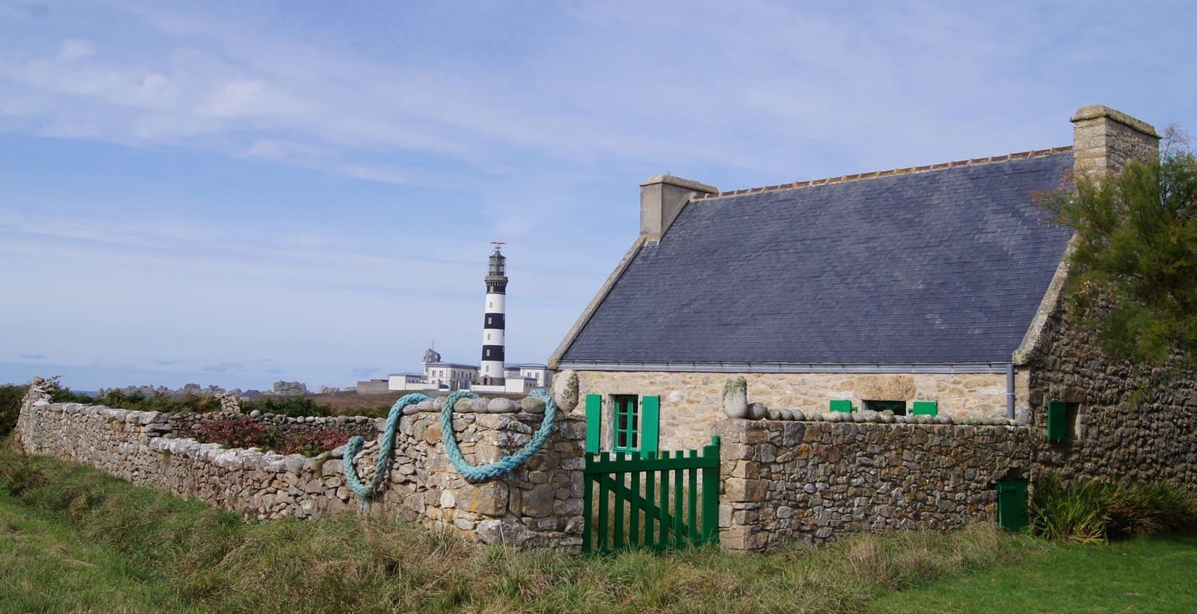
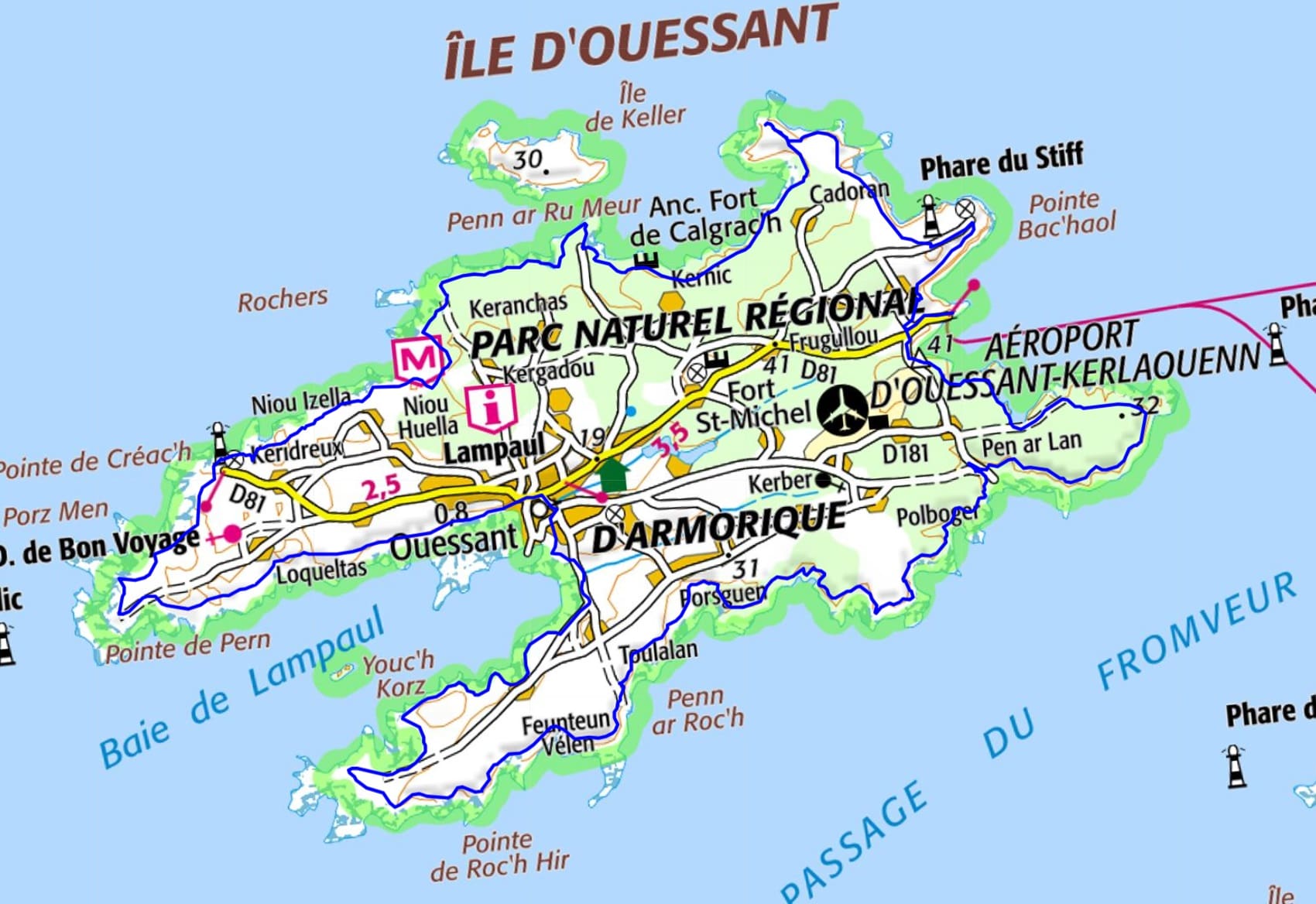
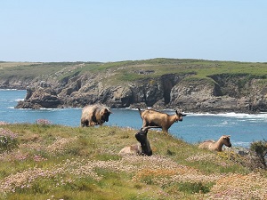
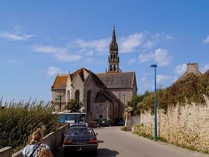
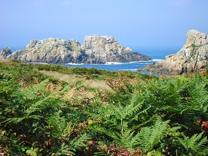
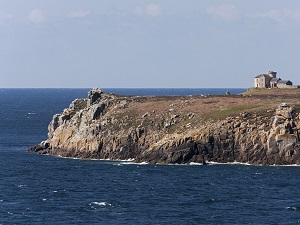
Starting from Port du Stiff, the coastal path first leads to the Pen ar Lan Cromlech and the Kroas Ar Halvar cross, testaments to an island spirituality rooted in stone. Following the jagged cliffs towards Port d'Arlan and the Runiou Pyramid, where the Iroise Sea roars relentlessly, the trail continues along Porz Goret and Prat beach, offering glimpses of the gentle coves before reaching the village of Ouessant, the island's vibrant heart. The path then leads to Pointe de Pern, a remote land of storm-sculpted rocks, not far from the Lighthouse and Beacon Museum, which recounts the history of maritime signaling. After a stop at Yuzin beach, the path crosses the Kranelier casemate, a vestige of the coastal defenses, before reaching the majestic Pointe de Kadoran and the Stiff Lighthouse, designed by Vauban, dominating a landscape of low moors where the famous black sheep graze.
The history of Ouessant is long and rich. The island has been inhabited since prehistoric times, as evidenced by the many megaliths that have been discovered there. Ouessant was an important passage point for Vikings and pirates in the Middle Ages. During this period, the island was raided several times. In the 16th century, Ouessant became an important center of trade and fishing. The island was then known for its production of dried cod, which was exported to the countries of Northern Europe. In the 19th century, Ouessant experienced significant economic development, particularly thanks to the construction of lighthouses. The Créac'h lighthouse, the tallest in France, was built in 1863.
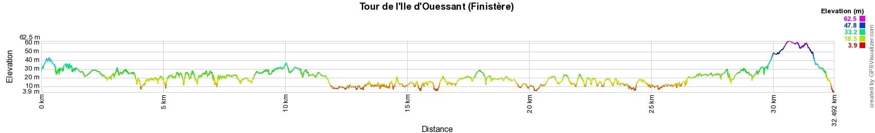

 Distance: 32km, Elevation maximum: 62m, Elevation minimum: 5m, Elevation gain uphill: 285m
IGN Maps: 0317OT - ILE D'OUESSANT / LE CONQUET.

Nearby paths:
![]() It is advisable to follow the beacons all along your hike and to bring the FFRandonnée topo-guide. You will also find information on MonGR.fr.
It is advisable to follow the beacons all along your hike and to bring the FFRandonnée topo-guide. You will also find information on MonGR.fr.
GR®, PR®, GRP® and the corresponding markings are trademarks of the French Federation of Hiking. They may not be reproduced without permission. The French Federation of Hiking, state-approved, includes organizations that maintain hiking routes. It publishes guides for these routes. With your donations, support the actions of the thousands of volunteer markers of the FFRandonnée.
GR-Infos.com is an editorial partner of MonGR.fr.
| Return |

Former holiday hotel with a garden along the Allier, L'Etoile Guest House is located in La Bastide-Puylaurent between Lozere, Ardeche, and the Cevennes in the mountains of Southern France. At the crossroads of GR®7, GR®70 Stevenson Path, GR®72, GR®700 Regordane Way, GR®470 Allier River springs and gorges, GRP® Cevenol, Ardechoise Mountains, Margeride. Numerous loop trails for hiking and one-day biking excursions. Ideal for a relaxing and hiking getaway.
Copyright©gr-infos.com (Authorization for private use only)
To help us maintain and improve GR-Infos.com, a contribution of 2€ is desired via Wero or bank transfer. Thank you!