
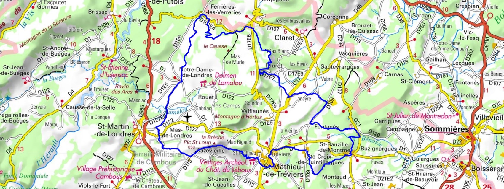
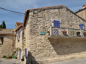
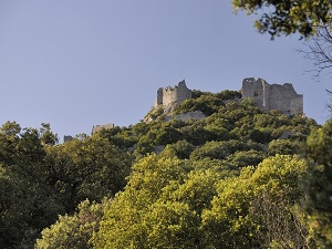
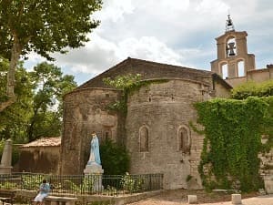
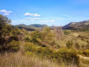
Starting from Saint-Mathieu-de-Tréviers, the trail first climbs towards Cazevieille, a limestone outcrop offering a breathtaking view of the jagged silhouette of the Pic du Midi, before descending towards the geological depression of Mas-de-Londres. Passing through Notre-Dame-de-Londres, hikers discover a preserved medieval heritage, marked by its castle and Romanesque church, in the heart of a pastoral plain. The terrain becomes more rugged towards the cliffs of Lauret, where water has sculpted landscapes of springs and caves. Turning off towards Fontanès and Saint-Bauzille-de-Montmel, the landscape takes on a more Mediterranean character, with holm oaks and the scent of thyme overlooking the plains of the Hérault region. The passage through the Puech des Mourgues reveals panoramas stretching from the Cévennes mountains to the sea, highlighting the strategic importance of these heights throughout history.

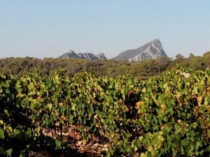
The Grand Pic Saint-Loup region is an emblematic transition zone of the Hérault department, stretching from the Mediterranean wine-growing plains to the foothills of the Causses. The landscape is dominated by the silhouette of the Pic Saint-Loup, a majestic limestone ridge that separates the arid garrigue scrubland from the vine-covered hillsides. The history of this region is intimately linked to viticulture, which has shaped the hills and given it its protected designation of origin (AOC), as well as to the religious past of the summit hermitage. The flora is typically Mediterranean, characterized by the omnipresence of Aleppo pine and fragrant garrigue (thyme, rosemary) in the dry areas. The fauna is adapted to this arid and hot environment, including wild boar, numerous reptiles, and garrigue bird species, forming a valuable ecosystem.
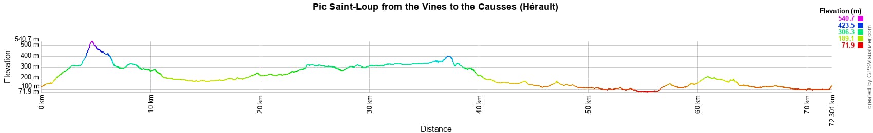
 Distance: 72km, Elevation maximum: 540m, Elevation minimum: 73m, Elevation gain uphill: 1123m
IGN Maps: 2742ET - GANGES / PIC SAINT-LOUP / SAINT-MARTIN-DE-LONDRES. 2842OT - SOMMIERES / VERGEZE.

Nearby paths:
![]() It is advisable to follow the beacons all along your hike and to bring the FFRandonnée topo-guide. You will also find information on MonGR.fr.
It is advisable to follow the beacons all along your hike and to bring the FFRandonnée topo-guide. You will also find information on MonGR.fr.
GR®, PR®, GRP® and the corresponding markings are trademarks of the French Federation of Hiking. They may not be reproduced without permission. The French Federation of Hiking, state-approved, includes organizations that maintain hiking routes. It publishes guides for these routes. With your donations, support the actions of the thousands of volunteer markers of the FFRandonnée.
GR-Infos.com is an editorial partner of MonGR.fr.
| Return |

Former holiday hotel with a garden along the Allier, L'Etoile Guest House is located in La Bastide-Puylaurent between Lozere, Ardeche, and the Cevennes in the mountains of Southern France. At the crossroads of GR®7, GR®70 Stevenson Path, GR®72, GR®700 Regordane Way, GR®470 Allier River springs and gorges, GRP® Cevenol, Ardechoise Mountains, Margeride. Numerous loop trails for hiking and one-day biking excursions. Ideal for a relaxing and hiking getaway.
Copyright©gr-infos.com (Authorization for private use only)
To help us maintain and improve GR-Infos.com, a contribution of 2€ is desired via Wero or bank transfer. Thank you!