
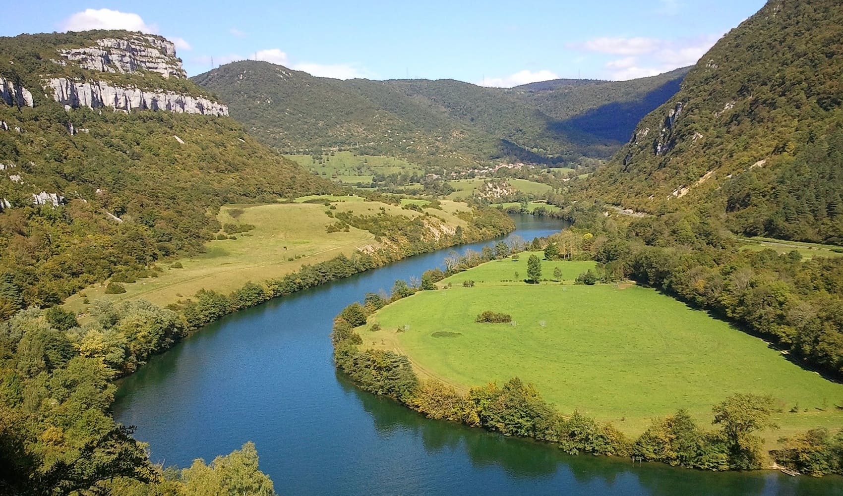
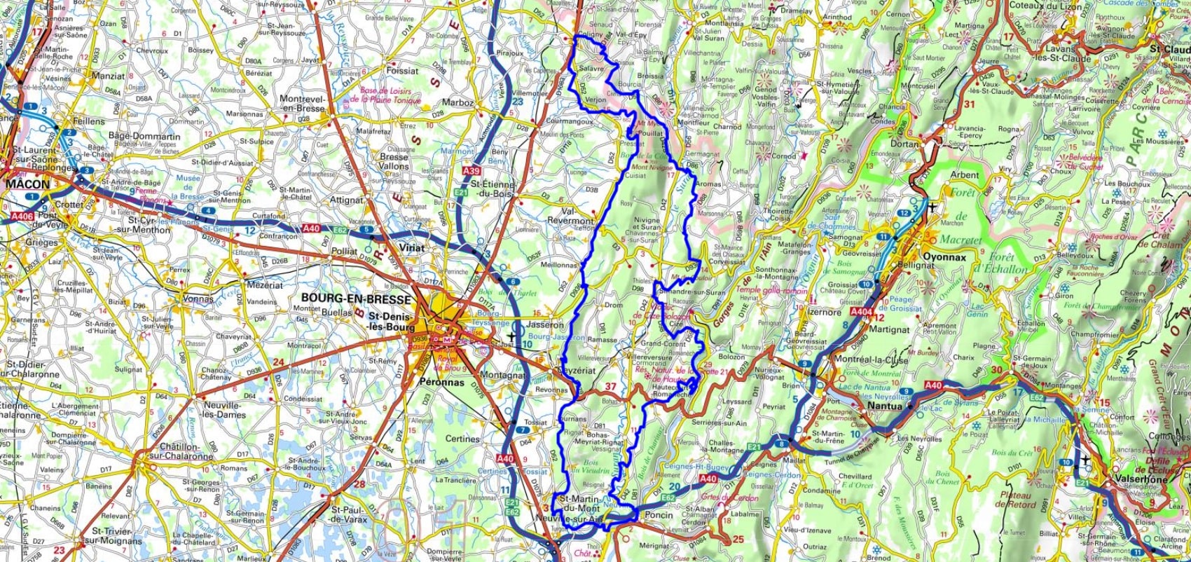
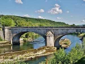
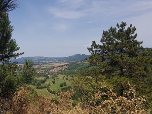
Starting in Neuville-sur-Ain, the trail winds through charming medieval villages built of limestone, such as Journans, Treffort-Cuisiat, and the town of Coligny, whose rich heritage testifies to its strategic border past. Climbing the ridges, hikers overlook a landscape of hedged fields and vineyards, offering breathtaking panoramas of the Bresse region and, on a clear day, the Mont Blanc range. Nature expresses itself powerfully here, from the Jura valleys near Bourcia to the limestone cliffs overlooking the Suran Valley. The route takes on a wilder dimension towards Grand-Corent and the Ain gorges, where preserved natural sites like the Hautecourt caves can be discovered. Crossing the Ain River at Cize, under its monumental viaduct, marks a dramatic transition to wooded hills before reaching the medieval town of Poncin.
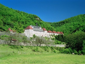
Its name, which means "beyond the mountain", is a reference to the first foothills of the Jura, which constitute its southern limits. Revermont covers approximately 1,500 km and has approximately 100,000 inhabitants. The relief of Revermont is gentle, with altitudes varying between 200 and 600 meters. The landscape is marked by limestone hills, deciduous and coniferous forests, meadows and crops. Revermont is a region rich in biodiversity. There are many animal and plant species, some of which are rare or threatened. The region is also rich in historical and cultural heritage. There are many picturesque villages, castles, churches and abbeys.
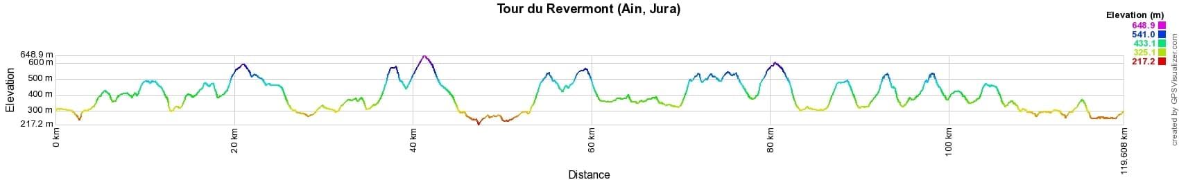

 Distance: 119km, Elevation maximum: 649m, Elevation minimum: 218m, Elevation gain uphill: 3639m
IGN Maps: Saint-Amour - 3128E. Bourg-En-Bresse (Est) - 3129E. Amberieu-En-Bugey - 3130E. Saint-Amour Arinthod Orgelet - 3227OT. Oyonnax Gorges de l'Ain - 3228OT. Nantua Hauteville-Lompnes Nord Bugey - 3230OT.
Nearby paths:
![]() It is advisable to follow the beacons all along your hike and to bring the FFRandonnée topo-guide. You will also find information on MonGR.fr.
It is advisable to follow the beacons all along your hike and to bring the FFRandonnée topo-guide. You will also find information on MonGR.fr.
GR®, PR®, GRP® and the corresponding markings are trademarks of the French Federation of Hiking. They may not be reproduced without permission. The French Federation of Hiking, state-approved, includes organizations that maintain hiking routes. It publishes guides for these routes. With your donations, support the actions of the thousands of volunteer markers of the FFRandonnée.
GR-Infos.com is an editorial partner of MonGR.fr.
| Return |

Former holiday hotel with a garden along the Allier, L'Etoile Guest House is located in La Bastide-Puylaurent between Lozere, Ardeche, and the Cevennes in the mountains of Southern France. At the crossroads of GR®7, GR®70 Stevenson Path, GR®72, GR®700 Regordane Way, GR®470 Allier River springs and gorges, GRP® Cevenol, Ardechoise Mountains, Margeride. Numerous loop trails for hiking and one-day biking excursions. Ideal for a relaxing and hiking getaway.
Copyright©gr-infos.com (Authorization for private use only)
To help us maintain and improve GR-Infos.com, a contribution of 2€ is desired via Wero or bank transfer. Thank you!