|
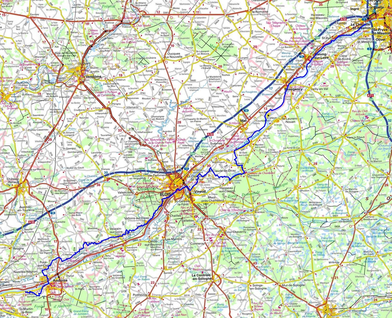
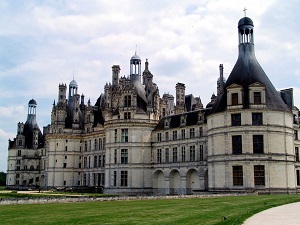
Hike on the GR®3 along Loire River through Loiret and Indre-et-Loire department from La Chapelle St Mesmin to Lussault-sur-Loire via Saint-Ay, Meung-sur-Loire, Beaugency, Tavers, Lestiou, Avaray, Muides-sur-Loire, Saint-Dye-sur-Loire, Chambord, Huisseau-sur-Cosson, Mont-pres-Chambord, Cellettes, Chailles, Cande-sur-Beuvron, Chaumont-sur-Loire, Rilly-sur-Loire, Souvigny-de-Touraine, Saint-Regle and Amboise. Guest House, Bed and Breakfast, Hotel, Camping, Shelter, Inn, Shops.
|

|

GR®3
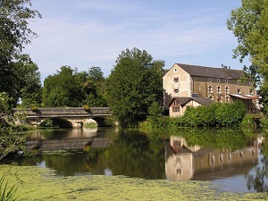
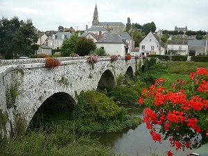
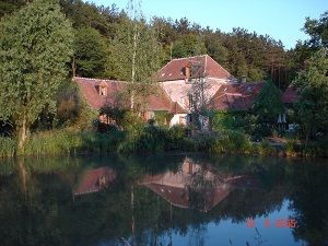
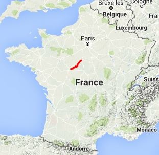
From La Chapelle St Mesmin (Loiret) to Lussault-sur-Loire (Indre-et-Loire)
Loire River trail
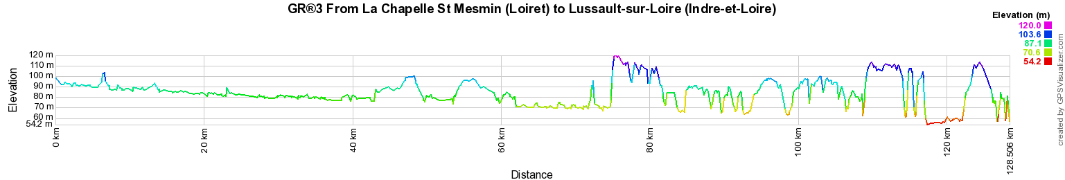
128km
Google Maps - Google Earth

© GPX Private use only |
Distance: 128km, Elevation maximum: 120m, Elevation minimum: 54m, Elevation gain uphill: 634m
IGN Maps: Amboise (1922E). Contres (2022E). Montrichard (2022O). Beaugency (2120E). Mer St-Laurent-Nouan
(2120O). Bracieux Chambord (2121O). Orleans foret d'Orleans massif d'Orleans (2219ET).

Registration
Accommodation or business owner on or near a GR®, you can appear on GR-INFOS
For your registration, you can send me by email (papadimitriou4@gmail.com): your address and phone number, your website (Facebook page), a brief description with 5 beautiful photos of your establishment.
Registration price : 25€/year or 100€/5 years per GR® or GRP®. Renewable. |
|
GR®3 Along the Loire river
From Mt Gerbier-de-Jonc (Ardeche) to Retournac (Haute-Loire)
From Retournac (Haute-Loire) to Chabreloche (Puy-de-Dome)
From Chabreloche (Puy-de-Dome) to St Aubin-sur-Loire (Saone-et-Loire)
From St Aubin-sur-Loire (Saone-et-Loire) to Parigny-les-Vaux (Nievre)
From Parigny-les-Vaux (Nievre) to Ousson-sur-Loire (Loiret)
From Ousson-sur-Loire (Loiret) to La Chapelle St Mesmin (Loiret)
From La Chapelle St Mesmin (Loiret) to Lussault-sur-Loire (Indre-et-Loire)
From Lussault-sur-Loire (Indre-et-Loire) to Parnay (Maine-et-Loire)
From Parnay to Mauges-sur-Loire (Maine-et-Loire)
From Mauges-sur-Loire (Maine-et-Loire) to St Etienne-de-Montluc (Loire-Atlantique)
From St Etienne-de-Montluc to La Baule (Loire-Atlantique)
 It is advisable to follow the beacons all along your hike and to bring you the FFRandonnee topo-guide. You
will also find information on MonGR.fr.
It is advisable to follow the beacons all along your hike and to bring you the FFRandonnee topo-guide. You
will also find information on MonGR.fr.
GR®, PR®, GRP®, and the corresponding signs of markings (white / red, yellow and yellow / red) are trademarks of the French
Federation of Hiking. They may not be reproduced without permission. The French Federation of Hiking, state-approved, includes organizations that create and maintain hiking routes on GR®, PR® and
GRP®. It publishes guides these topo hiking routes.
With your donations, support the actions of the thousands of volunteer markers of the FFRandonnee.
GR-Infos.com is an editorial partner of MonGR.fr.

Old romantic Hotel, L'Etoile Guest-House is a mountain retreat in the South of France. With a beautiful park along the Allier River, L'Etoile Guesthouse is located in La Bastide-Puylaurent between Lozere, Ardeche and Cevennes. Many hiking trails like GR®7, GR®70 Stevenson trail, GR®72, GR®700 Regordane way, Cevenol, GR®470 Allier River Springs and Gorges, Margeride, Ardechoise. Many hiking loops. The right place to relax.
Copyright©gr-infos.com (Authorization for private use only)