|
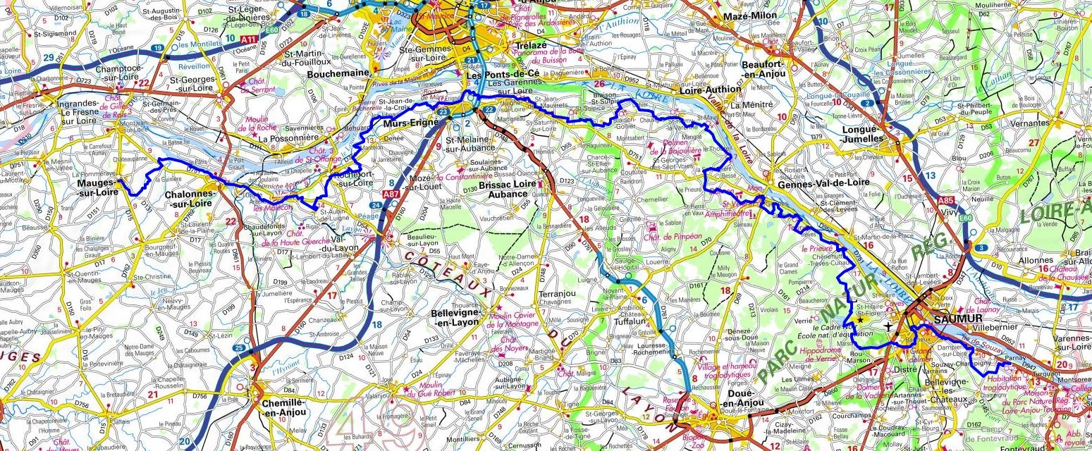
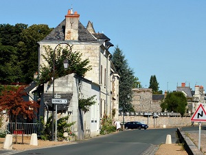
Hike on the GR®3 along Loire River through Maine-et-Loire department from Parnay to Mauges-sur-Loire via Dampierre-sur-Loire, Beaulieu, Saumur, Le Vaulanglais, Riou, Rou-Marson, La Croix, Chenehutte, Cunault, Gennes, Gennes, Le Thoureil, Saint-Remy-la-Varenne, Blaison-Gohier, Saint-Saturnin-sur-Loire, Saint-Jean-des-Mauvrets, Juigne-sur-Loire, erigne, Denee, Mantelon, Rochefort-sur-Loire, Ardenay, La Croix Brouillet and Chalonnes-sur-Loire. Guest House, Bed and Breakfast, Hotel, Camping, Shelter, Inn, Shops.
|

|

GR®3
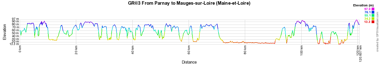
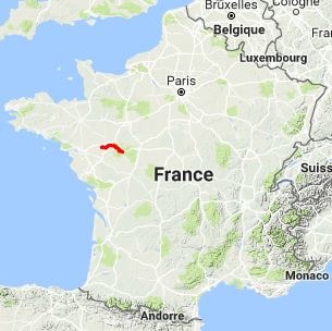
From Parnay to Mauges-sur-Loire (Maine-et-Loire)
Loire River trail
120km
Google Maps - Google Earth

© GPX Private use only |
Distance: 120km, Elevation maximum: 97m, Elevation minimum: 13m, Elevation gain uphill: 1205m
IGN Maps: Chalonnes-sur-Loire (1422E). Angers (1522O). Valanjou (1523O). Maze (1622O). Saumur (1623E).
Doue-la-Fontaine (1623O).

Registration
Accommodation or business owner on or near a GR®, you can appear on GR-INFOS
For your registration, you can send me by email (papadimitriou4@gmail.com): your address and phone number, your website (Facebook page), a brief description with 5 beautiful photos of your establishment.
Registration price : 25€/year or 100€/5 years per GR® or GRP®. Renewable. |
|
GR®3 Along the Loire river
From Mt Gerbier-de-Jonc (Ardeche) to Retournac (Haute-Loire)
From Retournac (Haute-Loire) to Chabreloche (Puy-de-Dome)
From Chabreloche (Puy-de-Dome) to St Aubin-sur-Loire (Saone-et-Loire)
From St Aubin-sur-Loire (Saone-et-Loire) to Parigny-les-Vaux (Nievre)
From Parigny-les-Vaux (Nievre) to Ousson-sur-Loire (Loiret)
From Ousson-sur-Loire (Loiret) to La Chapelle St Mesmin (Loiret)
From La Chapelle St Mesmin (Loiret) to Lussault-sur-Loire (Indre-et-Loire)
From Lussault-sur-Loire (Indre-et-Loire) to Parnay (Maine-et-Loire)
From Parnay to Mauges-sur-Loire (Maine-et-Loire)
From Mauges-sur-Loire (Maine-et-Loire) to St Etienne-de-Montluc (Loire-Atlantique)
From St Etienne-de-Montluc to La Baule (Loire-Atlantique)
 It is advisable to follow the beacons all along your hike and to bring you the FFRandonnee topo-guide. You
will also find information on MonGR.fr.
It is advisable to follow the beacons all along your hike and to bring you the FFRandonnee topo-guide. You
will also find information on MonGR.fr.
GR®, PR®, GRP®, and the corresponding signs of markings (white / red, yellow and yellow / red) are trademarks of the French
Federation of Hiking. They may not be reproduced without permission. The French Federation of Hiking, state-approved, includes organizations that create and maintain hiking routes on GR®, PR® and
GRP®. It publishes guides these topo hiking routes.
With your donations, support the actions of the thousands of volunteer markers of the FFRandonnee.
GR-Infos.com is an editorial partner of MonGR.fr.

Old romantic Hotel, L'Etoile Guest-House is a mountain retreat in the South of France. With a beautiful park along the Allier River, L'Etoile Guesthouse is located in La Bastide-Puylaurent between Lozere, Ardeche and Cevennes. Many hiking trails like GR®7, GR®70 Stevenson trail, GR®72, GR®700 Regordane way, Cevenol, GR®470 Allier River Springs and Gorges, Margeride, Ardechoise. Many hiking loops. The right place to relax.
Copyright©gr-infos.com (Authorization for private use only)