|
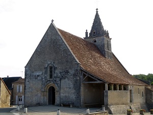
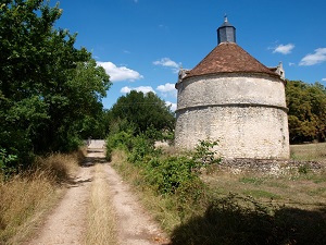
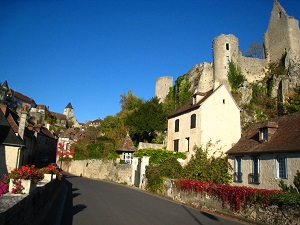
Hike on the GR®48 through Vienne department from L'Isle-Jourdain to Angles-sur-l'Anglin via La Cote Maronneau, La Grande Vergne, Persac, Gouex, Lussac-les-Chateaux, Vaux, Theuil, Montmorillon, Concise, Prunier, La Roche to Baussant, L'ebeaupin, Jouhet, Antigny and Saint-Savin. Gite d'Etapes d'etapes, Guest house, Shelters, Hotels, Camping, Youth Hostel.
|

|
GR®48
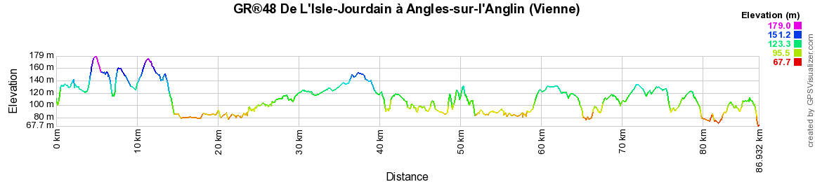
From Isle-Jourdain to Angles-sur-l'Anglin (Vienne)
86km
Google Maps - Google Earth


© GPX Private use only |
Distance: 86km, Elevation maximum: 178m, Elevation minimum: 70m, Elevation gain uphill: 607m
IGN Maps: Persac (1828E). l'Isle-Jourdain (Vienne) (1829E). Pleumartin la Roche-Posay (1926O). La Trimouille (1927E). St-Savin (Vienne) (1927O). Lathus-St-Remy (1928E). Montmorillon (1928O).
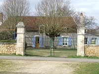
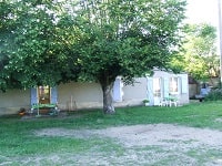
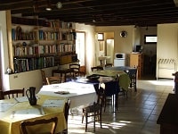
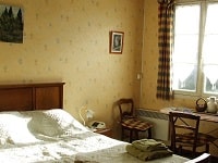
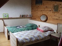
Le Bois d'Haut (Merigny): La Ferme du Bois d'Haut Guesthouse, 02 54 37 36 52, 06 80 45 18 11, Email
Peasant room of full foot with independent entrance and private sanitary. Large room with 8 beds and large living room. You can, if you wish, share our meal and thus better know the inhabitants and the territory that you cross. |
|
Registration
Accommodation or business owner on or near a GR®, you can appear on GR-INFOS
For your registration, you can send me by email (papadimitriou4@gmail.com): your address and phone number, your website (Facebook page), a brief description with 5 beautiful photos of your establishment.
Registration price : 50€/2 years or 100€/5 years per GR® or GRP®. Renewable. |
GR®48 From La Ribiere (Haute-Vienne) to Chinon (Indre-et-Loire)
From La Ribiere (Haute-Vienne) to Isle-Jourdain (Vienne)
From Isle-Jourdain to Angles-sur-l'Anglin (Vienne)
From Angles-sur-l'Anglin (Vienne) to Chinon (Indre-et-Loire)
 It is advisable to follow the beacons all along your hike and to bring you the FFRandonnee topo-guide. You
will also find information on MonGR.fr.
It is advisable to follow the beacons all along your hike and to bring you the FFRandonnee topo-guide. You
will also find information on MonGR.fr.
GR®, PR®, GRP®, and the corresponding signs of markings (white / red, yellow and yellow / red) are trademarks of the French
Federation of Hiking. They may not be reproduced without permission. The French Federation of Hiking, state-approved, includes organizations that create and maintain hiking routes on GR®, PR® and
GRP®. It publishes guides these topo hiking routes. With your donations, support the actions of the thousands of volunteer markers of the FFRandonnee.
GR-Infos.com is an editorial partner of MonGR.fr.


Former holiday hotel with a garden along the Allier, L'Etoile Guest House is located in La Bastide-Puylaurent between Lozere, Ardeche, and the Cevennes in the mountains of Southern France. At the crossroads of GR®7, GR®70 Stevenson Path, GR®72, GR®700 Regordane Way, GR®470 Allier River springs and gorges, GRP® Cevenol, Ardechoise Mountains, Margeride. Numerous loop trails for hiking and one-day biking excursions. Ideal for a relaxing and hiking getaway.
Copyright©gr-infos.com (Authorization for private use only)