
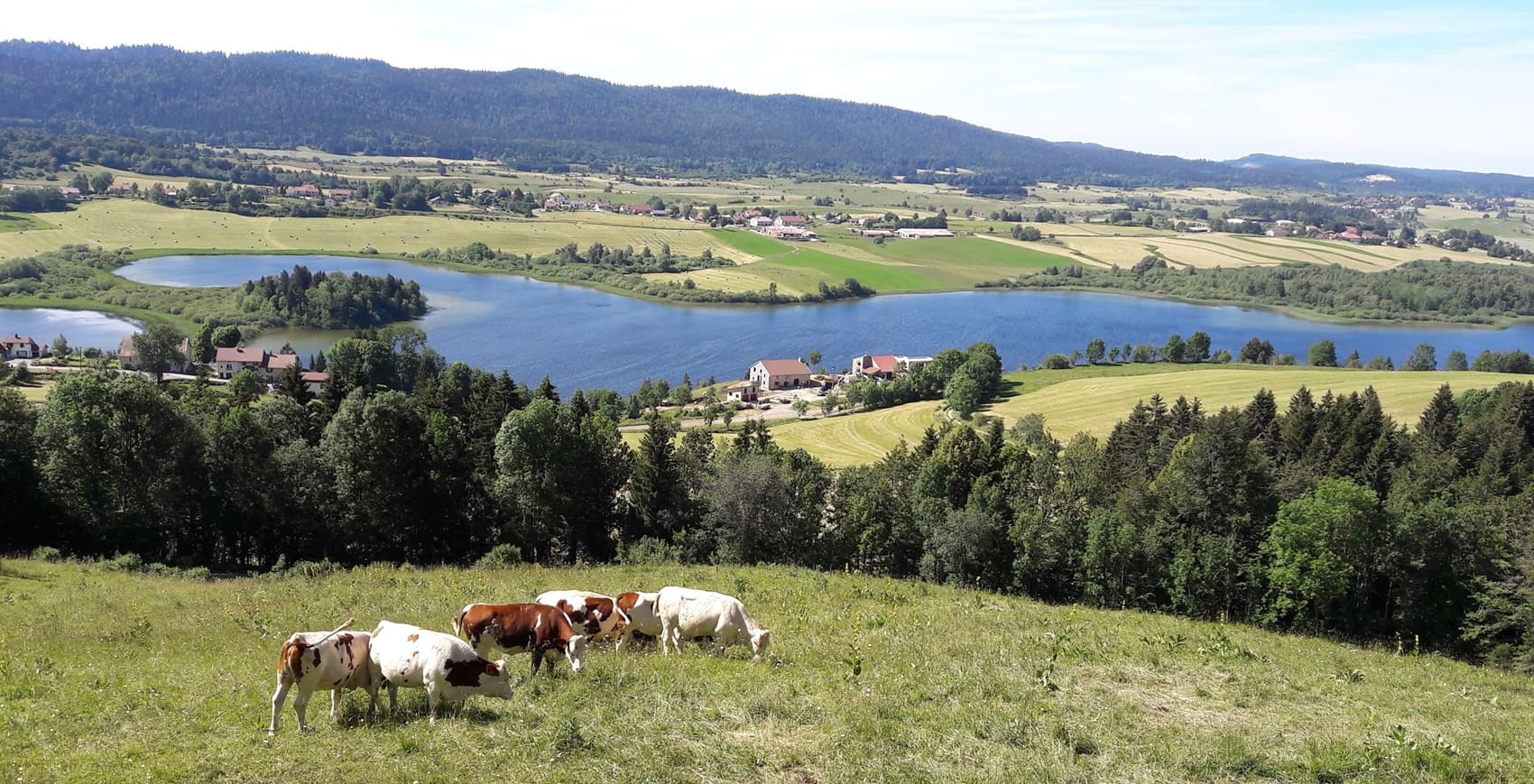
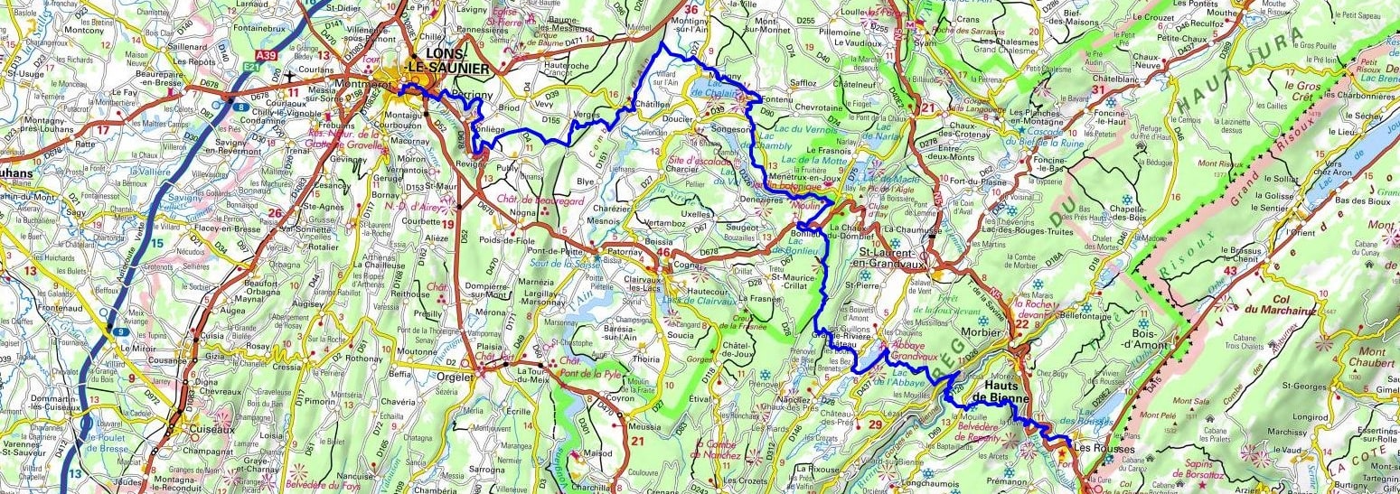
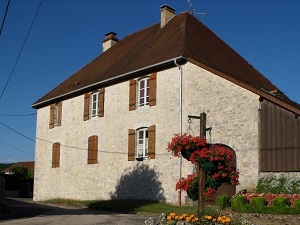
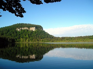
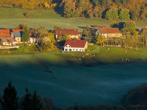
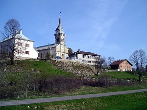
The GR®559, nicknamed the "Great Lakes Trail," offers a gradual ascent from the Lons Plateau to the peaks of the Haut-Jura. Historically, this trail follows the old salt routes, a resource that has been the source of wealth for Lons-le-Saunier and its thermal springs since Gallo-Roman times. Heritage is omnipresent: from the spectacular valleys of Baume-les-Messieurs to the perched village of Château-Chalon, hikers traverse listed sites with limestone architecture. Nature unfolds in striking variety, from the steep vineyards of the Revermont to the deciduous and spruce forests of the Haut-Jura Regional Nature Park. The highlight of the route lies in the succession of turquoise lakes (Chalain, Clairvaux, the Four Lakes), true glacial jewels nestled in verdant settings. As you approach Les Rousses, the landscape opens up to wild valleys and high-altitude pastures where cows graze whose milk is used to make the famous Comté cheese.
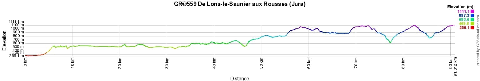
 Distance: 100km, Elevation maximum: 1110m, Elevation minimum: 256m, Elevation gain uphill: 2795m
IGN Maps: 3226ET - LONS-LE-SAUNIER / POLIGNY / RECULEE DE BAUME. 3326ET - CHAMPAGNOLE / LAC DE CHALAIN / PIC DE L'AIGLE. 3327ET - MOREZ / LES-ROUSSES / COL DE LA FAUCILLE. 3327OT - SAINT-CLAUDE / LAC DE VOUGLANS / PNR DU HAUT.

Nearby paths:
![]() It is advisable to follow the beacons throughout your itinerary and to take the Fédération Française de la Randonnée Pédestre topo-guide with you. You will also find information on MonGR.fr.
It is advisable to follow the beacons throughout your itinerary and to take the Fédération Française de la Randonnée Pédestre topo-guide with you. You will also find information on MonGR.fr.
GR®, PR®, GRP®, and the corresponding signs of markings (white / red, yellow and yellow / red) are trademarks of the French Federation of Hiking. They may not be reproduced without permission. The French Federation of Hiking, state-approved, includes organizations that create and maintain hiking routes on GR®, PR®, and GRP®. It publishes guides for these topo hiking routes. With your donations, you support the actions of the thousands of FFRandonnée volunteer markers.
GR-Infos.com is an editorial partner of MonGR.fr.
| Return |

Former holiday hotel with a garden along the Allier, L'Etoile Guest House is located in La Bastide-Puylaurent between Lozere, Ardeche, and the Cevennes in the mountains of Southern France. At the crossroads of GR®7, GR®70 Stevenson Path, GR®72, GR®700 Regordane Way, GR®470 Allier River springs and gorges, GRP® Cevenol, Ardechoise Mountains, Margeride. Numerous loop trails for hiking and one-day biking excursions. Ideal for a relaxing and hiking getaway.
Copyright©gr-infos.com (Authorization for private use only)
To help us maintain and improve GR-Infos.com, a contribution of 2€ is desired via Wero or bank transfer. Thank you!