
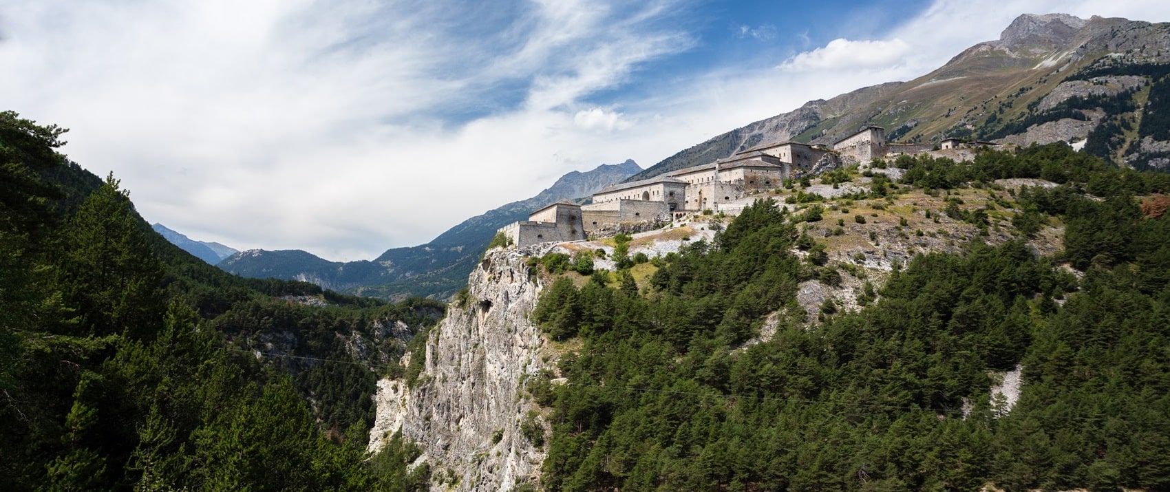
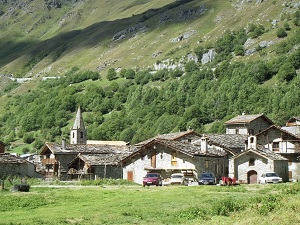
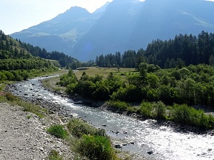
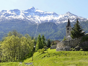
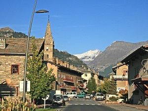
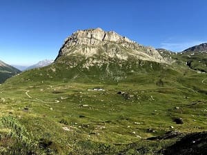
The GR®5E, also known as the Chemin du Petit Bonheur (Path of Little Happiness), connects Bonneval-sur-Arc to Modane, traversing the Haute Maurienne valley and offering an accessible route at the foot of the Vanoise's towering peaks. The landscape evolves from a high glacial valley, dominated by glaciers, to a historic communication route towards Italy. The architectural heritage is exceptional at the start, with the traditional houses of Bonneval and their slate roofs, testaments to a preserved Alpine history. The flora is characterized by larch and Swiss stone pine forests, giving way to flowery alpine pastures where the emblematic fauna of the Vanoise National Park, such as chamois and marmots, can be observed. Local history is also marked by military structures, notably the forts that protected the border near Modane, a crucial railway crossing point.
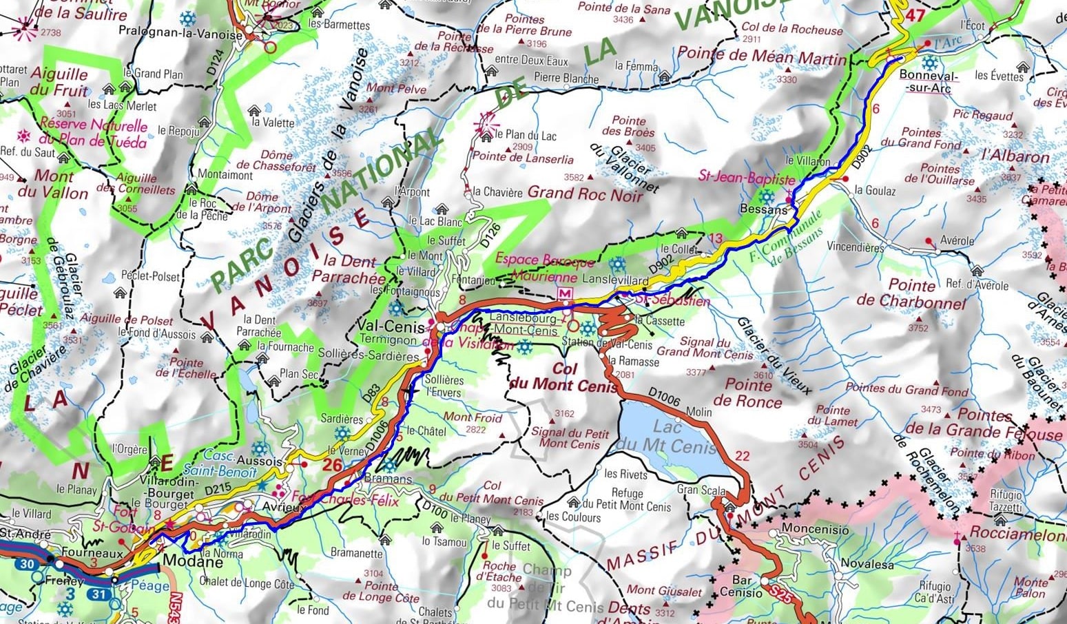
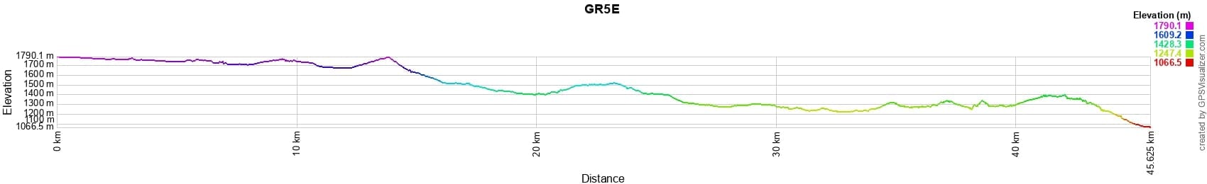
 Distance: 45km, Elevation maximum: 1790m, Elevation minimum: 1066m, Elevation gain uphill: 910m
IGN Maps: 3634OT - VAL-CENIS / CHARBONNEL. 3534OT - LES TROIS-VALLEES / MODANE / PN DE LA VANOISE. 3633ET - TIGNES / VAL-D'ISERE / HAUTE-MAURIENNE / PN DE LA VANOISE.
Nearby paths:
![]() It is advisable to follow the beacons all along your hike and to bring the FFRandonnee topo-guide. You will also find information on MonGR.fr.
It is advisable to follow the beacons all along your hike and to bring the FFRandonnee topo-guide. You will also find information on MonGR.fr.
GR®, PR®, GRP®, and the corresponding signs of markings (white/red, yellow and yellow/red) are trademarks of the French Federation of Hiking. They may not be reproduced without permission. The French Federation of Hiking, state-approved, includes organizations that create and maintain hiking routes on GR®, PR® and GRP®. It publishes guides for these topo hiking routes. With your donations, support the actions of the thousands of volunteer markers of the FFRandonnee.
GR-Infos.com is an editorial partner of MonGR.fr.
| Return |

Former holiday hotel with a garden along the Allier, L'Etoile Guest House is located in La Bastide-Puylaurent between Lozere, Ardeche, and the Cevennes in the mountains of Southern France. At the crossroads of GR®7, GR®70 Stevenson Path, GR®72, GR®700 Regordane Way, GR®470 Allier River springs and gorges, GRP® Cevenol, Ardechoise Mountains, Margeride. Numerous loop trails for hiking and one-day biking excursions. Ideal for a relaxing and hiking getaway.
Copyright©gr-infos.com (Authorization for private use only)
To help us maintain and improve GR-Infos.com, a €2 contribution is appreciated via Wero or bank transfer. Thank you!