|
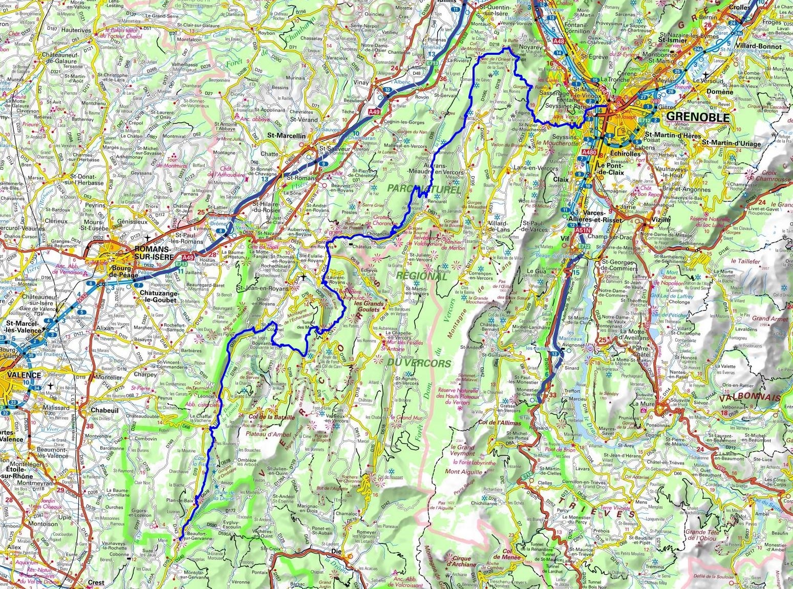
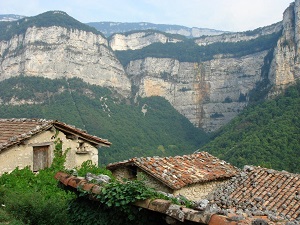
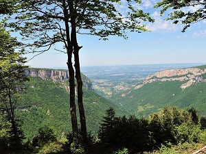
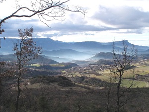
Hike on the GR®9 through Isere and Drome department from Grenoble to Beaufort-sur-Gervanne via Les Michalons, Saint-Nizier-du-Moucherotte, Engins, Autrans, Prelong, Rencurel, Choranche, Pont-en-Royans, Sainte-Eulalie-en-Royans, Saint-Laurent-en-Royans, Bouvante, Saint-Martin-le-Colonel, Leoncel and Plan-de-Baix. Guest House, Bed and Breakfast, Hotel, Camping, Shelter, Inn, Shops.
|

|

GR®9
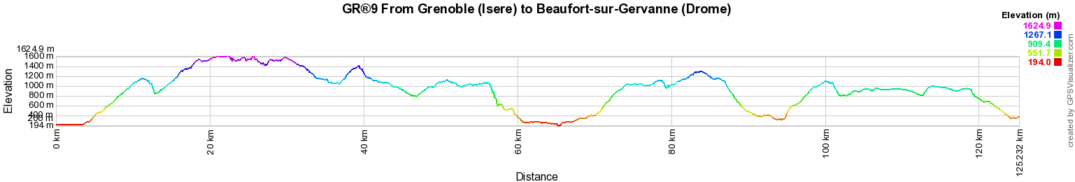
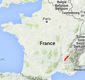
From Grenoble (Isere) to Beaufort-sur-Gervanne (Drome)
From Jura to Mediterranean
125km
Google Maps - Google Earth

© GPX Private use only |
Distance: 125km, Elevation maximum: 1625m, Elevation minimum: 194m, Elevation gain uphill: 6102m
IGN Maps: Combe Laval foret de Lente PNR du Vercors (3136ET). Charpey (3136O). Die Crest PNR du Vercors (3137OT). Tullins (3234O). Autrans Gorges de la Bourne PNR du Vercors (3235OT). Grenoble Chamrousse Belledonne (3335OT).

Registration
Accommodation or business owner on or near a GR®, you can appear on GR-INFOS
For your registration, you can send me by email (papadimitriou4@gmail.com): your address and phone number, your website (Facebook page), a brief description with 5 beautiful photos of your establishment.
Registration price : 100€/5 years per GR® or GRP®. Renewable. |
 |
GR®9 From Jura to Mediterranean
From St Amour (Jura) to Mijoux (Ain)
From Mijoux (Ain) to Yenne (Savoie)
From Yenne (Savoie) to Grenoble (Isere)
From Grenoble (Isere) to Beaufort-sur-Gervanne (Drome)
From Beaufort-sur-Gervanne to Buis-les-Baronnies (Drome)
From Buis-les-Baronnies (Drome) to Cucuron (Vaucluse)
From Cucuron (Vaucluse) to Saint Zacharie (Var)
From Saint Zacharie to Port Grimaud (Var)
Wikipedia GR®9
 It is advisable to follow the beacons all along your hike and to bring you the FFRandonnee topo-guide. You
will also find information on MonGR.fr.
It is advisable to follow the beacons all along your hike and to bring you the FFRandonnee topo-guide. You
will also find information on MonGR.fr.
GR®, PR®, GRP®, and the corresponding signs of markings (white / red, yellow and yellow / red) are trademarks of the French
Federation of Hiking. They may not be reproduced without permission. The French Federation of Hiking, state-approved, includes organizations that create and maintain hiking routes on GR®, PR® and
GRP®. It publishes guides these topo hiking routes.
With your donations, support the actions of the thousands of volunteer markers of the FFRandonnee.
GR-Infos.com is an editorial partner of MonGR.fr.

Old romantic Hotel, L'Etoile Guest-House is a mountain retreat in the South of France. With a beautiful park along the Allier River, L'Etoile Guesthouse is located in La Bastide-Puylaurent between Lozere, Ardeche and Cevennes. Many hiking trails like GR®7, GR®70 Stevenson trail, GR®72, GR®700 Regordane way, Cevenol, GR®470 Allier River Springs and Gorges, Margeride, Ardechoise. Many hiking loops. The right place to relax.
Copyright©gr-infos.com (Authorization for private use only)