
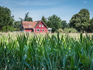
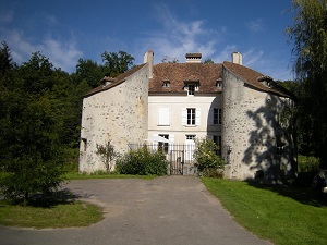
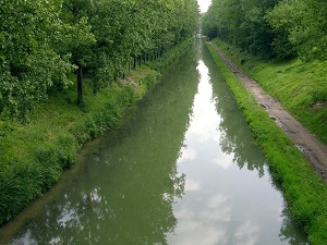
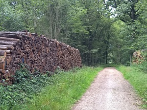
Starting in Pontoise, a city of art and history, this route along the Île-de-France Green Belt crosses the Val-d'Oise and Seine-Saint-Denis departments. The trail reveals a rehabilitated industrial heritage and unexpected departmental parks before opening onto the vast agricultural plains of Seine-et-Marne. The route skirts the borders of the Yonne and Essonne departments, where wooded valleys and waterways like the Yerres and the Orge create preserved bucolic landscapes. Upon reaching the Yvelines department, royal history comes into play through the state forests and the grounds of prestigious châteaux surrounding the capital. This green ribbon forms a vital ecological corridor, alternating between biodiverse wetlands, cereal-growing plateaus, and limestone hillsides. As the kilometers unfold, walkers discover a diverse Île-de-France region, where medieval bell towers stand alongside contemporary architecture.
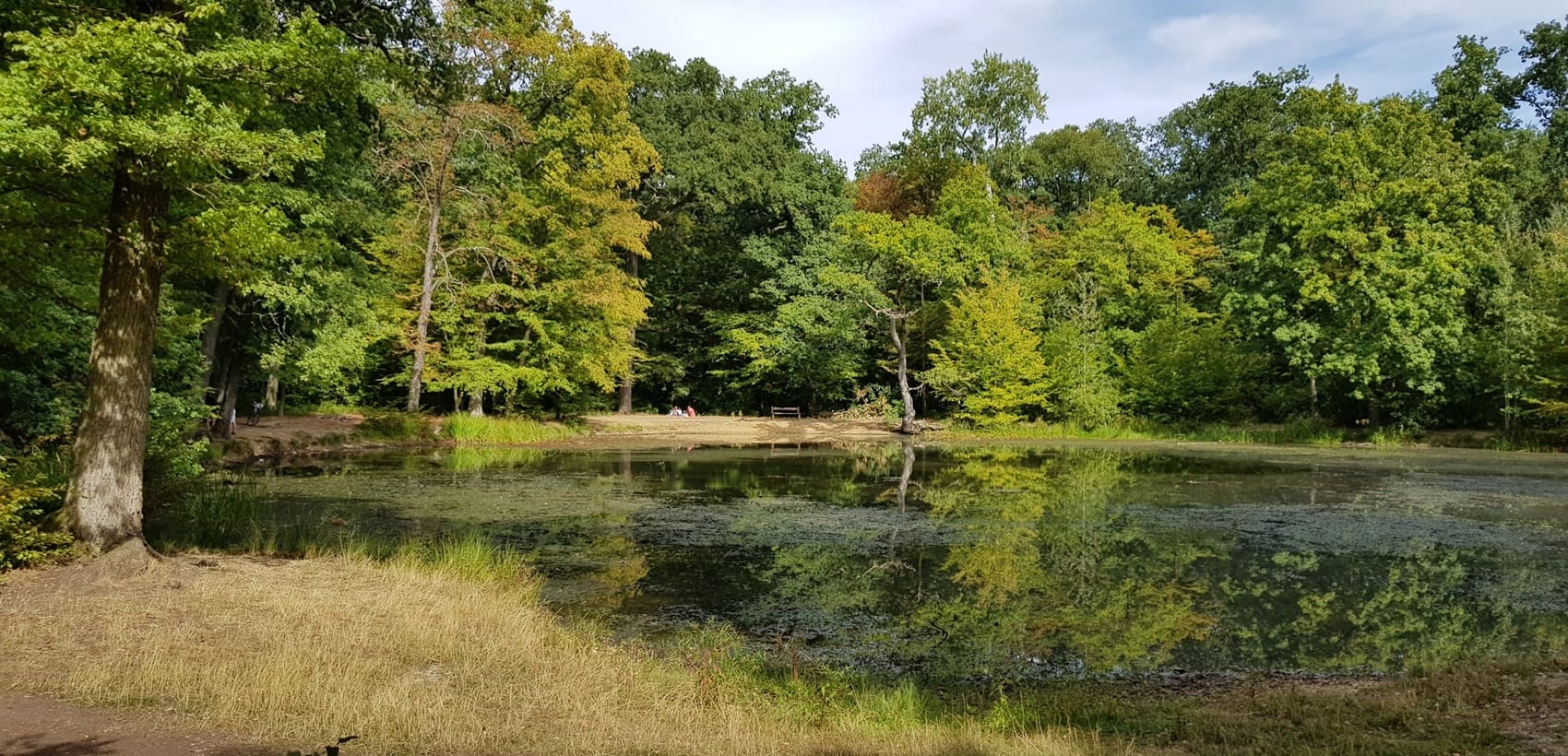
The Île-de-France Green Belt is a breath of fresh air encircling the Paris metropolitan area within a radius of 10 to 30 kilometers, thus protecting a vital balance between urban development and nature. Conceived in the mid-20th century to contain urban sprawl, it now preserves a mosaic of landscapes ranging from the state-owned forests of Versailles and Saint-Germain-en-Laye to market gardens and agricultural plains. This exceptional natural heritage shelters rich biodiversity, from the wetlands of the Upper Seine Valley to the wooded hillsides of the Marne. The historical heritage is equally impressive, with prestigious castles, abbeys, and old villages that bear witness to the region's rural history. Between regional natural parks and protected areas, the Green Belt is the site of a major ecological restoration, essential for temperature regulation and the quality of life of Île-de-France residents.
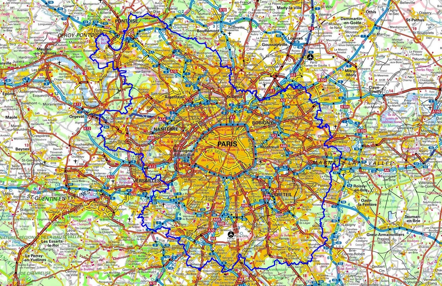
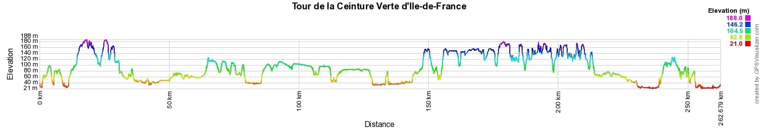
 Distance: 266km, Elevation maximum: 188m, Elevation minimum: 21m, Elevation gain uphill: 2477m
IGN Maps: 2214ET - VERSAILLES / FORETS DE MARLY ET DE SAINT-GERMAIN. 2313OT - FORETS DE MONTMORENCY, DE L'ISLE-ADAM ET DE CARNELLE. 2314OT - PARIS / FORETS DE MEUDON ET DE FAUSSES REPOSES. 2315OT - PALAISEAU / ARPAJON / FORET DE VERRIERES. 2413OT - DAMMARTIN-EN-GOELE. 2414ET - MARNE-LA-VALLEE / FORETS D'ARMAINVILLIERS / FORETS DE FERRIERES ET DE CRECY. 2415OT - EVRY/MELUN/FORETS DE NOTRE-DAME, DE SENART ET DE ROUGEAU.

Nearby paths:
![]() It is advisable to follow the beacons all along your hike and to bring the FFRandonnée topo-guide. You will also find information on MonGR.fr.
It is advisable to follow the beacons all along your hike and to bring the FFRandonnée topo-guide. You will also find information on MonGR.fr.
GR®, PR®, GRP® and the corresponding markings are trademarks of the French Federation of Hiking. They may not be reproduced without permission. The French Federation of Hiking, state-approved, includes organizations that maintain hiking routes. It publishes guides for these routes. With your donations, support the actions of the thousands of volunteer markers of the FFRandonnée.
GR-Infos.com is an editorial partner of MonGR.fr.
| Return |

Former holiday hotel with a garden along the Allier, L'Etoile Guest House is located in La Bastide-Puylaurent between Lozere, Ardeche, and the Cevennes in the mountains of Southern France. At the crossroads of GR®7, GR®70 Stevenson Path, GR®72, GR®700 Regordane Way, GR®470 Allier River springs and gorges, GRP® Cevenol, Ardechoise Mountains, Margeride. Numerous loop trails for hiking and one-day biking excursions. Ideal for a relaxing and hiking getaway.
Copyright©gr-infos.com (Authorization for private use only)
To help us maintain and improve GR-Infos.com, a contribution of 2€ is desired via Wero or bank transfer. Thank you!