
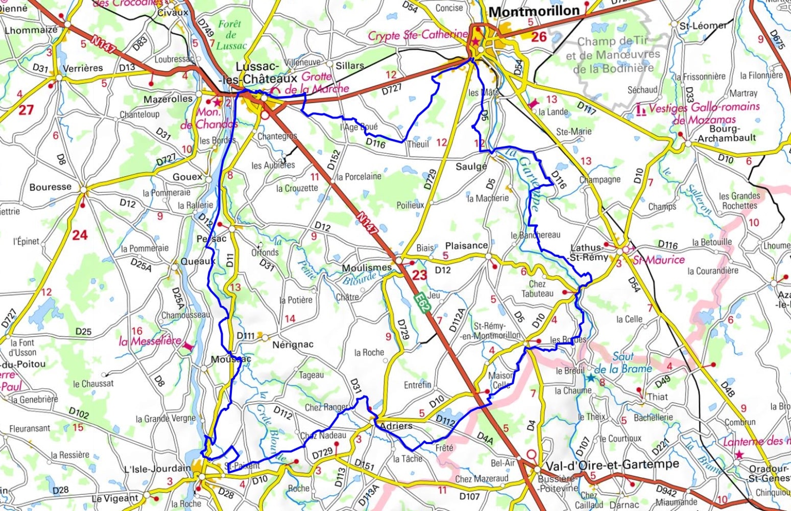
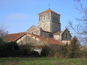
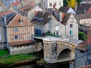
Starting in Montmorillon, the renowned City of Writing with its steep medieval streets, the trail crosses Saulgé and the Adriers livestock farmlands, offering unspoiled nature where hedgerows alternate with vast ponds. Upon reaching L’Isle-Jourdain, the landscape becomes more spectacular with its viaduct overlooking the Vienne River, a prime location for lovers of river panoramas. The route then continues to Lussac-les-Châteaux, a prehistoric site famous for its caves and unique Paleolithic heritage. Between La Côte Maronneau and the hamlet of Theuil, hikers wander through a mosaic of oak woods and hidden valleys typical of the southern part of the department. Local heritage is revealed through small castles, fortified farms, and discreet Romanesque churches like that of Saint-Rémy-en-Montmorillon.
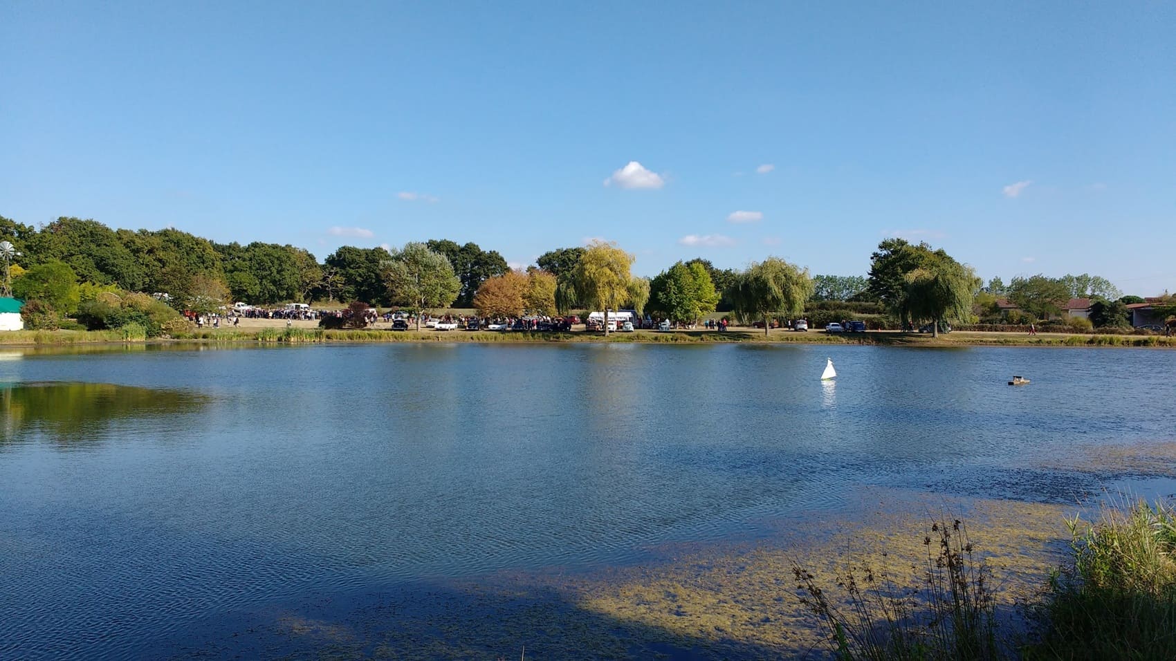
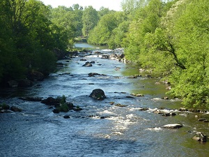
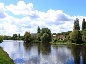
The Vienne Limousine, a transitional region on the border between Poitou and Limousin, boasts a unique identity shaped by water and granite. This land of rivers, with the Vienne as its main artery, offers landscapes of steep-sided valleys and hedged plateaus where nature reigns supreme. Its heritage is deeply marked by medieval history, with towns of character such as L'Isle-Jourdain and its imposing viaduct, or Availles-Limouzine. The local architecture bears witness to a robust rural past, from Romanesque granite churches to old mills lining the waterways. Biodiversity flourishes in the heaths and wetlands, providing a precious refuge for protected wildlife, including otters and numerous migratory birds.
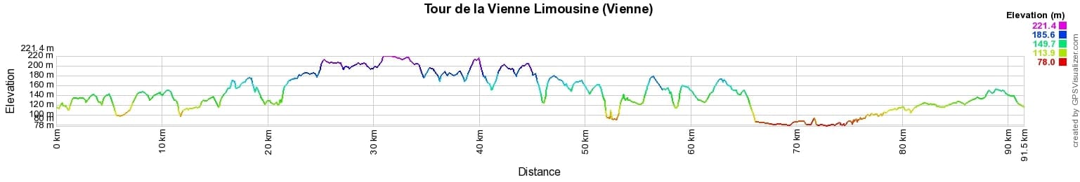
 Distance: 91km, Elevation maximum: 223m, Elevation minimum: 79m, Elevation gain uphill: 798m
IGN Maps: Persac (1828E). L'Isle-Jourdain (Vienne) (1829E). Lathus-St-Remy (1928E). Montmorillon (1928O). Adriers (1929O).
Nearby paths:
![]() It is advisable to follow the beacons all along your hike and to bring the FFRandonnée topo-guide. You will also find information on MonGR.fr.
It is advisable to follow the beacons all along your hike and to bring the FFRandonnée topo-guide. You will also find information on MonGR.fr.
GR®, PR®, GRP® and the corresponding markings are trademarks of the French Federation of Hiking. They may not be reproduced without permission. The French Federation of Hiking, state-approved, includes organizations that maintain hiking routes. It publishes guides for these routes. With your donations, support the actions of the thousands of volunteer markers of the FFRandonnée.
GR-Infos.com is an editorial partner of MonGR.fr.
| Return |

Former holiday hotel with a garden along the Allier, L'Etoile Guest House is located in La Bastide-Puylaurent between Lozere, Ardeche, and the Cevennes in the mountains of Southern France. At the crossroads of GR®7, GR®70 Stevenson Path, GR®72, GR®700 Regordane Way, GR®470 Allier River springs and gorges, GRP® Cevenol, Ardechoise Mountains, Margeride. Numerous loop trails for hiking and one-day biking excursions. Ideal for a relaxing and hiking getaway.
Copyright©gr-infos.com (Authorization for private use only)
To help us maintain and improve GR-Infos.com, a contribution of 2€ is desired via Wero or bank transfer. Thank you!