
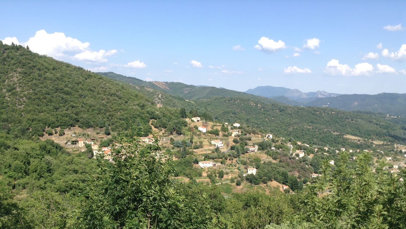
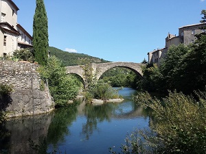
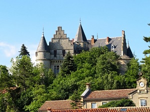
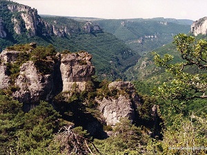
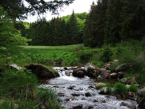
Starting from Le Vigan, a historic town nestled at the foot of the Cévennes foothills, the trail first climbs towards Avèze, famous for its silk-spinning heritage, before reaching the perched village of Montdardier and its medieval-looking castle overlooking the entrance to the Causse plateau. Crossing the hamlet of Navas, you enter a spectacular mineral landscape where dry stone walls create ancient terraces, testaments to a tenacious mountain agriculture. The route then leads to Bez-Esparon, offering breathtaking views of the Aigoual peaks, before descending towards Bréau-Mars through ancient chestnut forests. Nature here is wild, its rhythm set by the murmur of the Arre River and a biodiversity preserved within the Cévennes National Park.
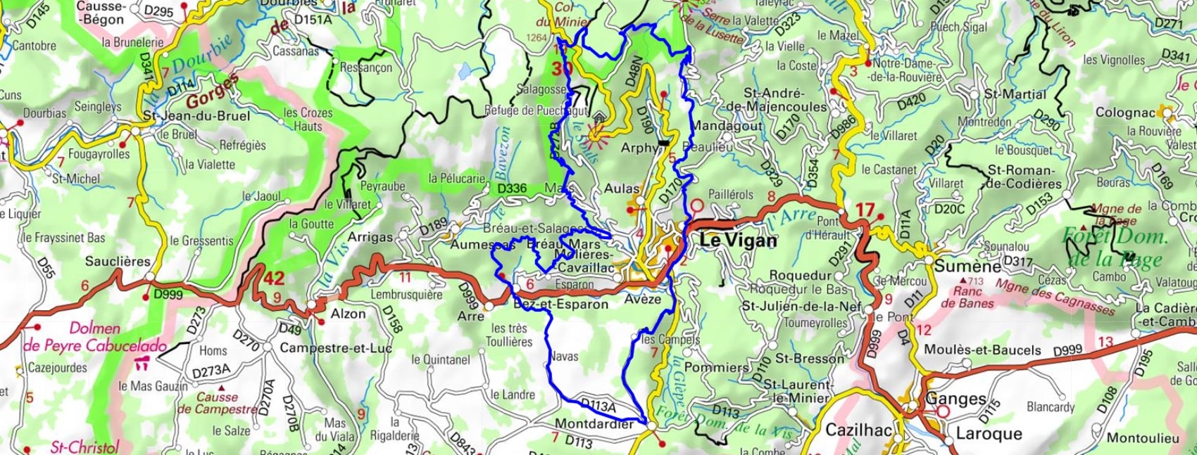
The Vigan region is located in the south of France, in the Gard department. It is bordered by the Cévennes to the north, Languedoc to the south, Ardèche to the east, and Hérault to the west. The Viganais is characterized by a rugged terrain, with mountains, valleys, and gorges. The landscapes are varied, ranging from pine forests to the pastures of the Cévennes, including the vineyards of Languedoc. The region is also rich in historical and cultural heritage. There are many medieval villages, castles, churches, and museums. The history of Vigan dates back to the 5th century, when the city was known as "Carbonnac". It was located on an important commercial axis, the Via Domitia, which linked Rome to Spain.
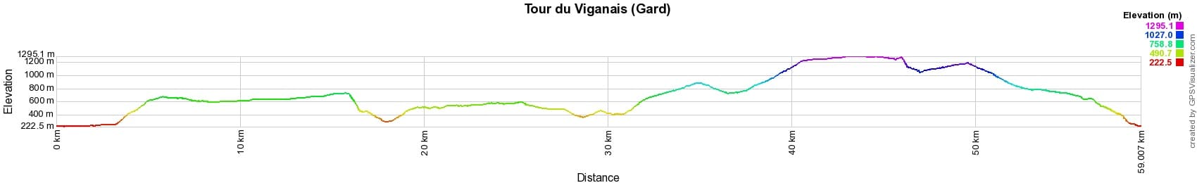

 Distance: 59km, Maximum elevation: 1295m, Minimum elevation: 222m, Total ascent: 2427m
IGN Maps: 2641ET - MONT-AIGOUAL/LE VIGAN / PN DES CEVENNES. 2642ET - SAINT-GUILHEM-LE-DESERT.

Nearby paths:
![]() It is advisable to follow the beacons all along your hike and to bring the FFRandonnée topo-guide. You will also find information on MonGR.fr.
It is advisable to follow the beacons all along your hike and to bring the FFRandonnée topo-guide. You will also find information on MonGR.fr.
GR®, PR®, GRP® and the corresponding markings are trademarks of the French Federation of Hiking. They may not be reproduced without permission. The French Federation of Hiking, state-approved, includes organizations that maintain hiking routes. It publishes guides for these routes. With your donations, support the actions of the thousands of volunteer markers of the FFRandonnée.
GR-Infos.com is an editorial partner of MonGR.fr.
| Return |

Former holiday hotel with a garden along the Allier, L'Etoile Guest House is located in La Bastide-Puylaurent between Lozere, Ardeche, and the Cevennes in the mountains of Southern France. At the crossroads of GR®7, GR®70 Stevenson Path, GR®72, GR®700 Regordane Way, GR®470 Allier River springs and gorges, GRP® Cevenol, Ardechoise Mountains, Margeride. Numerous loop trails for hiking and one-day biking excursions. Ideal for a relaxing and hiking getaway.
Copyright©gr-infos.com (Authorization for private use only)
To help us maintain and improve GR-Infos.com, a contribution of 2€ is desired via Wero or bank transfer. Thank you!