
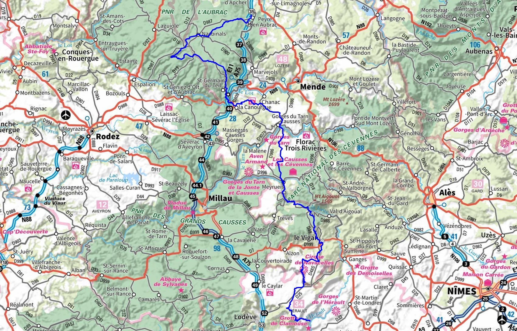
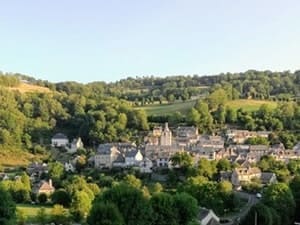
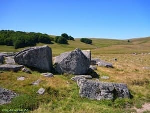
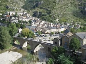
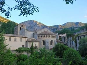
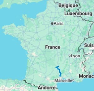
Starting from Peyre-en-Aubrac (Aumont-Aubrac), the route immerses you in the vast granite landscape of the Aubrac plateau, passing through Nasbinals and its Romanesque churches before descending into the Lot Valley at La Canourgue, the "Little Venice of Lozère." The journey continues across the Grands Causses, crossing the medieval village of Sainte-Enimie nestled in the Tarn Gorges, before climbing towards the Aigoual massif and Meyrueis. The landscape alternates between limestone steppes and dense beech forests around Saint-Sauveur-Camprieu. Descending towards Le Vigan, the climate becomes more southern, marked by chestnut terraces and Cévennes architecture. At the Cirque de Navacelles, the Vis River has carved a spectacular meander through the limestone of the Larzac plateau. After the La Vacquerie plateau, the trail ends with the mystical descent towards the abbey of Saint-Guilhem-le-Désert, a jewel of Languedocian Romanesque art.
The Way of Saint-Guilhem, linking Aumont-Aubrac to Saint-Guilhem-le-Désert, is an ancient transhumance and pilgrimage route that traverses an extraordinary variety of landscapes. The journey begins on the high granite plateaus of the Aubrac, characterized by vast pastures, before descending into the mineral and karst landscape of the Grands Causses. The landscape is marked by this spectacular transition, passing from high-altitude beech forests to the deep gorges of the Tarn, then to the Mediterranean garrigue of the Hérault. The history of this route is that of shepherds and their flocks, as well as pilgrims traveling to the monastery of Saint-Guilhem-le-Désert. The fauna is dominated by vultures reintroduced to the Causses and livestock species, while the flora ranges from the gentians of the Aubrac to plants adapted to the drought of the South.
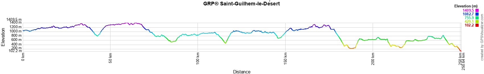
 Distance: 250km, Maximum elevation: 1409m, Minimum elevation: 102m, Total ascent: 6282m
Nearby paths:
![]() It is advisable to follow the beacons all along your hike and to bring the FFRandonnée topo-guide. Information is also available on MonGR.fr.
It is advisable to follow the beacons all along your hike and to bring the FFRandonnée topo-guide. Information is also available on MonGR.fr.
GR®, PR®, GRP® and the corresponding markings are trademarks of the French Federation of Hiking. They may not be reproduced without permission. The French Federation of Hiking, state-approved, includes organizations that maintain hiking routes. It publishes guides for these routes. With your donations, support the actions of thousands of volunteer markers.
GR-Infos.com is an editorial partner of MonGR.fr.
| Return |

Former holiday hotel with a garden along the Allier, L'Etoile Guest House is located in La Bastide-Puylaurent between Lozère, Ardèche, and the Cévennes. At the crossroads of GR®7, GR®70 Stevenson Path, GR®700 Regordane Way, and numerous GRP® routes. Ideal for a relaxing and hiking getaway.
Copyright©gr-infos.com (Authorization for private use only)
To help us maintain and improve GR-Infos.com, a contribution of 2€ is desired via Wero or bank transfer. Thank you!