
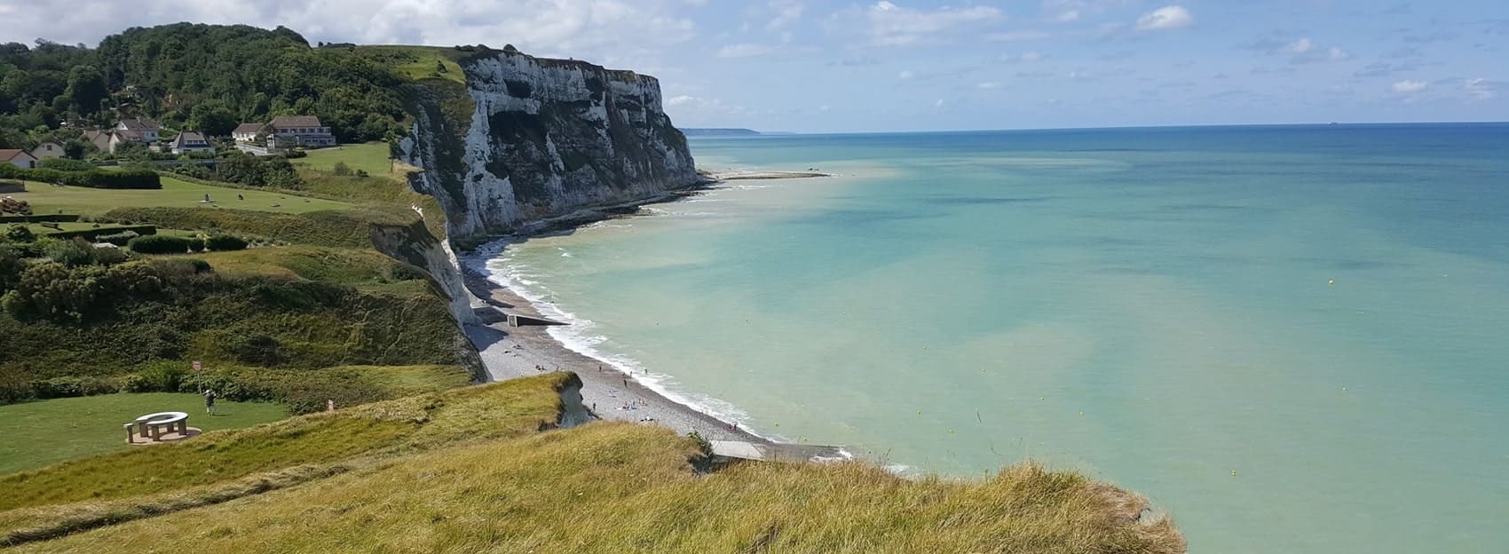
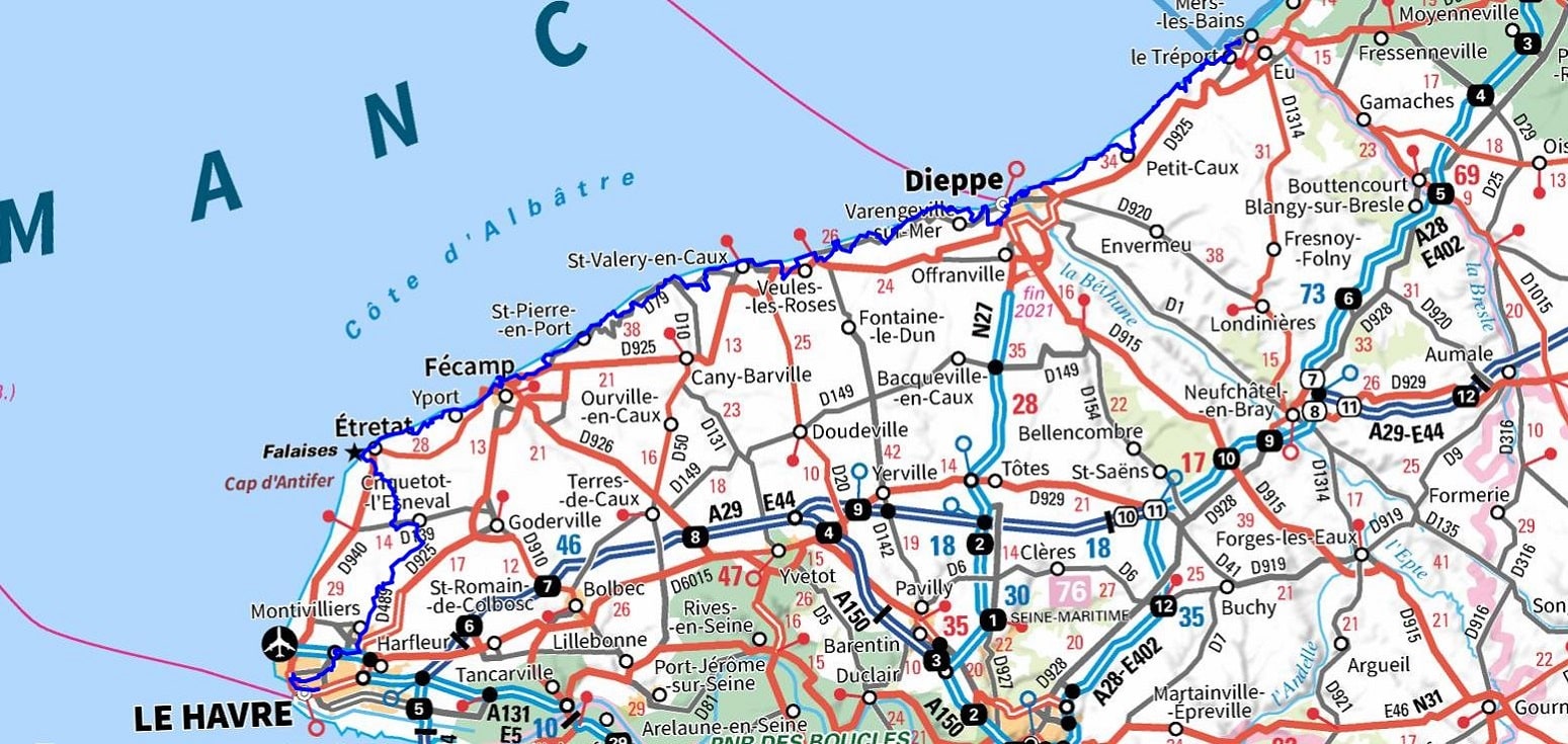
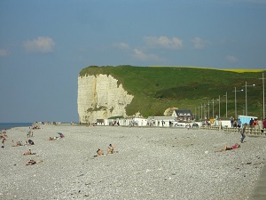
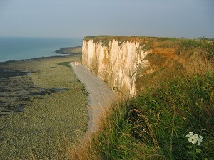
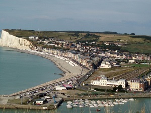
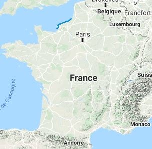
The GR®21 long-distance hiking trail connects Le Havre to Le Tréport, following the spectacular Alabaster Coast in Seine-Maritime. The landscape is dominated by majestic white chalk cliffs that rise vertically above the Channel, offering breathtaking views of the sea. The flora is typical of the coastline, adapted to sea spray and wind, consisting of low-lying vegetation and maritime grasslands on the limestone plateau. The region's history is marked by coastal defence, with the remains of the Atlantic Wall, while the architectural heritage is exceptional, punctuated by lighthouses and famous fishing villages like Étretat. The fauna is dominated by seabirds that nest in the crevices of the cliffs, making this trail a unique place where the power of nature and maritime history converge.
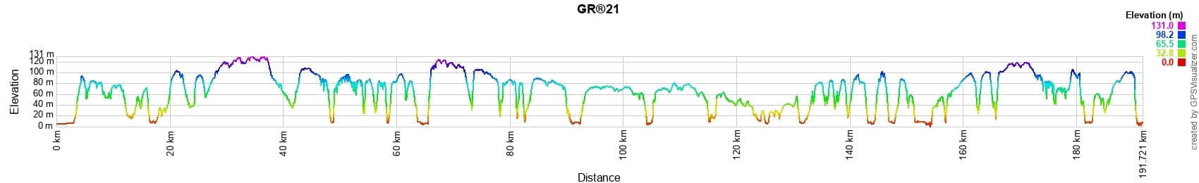
 Distance: 194km, Elevation maximum: 130m, Elevation minimum: 2m, Elevation gain uphill: 2792m
Nearby paths:
![]() It is advisable to follow the beacons all along your hike and to bring the FFRandonnée topo-guide. You will also find information on MonGR.fr.
It is advisable to follow the beacons all along your hike and to bring the FFRandonnée topo-guide. You will also find information on MonGR.fr.
GR®, PR®, GRP®, and the corresponding signs of markings (white/red, yellow and yellow/red) are trademarks of the French Federation of Hiking. They may not be reproduced without permission. The French Federation of Hiking, state-approved, includes organizations that create and maintain hiking routes on GR®, PR® and GRP®. It publishes topo-guides for these hiking routes. With your donations, support the actions of the thousands of volunteer markers of the FFRandonnée.
GR-Infos.com is an editorial partner of MonGR.fr.
| Return |

Former holiday hotel with a garden along the Allier, L'Etoile Guest House is located in La Bastide-Puylaurent between Lozere, Ardeche, and the Cevennes in the mountains of Southern France. At the crossroads of GR®7, GR®70 Stevenson Path, GR®72, GR®700 Regordane Way, GR®470 Allier River springs and gorges, GRP® Cevenol, Ardechoise Mountains, Margeride. Numerous loop trails for hiking and one-day biking excursions. Ideal for a relaxing and hiking getaway.
Copyright©gr-infos.com (Authorization for private use only)
To help us maintain and improve GR-Infos.com, a contribution of 2€ is desired via Wero or bank transfer. Thank you!