|
Hike on the GR®6 through Gironde deparment from Villandraut to Sainte Foy-la-Grande via Leogeats, Bommes, Pujols-sur-Ciron, Preignac, Langon, Saint-Pierre-de-Mons, Saint-Pardon-de-Conques, Saint-Loubert, Castets-en-Dorthe, Caudrot, Sainte-Foy-la-Longue, Morizes, Saint-Exupery, Saint-Hilaire-du-Bois, Sauveterre-de-Guyenne, Blasimon, Mauriac, Saint-Antoine-du-Queyret, Listrac-de-Dureze, Pellegrue, Landerrouat, Riocaud and Saint-Andre-et-Appelles. Guest House, Bed and Breakfast, Hotel, Camping, Shelter, Inn, Shops.
|

|

GR®6
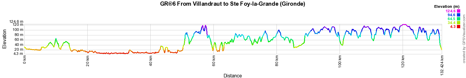
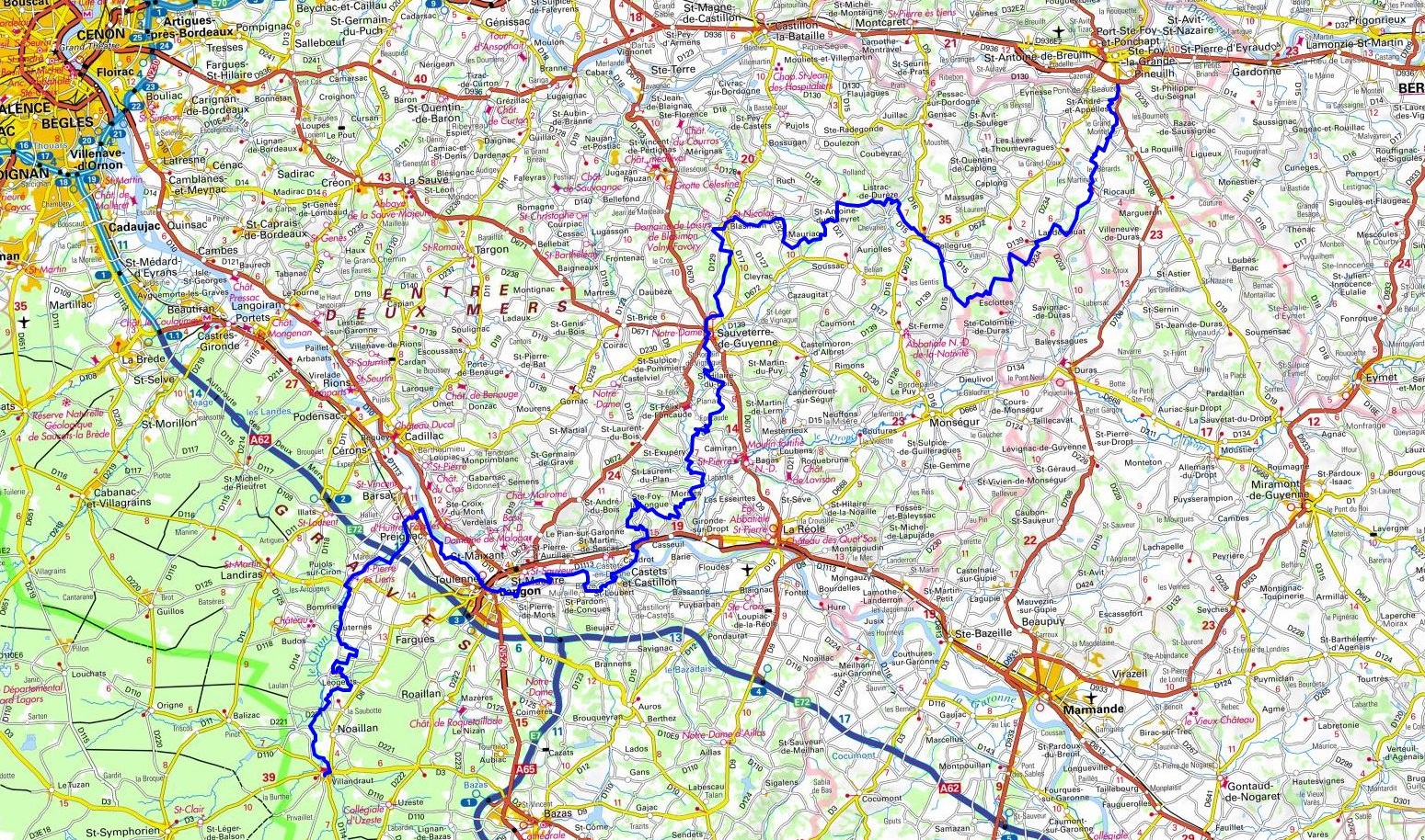
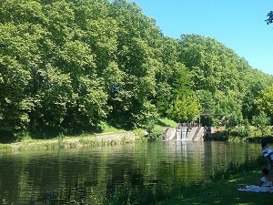
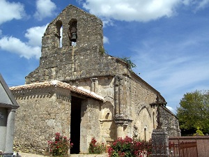
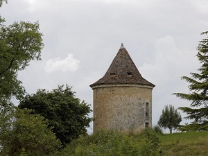
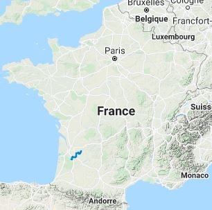
From Villandraut to Ste Foy-la-Grande (Gironde)
132km
Google Maps - Google Earth

© GPX Private use only |
Distance: 132km, Elevation maximum: 125m, Elevation minimum: 4m, Elevation gain uphill: 1128m
IGN Maps: Langon - IGN 1638O. Sauveterre-De-Guyenne - 1637E. La Reole - 1638E. Villandraut - 1638O. Duras - 1737E. Monsegur - 1737O. Sainte-Foy-La-Grande - IGN 1736E
Place called Gorce (Esclottes): Val de Gorce Rooms at the Farm, M. Chort Chantal, 06 11 99 72 37, Email, Facebook
We are in a valley in the middle of the forest and we raise Shetland ponies. Each room has a 140 x 200 bed, kitchen and bathrooms are shared. The house is simple but comfortable. Possibility of breakfast.
Bar/restaurant/bread depot in the village of Landerrouat. You have to go through Landerrouat to get to us.
|
    
|

Registration
Accommodation or business owner on or near a GR®, you can appear on GR-INFOS
For your registration, you can send me by email (papadimitriou4@gmail.com): your address and phone number, your website (Facebook page), a brief description with 5 beautiful photos of your establishment.
Registration price : 100€/5 years per GR® or GRP®. Renewable. |
|
GR®6 From Gironde to Alpes-de-Haute-Provence
From Arcachon to Villandraut (Gironde)
From Villandraut to Ste Foy-la-Grande (Gironde)
From Ste Foy-la-Grande (Gironde) to Eyzies-de-Tayac-Sireuil (Dordogne)
From Eyzies-de-Tayac-Sireuil (Dordogne) to Lacapelle-Marival (Lot)
From Lacapelle-Marival (Lot) to Espalion (Aveyron)
From Espalion (Aveyron) to St Pierre-des-Tripiers (Lozere)
From Saint-Pierre-des-Tripiers (Lozere) to Ners (Gard)
From Ners (Gard) to Aureille (Bouches-du-Rhone)
From Aureille (Bouches-du-Rhone) to Viens (Vaucluse)
From Viens (Vaucluse) to Authon (Alpes-de-Haut e-Provence)
From Authon (Alpes-de-Haute-Provence) to Fouillouse (Hautes-Alpes)
 It is advisable to follow the beacons all along your hike and to bring you the FFRandonnee topo-guide. You
will also find information on MonGR.fr.
It is advisable to follow the beacons all along your hike and to bring you the FFRandonnee topo-guide. You
will also find information on MonGR.fr.
GR®, PR®, GRP®, and the corresponding signs of markings (white / red, yellow and yellow / red) are trademarks of the French
Federation of Hiking. They may not be reproduced without permission. The French Federation of Hiking, state-approved, includes organizations that create and maintain hiking routes on GR®, PR® and
GRP®. It publishes guides these topo hiking routes.
With your donations, support the actions of the thousands of volunteer markers of the FFRandonnee.
GR-Infos.com is an editorial partner of MonGR.fr.

Old romantic Hotel, L'Etoile Guest-House is a mountain retreat in the South of France. With a beautiful park along the Allier River, L'Etoile Guesthouse is located in La Bastide-Puylaurent between Lozere, Ardeche and Cevennes. Many hiking trails like GR®7, GR®70 Stevenson trail, GR®72, GR®700 Regordane way, Cevenol, GR®470 Allier River Springs and Gorges, Margeride, Ardechoise. Many hiking loops. The right place to relax.
Copyright©gr-infos.com (Authorization for private use only)