|
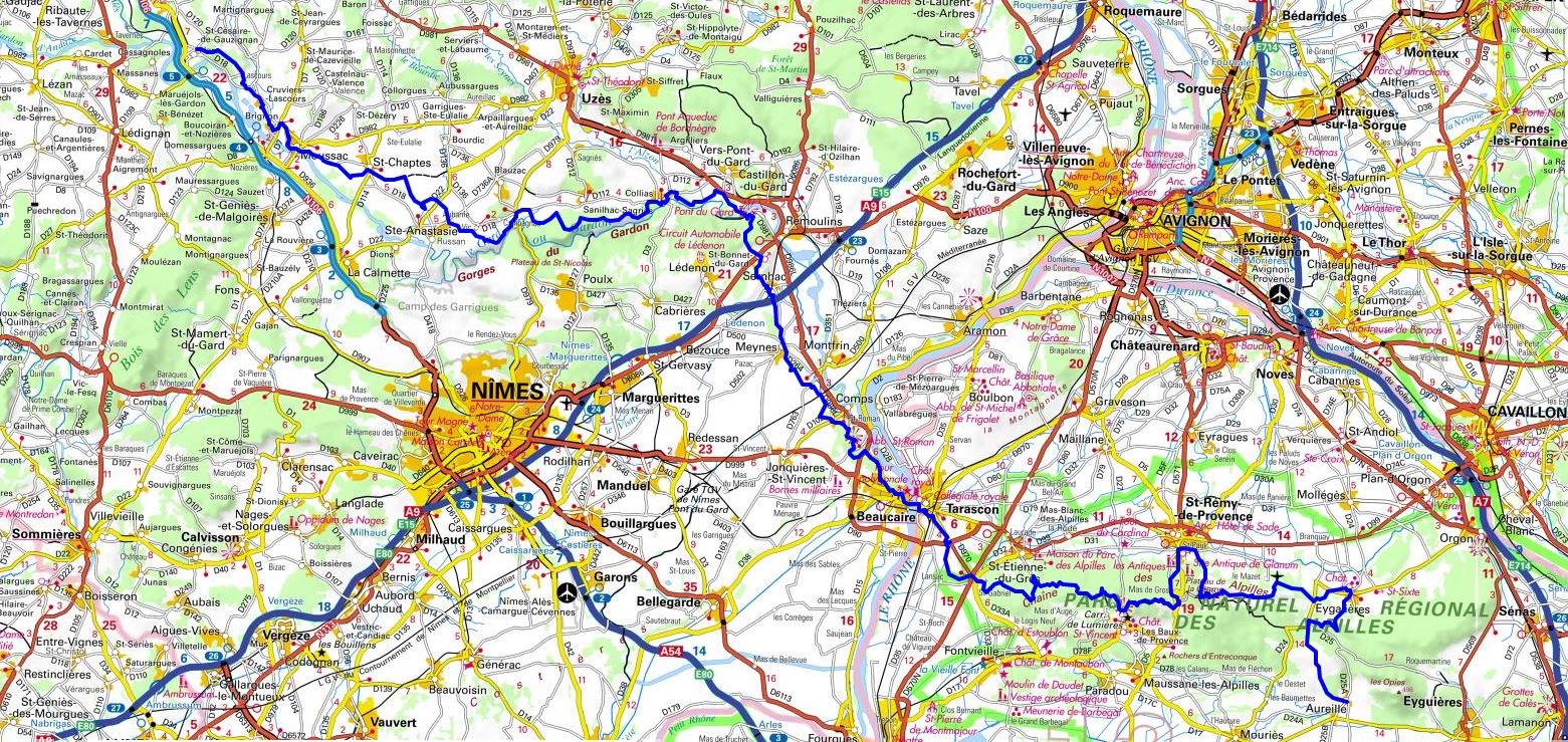
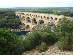
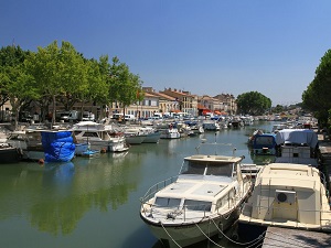
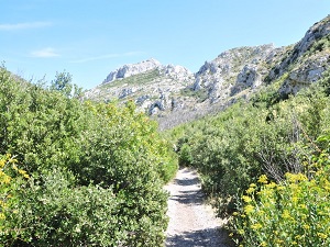
Hike on the GR®6 through Gard and les Bouches-du-Rhone from Ners to Aureille via Lascours, Cruviers-Lascours, Brignon, Moussac, Saint-Chaptes, Aubarne, Vic, La Begude, Sanilhac-Sagries, Collias, La Barque Vieille, Pont du Gard, Saint-Bonnet-du-Gard, Sernhac, Meynes, La Treille, Gaudon, Beaucaire, Tarascon, Saint-Gabriel, Saint-Remy-de-Provence, Saint-Paul and Eygalieres. Guest House, Bed and Breakfast, Hotel, Camping, Shelter, Inn, Shops.
|

|

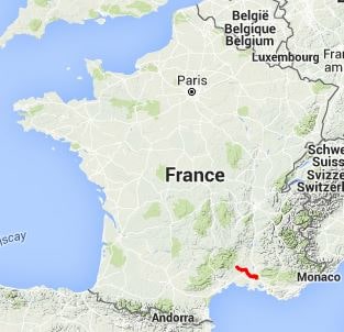
GR®6
From Ners (Gard) to Aureille (Bouches-du-Rhone)
125Km
Google Maps - Google Earth

© GPX Private use only |
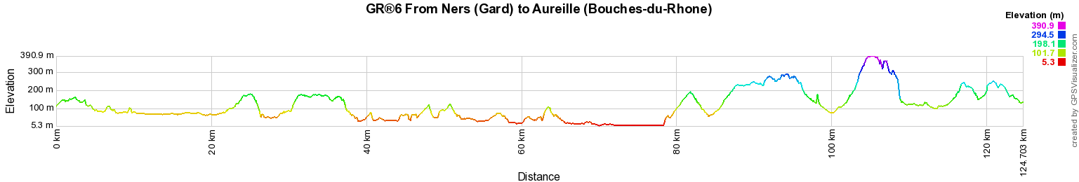
Distance: 125km, Elevation maximum: 391m, Elevation minimum: 5m, Elevation gain uphill: 2054m
IGN Maps: Vezenobres (2841E). Uzes (2941O). Beaucaire Tarascon (2942E). Tarascon St-Remy-de-Provence Chaine des Alpilles (3042OT).
St-Martin-de-Crau Les Baux-de-Provence Les Alpilles (3043OT).

Registration
Accommodation or business owner on or near a GR®, you can appear on GR-INFOS
For your registration, you can send me by email (papadimitriou4@gmail.com): your address and phone number, your website (Facebook page), a brief description with 5 beautiful photos of your establishment.
Registration price : 25€/year or 100€/5 years per GR® or GRP®. Renewable. |
|
GR®6 From Gironde to Alpes-de-Haute-Provence
From Arcachon to Villandraut (Gironde)
From Villandraut to Ste Foy-la-Grande (Gironde)
From Ste Foy-la-Grande (Gironde) to Eyzies-de-Tayac-Sireuil (Dordogne)
From Eyzies-de-Tayac-Sireuil (Dordogne) to Lacapelle-Marival (Lot)
From Lacapelle-Marival (Lot) to Espalion (Aveyron)
From Espalion (Aveyron) to St Pierre-des-Tripiers (Lozere)
From Saint-Pierre-des-Tripiers (Lozere) to Ners (Gard)
From Ners (Gard) to Aureille (Bouches-du-Rhone)
From Aureille (Bouches-du-Rhone) to Viens (Vaucluse)
From Viens (Vaucluse) to Authon (Alpes-de-Haut e-Provence)
From Authon (Alpes-de-Haute-Provence) to Fouillouse (Hautes-Alpes)
 It is advisable to follow the beacons all along your hike and to bring you the FFRandonnee topo-guide. You
will also find information on MonGR.fr.
It is advisable to follow the beacons all along your hike and to bring you the FFRandonnee topo-guide. You
will also find information on MonGR.fr.
GR®, PR®, GRP®, and the corresponding signs of markings (white / red, yellow and yellow / red) are trademarks of the French
Federation of Hiking. They may not be reproduced without permission. The French Federation of Hiking, state-approved, includes organizations that create and maintain hiking routes on GR®, PR® and
GRP®. It publishes guides these topo hiking routes.
With your donations, support the actions of the thousands of volunteer markers of the FFRandonnee.
GR-Infos.com is an editorial partner of MonGR.fr.

Old romantic Hotel, L'Etoile Guest-House is a mountain retreat in the South of France. With a beautiful park along the Allier River, L'Etoile Guesthouse is located in La Bastide-Puylaurent between Lozere, Ardeche and Cevennes. Many hiking trails like GR®7, GR®70 Stevenson trail, GR®72, GR®700 Regordane way, Cevenol, GR®470 Allier River Springs and Gorges, Margeride, Ardechoise. Many hiking loops. The right place to relax.
Copyright©gr-infos.com (Authorization for private use only)