
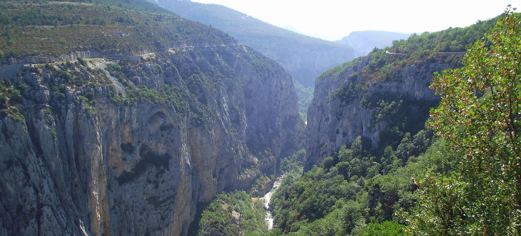
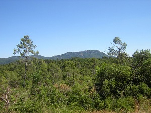
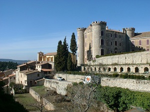
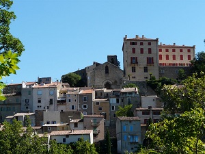
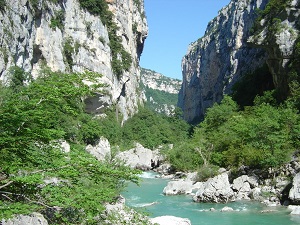
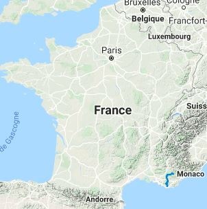
The GR99 long-distance hiking trail connects the hills around Toulon to the gateway of the Prealps. It crosses the Sainte-Baume and Verdon Regional Natural Parks. The path climbs above the coastline before descending into the Var hinterland, traversing white limestone ridges and densely forested plateaus. Crossing the Sainte-Baume massif, hikers follow in the footsteps of Mary Magdalene towards her sacred grotto, a major pilgrimage site since the Middle Ages. Further north, the trail passes by old icehouses and agricultural terraces, remnants of a resilient rural economy in the face of the arid Mediterranean climate. The landscapes unfold with increasing intensity: the oak and beech forests of the Sainte-Baume give way to the plains of the Issole valley, then to the spectacular plateaus of the Upper Var. The arrival offers breathtaking views of the Verdon Gorges, where the limestone is sculpted into vertiginous cliffs.
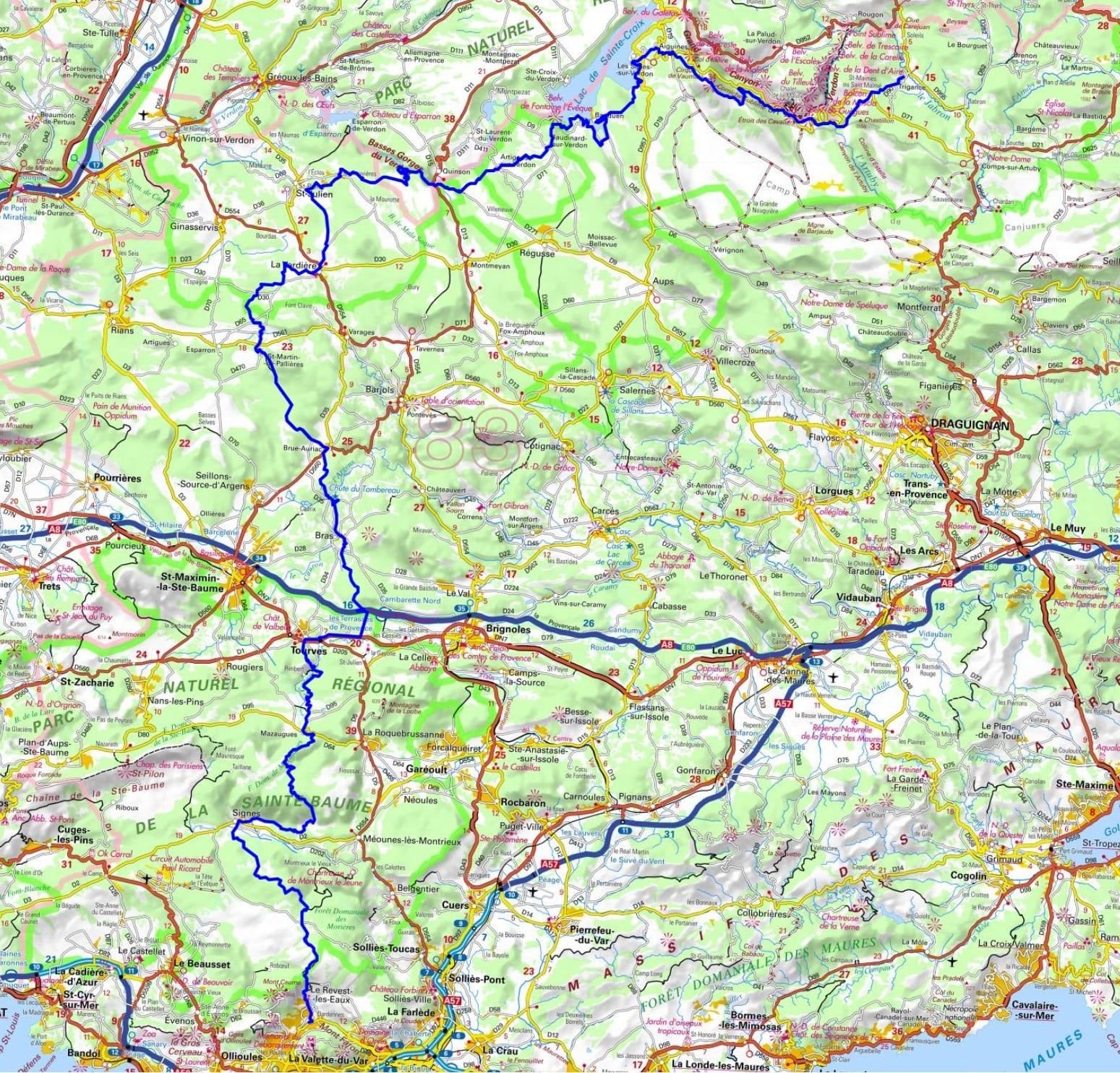
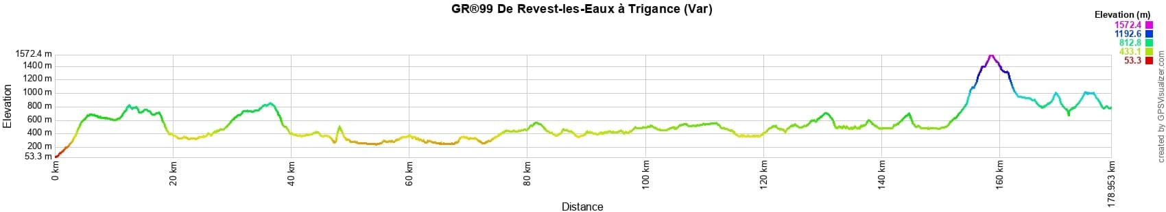
 Distance: 179km, Elevation maximum: 1559m, Elevation minimum: 64m, Elevation gain uphill: 5701m
IGN Maps: Greoux-les-Bains Rians PNR du Verdon (3343OT). St-Maximin-la-Ste-Baume Barjols Trets Mont Aurelien (3344OT). Signes Tourves massif de la Ste-Baume (3345OT). Toulon le Gros Cerveau Mont Faron (3346OT).
Nearby paths:
![]() It is advisable to follow the beacons all along your hike and to bring the FFRP topo-guide. You will also find information on MonGR.fr.
It is advisable to follow the beacons all along your hike and to bring the FFRP topo-guide. You will also find information on MonGR.fr.
® The GR® GRP® PR acronyms, as well as the corresponding trail signs (white/red, yellow and yellow/red), are trademarks of the Fédération Française de la Randonnée Pédestre. They may not be reproduced without its permission. The FFRP, recognized as being of public utility, groups together the associations which create and maintain the hiking routes on the GR® GRP® PR. It publishes topo-guides for these hiking routes. With your donations, support the actions of the thousands of volunteer markers of the FFRP.
GR-Infos.com is an editorial partner of MonGR.fr.
| Return |

Former holiday hotel with a garden along the Allier, L'Etoile Guest House is located in La Bastide-Puylaurent between Lozere, Ardeche and the Cevennes in the mountains of Southern France. At the crossroads of GR®7, GR®70 Stevenson trail, GR®72, GR®700 Regordane way, GR®470 Springs and Gorges of the Allier river, GRP® Cevenol, Ardechoise mountain, Margeride. Many loop routes for hiking and cycling for a day. Ideal for a relaxing and hiking stay.
Copyright©gr-infos.com (Authorization of use for private purposes only)
To help us maintain and improve GR-Infos.com, a contribution of 2€ is desired via Wero or bank transfer. Thank you!