
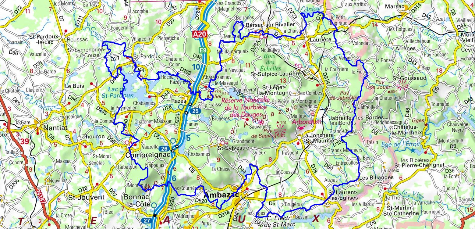
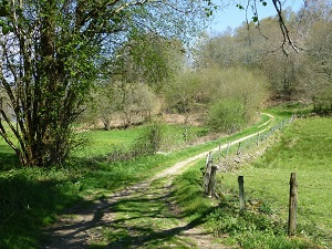
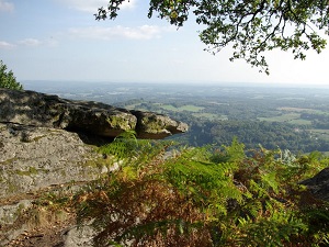
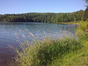
The trail winds its way through a land of legends, linking Compreignac to the serene Lake Saint-Pardoux, a true azure oasis nestled in a verdant setting. Hikers traverse landscapes of moorland and deep forests towards Razès and Beaubiat, where granite outcrops in the form of mysterious rock formations. Religious and medieval heritage is showcased in Bersac-sur-Rivalier and Laurière, charming villages that seem to have been frozen in time. Climbing towards La Bezassade and Jabreilles-les-Bordes, one discovers the remains of ancient fortified settlements and old kaolin mines, evidence of ancestral human activity. The route then meanders between the peat bogs and beech forests of Les Billanges, offering remarkable biodiversity where water is ever-present. The adventure ends in the gentle valleys of Saint-Laurent-les-Églises, after climbing peaks that offer breathtaking views of the Blond mountains.
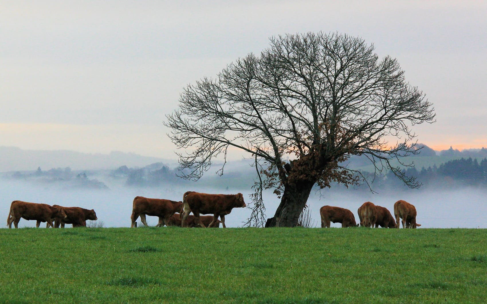
Dominating the Limousin plain, the Monts d'Ambazac form a wild granite massif where nature and history are intimately intertwined. This territory, home to the highest point in the Haute-Vienne department at the Puy de Saint-Leit, is characterized by its impressive rocky outcrops and mysterious peat bogs, such as the Dauges peat bog, a protected nature reserve. The heritage here is marked by the epic story of the Order of Grandmont, whose medieval abbey exerted its influence throughout Europe, leaving behind isolated sanctuaries and enduring legends. The trails wind between dense deciduous forests and heathlands, offering sweeping views of the Monts de Blond and the Vienne valley. Along the way, hikers discover small stone villages, shepherds' huts, and old kaolin quarries that recall the importance of Limoges porcelain. The local wildlife is well-protected, providing shelter for rare species of bats and birds of prey that thrive in this rugged terrain.
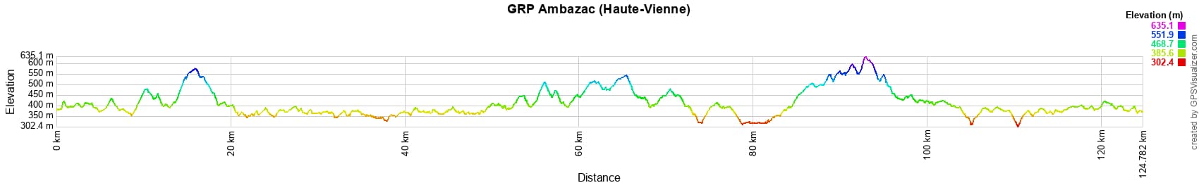
 Distance: 124km, Elevation maximum: 638m, Elevation minimum: 310m, Elevation gain uphill: 2280m
IGN Maps: Ambazac - 2030E. La Souterraine - 2129O. Saint-Sulpice-Lauriere - 2130O.
Nearby paths:
![]() It is advisable to follow the beacons all along your hike and to bring the FFRandonnée topo-guide. You will also find information on MonGR.fr.
It is advisable to follow the beacons all along your hike and to bring the FFRandonnée topo-guide. You will also find information on MonGR.fr.
GR®, PR®, GRP® and the corresponding markings are trademarks of the French Federation of Hiking. They may not be reproduced without permission. The French Federation of Hiking, state-approved, includes organizations that maintain hiking routes. It publishes guides for these routes. With your donations, support the actions of the thousands of volunteer markers of the FFRandonnée.
GR-Infos.com is an editorial partner of MonGR.fr.
| Return |

Former holiday hotel with a garden along the Allier, L'Etoile Guest House is located in La Bastide-Puylaurent between Lozere, Ardeche, and the Cevennes in the mountains of Southern France. At the crossroads of GR®7, GR®70 Stevenson Path, GR®72, GR®700 Regordane Way, GR®470 Allier River springs and gorges, GRP® Cevenol, Ardechoise Mountains, Margeride. Numerous loop trails for hiking and one-day biking excursions. Ideal for a relaxing and hiking getaway.
Copyright©gr-infos.com (Authorization for private use only)
To help us maintain and improve GR-Infos.com, a contribution of 2€ is desired via Wero or bank transfer. Thank you!