
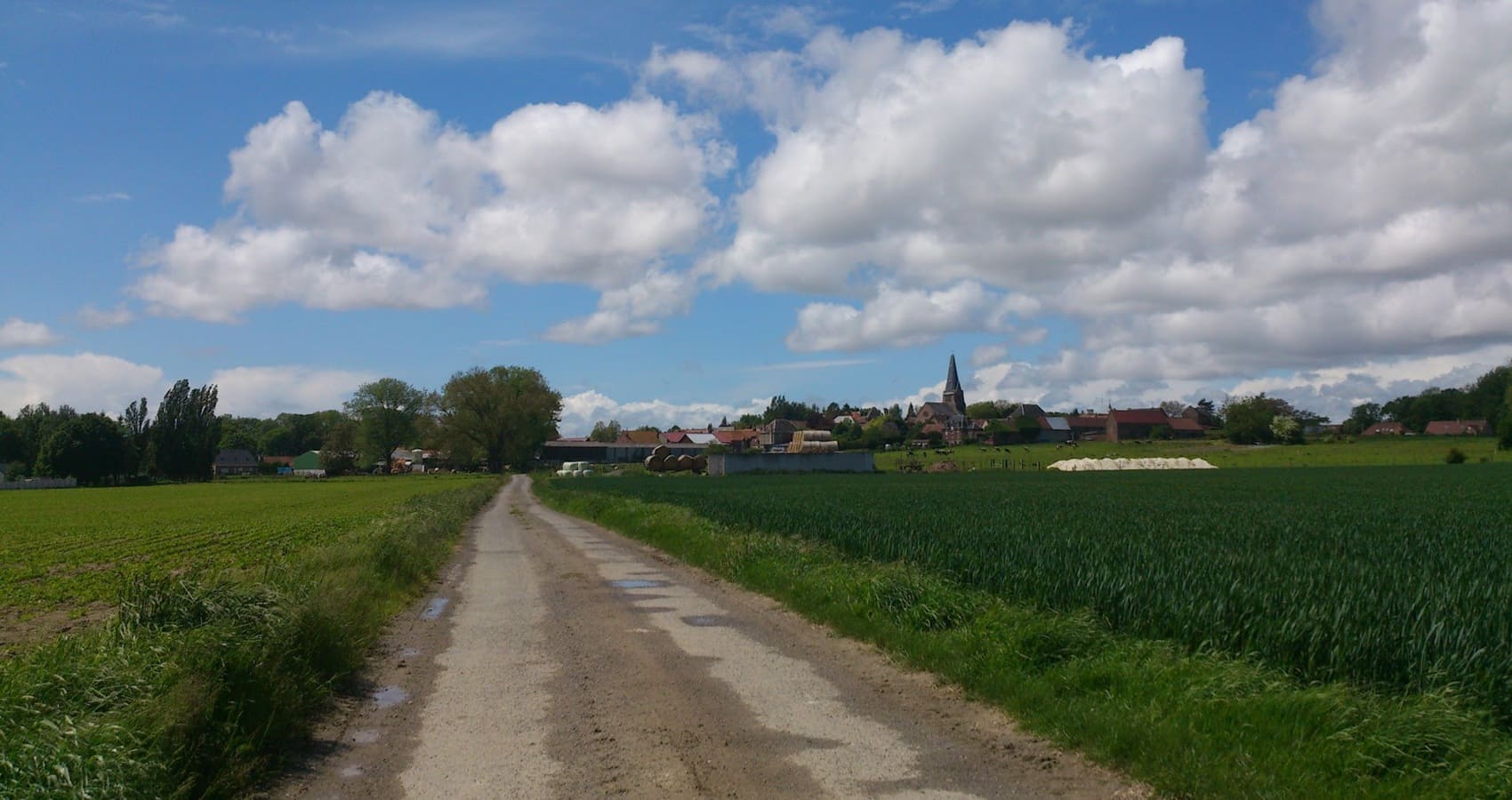
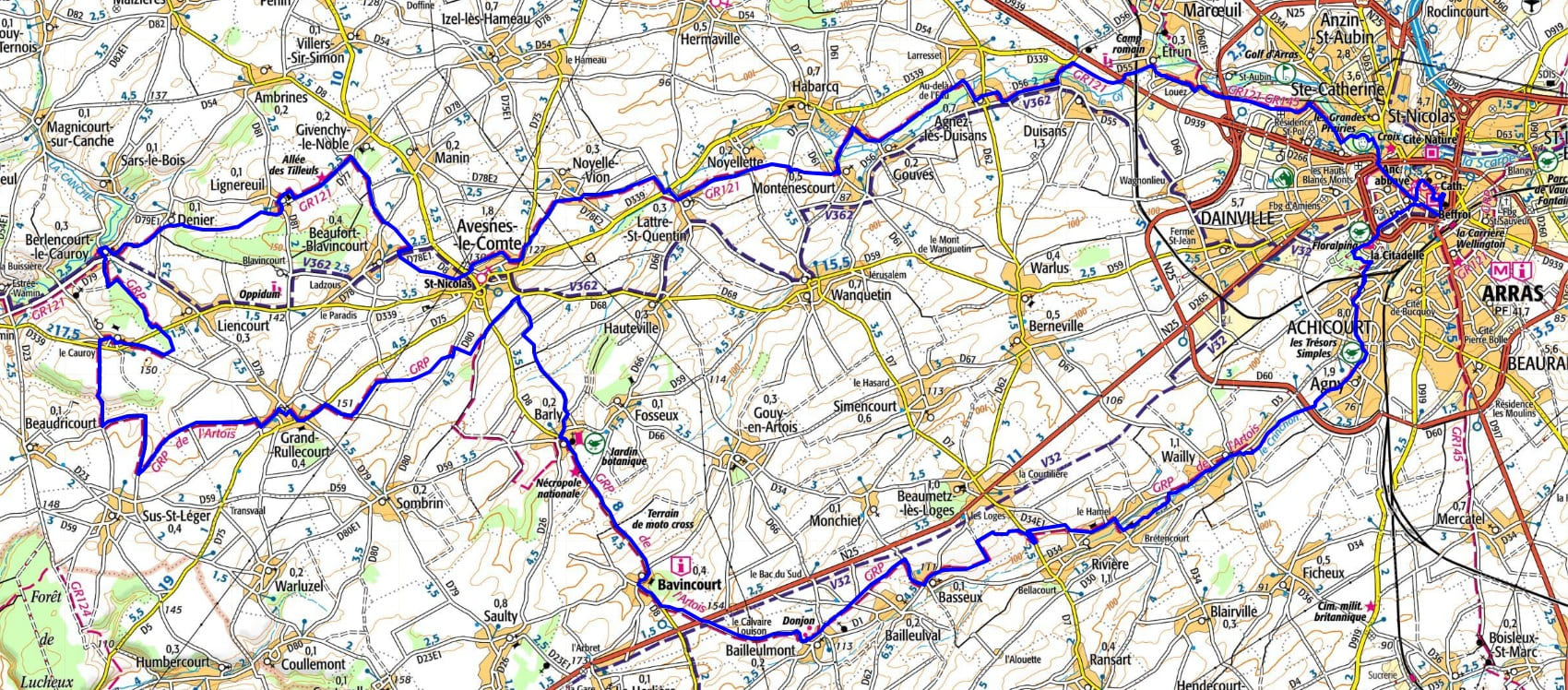
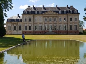
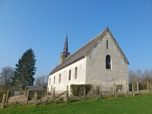
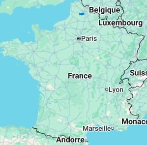
Starting from Arras, a city famous for its flamboyant Baroque squares, the trail crosses the villages of Agny and Wailly through open plains. Following the Crinchon valley towards Rivière and Bailleulmont, hikers discover the fortified farms typical of the Pas-de-Calais region. The route leads to Barly and its elegant 18th-century chateau—a true masterpiece of white stone—before continuing to Avesnes-le-Comte, which is surrounded by vast cereal plains and gentle, green valleys. Between Berlencourt-le-Cauroy and Lignereuil, the landscape unfolds through wooded dales that offer clear views over Artois. The return journey passes through Lattre-Saint-Quentin and Habarcq, where chalk churches and small streams whisper the history of an authentic terroir. In Agnez-lès-Duisans, the ashlar masonry reflects centuries-old craftsmanship before the trail reaches Étrun, the site of a former royal abbey.
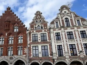
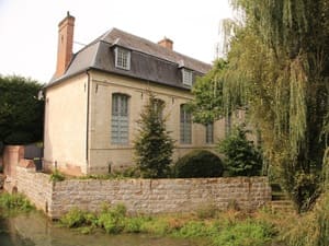
Artois, the historic heart of Pas-de-Calais, is a land of contrasts where the fertile Lens plains meet the gentle slopes of the Artois Hills. Its capital, Arras, dazzles with its two Baroque squares—unique in Europe—and its majestic belfry, symbols of medieval merchant power and strong Flemish influence. The region's religious heritage shines through the Abbey of Mont-Saint-Éloi, whose imposing ruins dominate the surrounding countryside. Artesian nature reveals itself in the Scarpe and Authie valleys, which serve as true ecological corridors rich in wetlands and biodiversity. Between the rows of poplars and the meadows of the Ternois, water is ever-present, feeding many historic mills and classical chateaus. The parks and gardens of grand Artois estates, such as those in Rancicourt, testify to an ancestral art of living tied closely to the land. This province is a mosaic of bocage and cereal plateaus, where rural heritage is vividly written in the red bricks of its fortified farms.
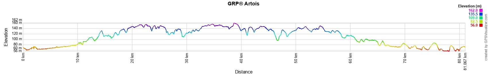
 Distance: 81km (approx. 50 miles), Max altitude: 161m, Min altitude: 56m, Total elevation gain: 536m
Nearby paths:
![]() It is advisable to follow the beacons all along your hike and to bring the FFRandonnée topo-guide. You will also find information on MonGR.fr.
It is advisable to follow the beacons all along your hike and to bring the FFRandonnée topo-guide. You will also find information on MonGR.fr.
GR®, PR®, GRP® and the corresponding markings are trademarks of the French Federation of Hiking. They may not be reproduced without permission. The French Federation of Hiking, state-approved, includes organizations that maintain hiking routes. It publishes guides for these routes. With your donations, support the actions of the thousands of volunteer markers of the FFRandonnée.
GR-Infos.com is an editorial partner of MonGR.fr.
| Return |

Former holiday hotel with a garden along the Allier, L'Etoile Guest House is located in La Bastide-Puylaurent between Lozere, Ardeche, and the Cevennes in the mountains of Southern France. At the crossroads of GR®7, GR®70 Stevenson Path, GR®72, GR®700 Regordane Way, GR®470 Allier River springs and gorges, GRP® Cevenol, Ardechoise Mountains, Margeride. Numerous loop trails for hiking and one-day biking excursions. Ideal for a relaxing and hiking getaway.
Copyright©gr-infos.com (Authorization for private use only)
To help us maintain and improve GR-Infos.com, a contribution of 2€ is desired via Wero or bank transfer. Thank you!