
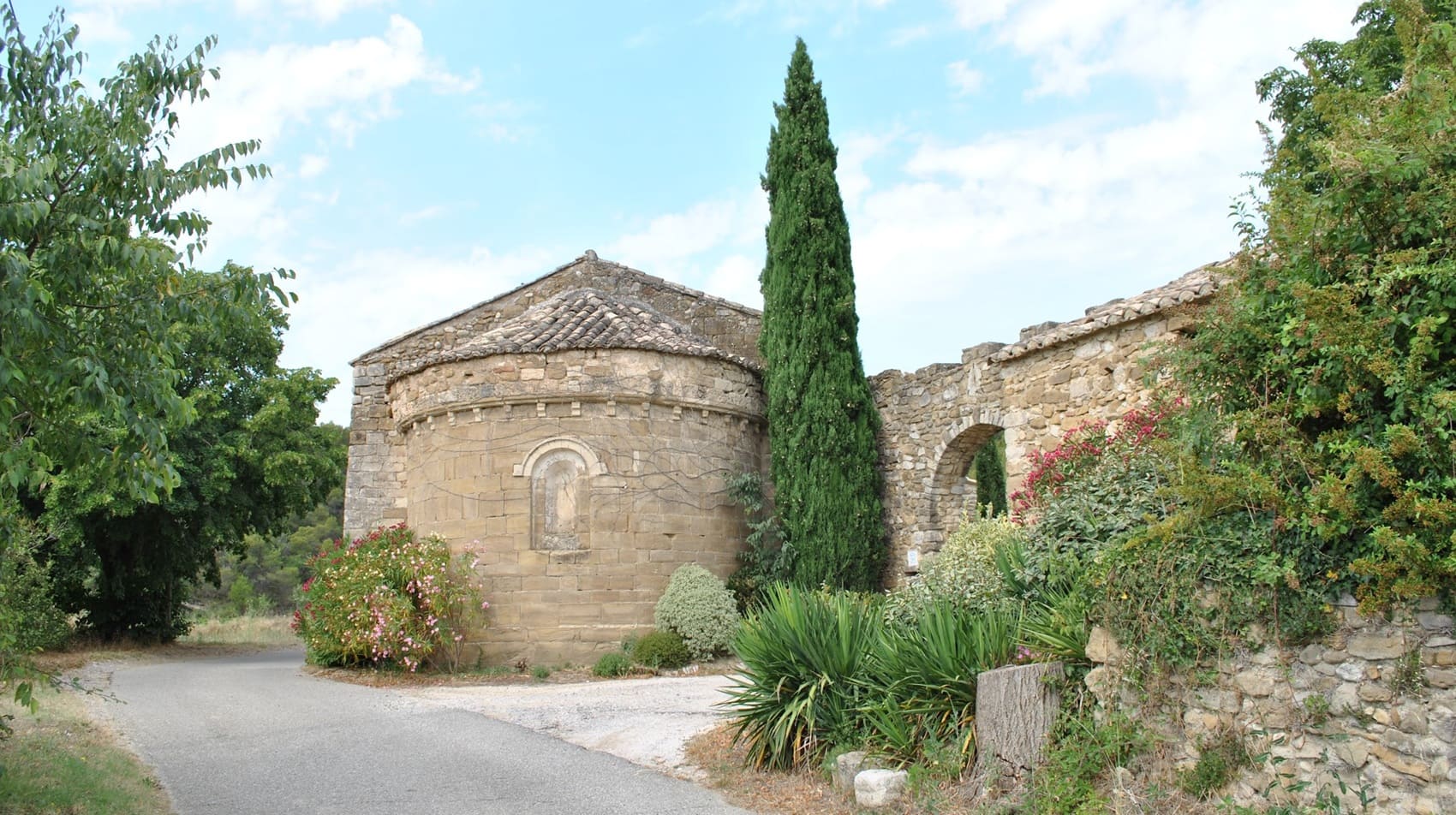
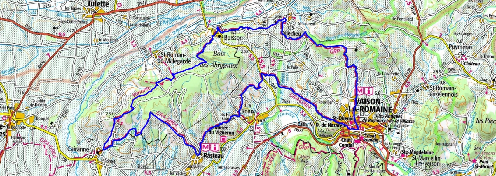
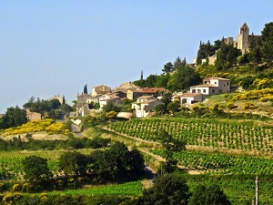
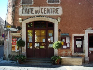
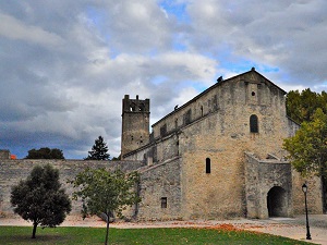
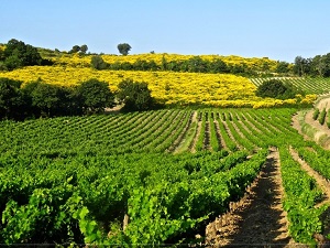
Starting in Rasteau, famous for its rich wines, the trail winds through hills of blue marl and fragrant garrigue towards Cairanne, offering breathtaking views of the Dentelles de Montmirail. The route then passes through the perched villages of Buisson and Villedieu, where shaded squares and fountains bear witness to an enduring Provençal way of life. The trail continues to Vaison-la-Romaine, a unique town with ancient ruins, a Roman bridge, and a medieval upper town. The loop then leads to Roaix, a village whose terraces overlook the Comtat Venaissin plain. Here, nature is a mosaic of vineyards, truffle oaks, and pine forests, bathed in a light that has captivated many painters. Between silver olive trees and dry-stone walls, every kilometer reveals traces of the Knights Templar and Knights Hospitaller who shaped this land.
The Rasteau massif is known for its AOC Rasteau wines, produced primarily from Grenache grapes. The massif is home to picturesque villages like Rasteau, Saint-Pantaléon-les-Vignes and Beaumes-de-Venise. It was once occupied by the Romans, who built roads and aqueducts, with remains discovered on the site of Rasteau village. In the Middle Ages, the massif was a major center for wine production, with the monks of Sénanque Abbey playing a crucial role in developing local viticulture.
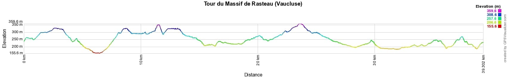

 Distance: 39km, Elevation maximum: 360m, Elevation minimum: 156m, Elevation gain uphill: 815m
IGN Maps: 3139OT - NYONS. 3040ET - CARPENTRAS VAISON-LA-ROMAINE DENTELLES DE MONTMIRAIL. 3040OT - ORANGE Massif de Rasteau. 3039ET - VALRÉAS SAINT-PAUL-TROIS-CHÂTEAUX.

Nearby paths:
![]() It is advisable to follow the beacons all along your hike and to bring the FFRandonnée topo-guide. You will also find information on MonGR.fr.
It is advisable to follow the beacons all along your hike and to bring the FFRandonnée topo-guide. You will also find information on MonGR.fr.
GR®, PR®, GRP® and the corresponding markings are trademarks of the French Federation of Hiking. They may not be reproduced without permission. The French Federation of Hiking, state-approved, includes organizations that maintain hiking routes. It publishes guides for these routes. With your donations, support the actions of the thousands of volunteer markers of the FFRandonnée.
GR-Infos.com is an editorial partner of MonGR.fr.
| Return |

Former holiday hotel with a garden along the Allier, L'Etoile Guest House is located in La Bastide-Puylaurent between Lozere, Ardeche, and the Cevennes in the mountains of Southern France. At the crossroads of GR®7, GR®70 Stevenson Path, GR®72, GR®700 Regordane Way, GR®470 Allier River springs and gorges, GRP® Cevenol, Ardechoise Mountains, Margeride. Numerous loop trails for hiking and one-day biking excursions. Ideal for a relaxing and hiking getaway.
Copyright©gr-infos.com (Authorization for private use only)
To help us maintain and improve GR-Infos.com, a contribution of 2€ is desired via Wero or bank transfer. Thank you!