
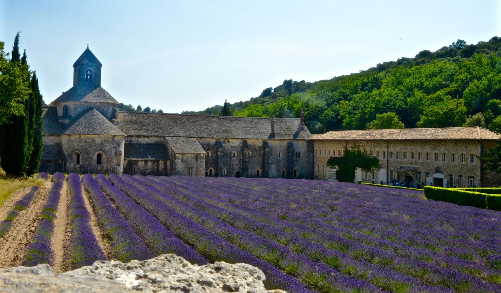
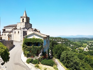
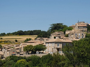
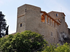
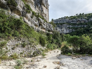
Starting in Venasque, perched atop its steep rock, the trail first winds through oak forests towards Murs, before descending to the ochre cliffs of Joucas and the iconic village of Gordes, a masterpiece of dry-stone architecture. Heritage unfolds at every turn, from the Plague Wall in Cabrières-d'Avignon to the ancient bories (dry-stone huts) that dot the limestone plateau. At Fontaine-de-Vaucluse, nature impresses with the power of its spring nestled at the foot of a monumental cliff. The path then meanders through Saumane-de-Vaucluse and its castle, linked to the family of the Marquis de Sade, offering breathtaking views over the Comtat Venaissin plain. The route continues through the picturesque streets of La Roque-sur-Pernes and the hilltop village of Le Beaucet, guardian of local medieval history.
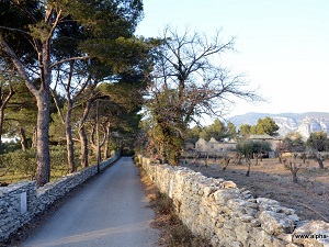
The Vaucluse Monts are home to a wide variety of ecosystems, including forests, meadows, cliffs, and caves. The region is also known for its vibrant colors, particularly ochres which are used to create paints and pigments. The Monts de Vaucluse are home to a wide variety of animals, including deer, wild boars, badgers, foxes, and birds of prey. The region is also an important habitat for migratory birds. The Vaucluse Monts is home to a wide variety of plants, including oaks, pines, olive trees, vines, and wildflowers. The region is also known for its lavender fields.
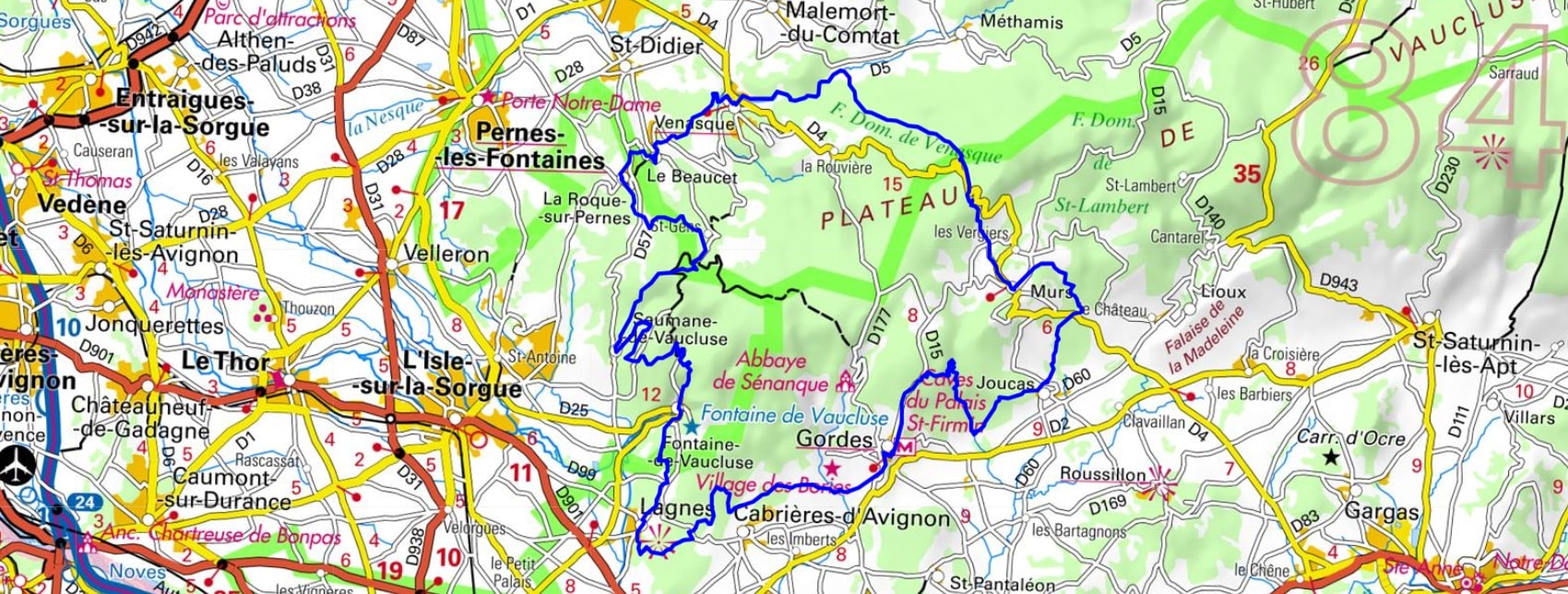
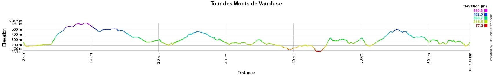
 Distance: 66km, Maximum elevation: 630m, Minimum elevation: 77m, Total ascent: 2193m
IGN Maps: 3142OT - CAVAILLON FONTAINE-DE-VAUCLUSE.

Nearby paths:
![]() It is advisable to follow the beacons all along your hike and to bring the FFRandonnée topo-guide. You will also find information on MonGR.fr.
It is advisable to follow the beacons all along your hike and to bring the FFRandonnée topo-guide. You will also find information on MonGR.fr.
GR®, PR®, GRP® and the corresponding markings are trademarks of the French Federation of Hiking. They may not be reproduced without permission. The French Federation of Hiking, state-approved, includes organizations that maintain hiking routes. It publishes guides for these routes. With your donations, support the actions of the thousands of volunteer markers of the FFRandonnée.
GR-Infos.com is an editorial partner of MonGR.fr.
| Return |

Former holiday hotel with a garden along the Allier, L'Etoile Guest House is located in La Bastide-Puylaurent between Lozere, Ardeche, and the Cevennes in the mountains of Southern France. At the crossroads of GR®7, GR®70 Stevenson Path, GR®72, GR®700 Regordane Way, GR®470 Allier River springs and gorges, GRP® Cevenol, Ardechoise Mountains, Margeride. Numerous loop trails for hiking and one-day biking excursions. Ideal for a relaxing and hiking getaway.
Copyright©gr-infos.com (Authorization for private use only)
To help us maintain and improve GR-Infos.com, a contribution of 2€ is desired via Wero or bank transfer. Thank you!