
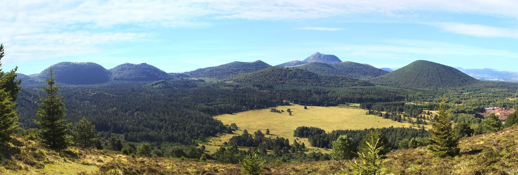
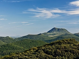
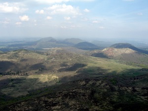
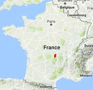
The GR®441 offers a unique geological immersion into the heart of a group of 80 volcanoes with varied shapes, including domes, craters, and cinder cones. The trail crosses lands shaped by pastoralism and the quarrying of volcanic stone—specifically Volvic lava—which has forged the region's architectural identity, evident in its villages of dark stone and traditional bread ovens. Hikers transition from wooded domes to vast high-altitude pastures, known as "estives," where Salers cows still graze. The natural environment shelters flora specific to basaltic soils and a rich fauna, including birds of prey such as the red kite. The visual highlight remains the constant view of the majestic Puy de Dôme, the giant of the range, which dominates this volcanic alignment unique in Europe.
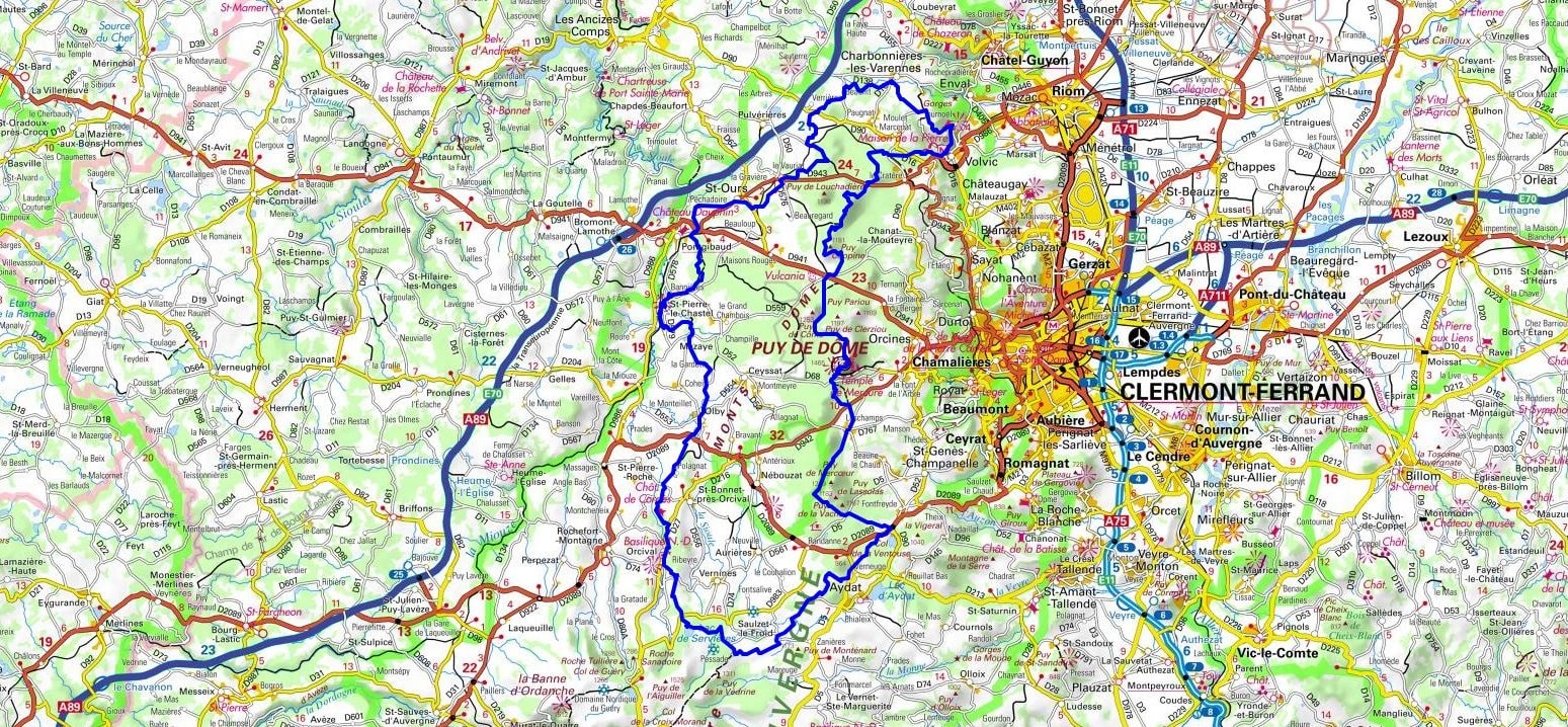
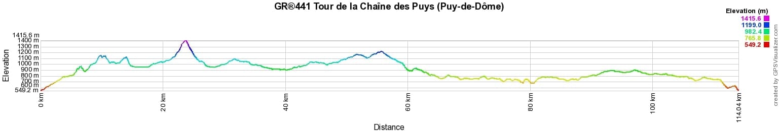
 Distance: 114km, Elevation maximum: 1416m, Elevation minimum: 549m, Elevation gain uphill: 2659m
IGN Maps: Clermont-Ferrand (2531E). Chaine des Puys PNR des Volcans d'Auvergne (2531ET).
Nearby paths:
![]() It is advisable to follow the beacons throughout your itinerary and to bring the Fédération Française de la Randonnée Pédestre topo-guide with you. You will also find information on MonGR.fr.
It is advisable to follow the beacons throughout your itinerary and to bring the Fédération Française de la Randonnée Pédestre topo-guide with you. You will also find information on MonGR.fr.
GR®, PR®, GRP®, and the corresponding signs of markings (white / red, yellow and yellow / red) are trademarks of the French Federation of Hiking. They may not be reproduced without permission. The French Federation of Hiking, state-approved, includes organizations that create and maintain hiking routes on GR®, PR®, and GRP®. It publishes guides for these topo hiking routes. With your donations, you support the actions of the thousands of FFRandonnée volunteer markers.
GR-Infos.com is an editorial partner of MonGR.fr.
| Return |

Former holiday hotel with a garden along the Allier, L'Etoile Guest House is located in La Bastide-Puylaurent between Lozere, Ardeche, and the Cevennes in the mountains of Southern France. At the crossroads of GR®7, GR®70 Stevenson Path, GR®72, GR®700 Regordane Way, GR®470 Allier River springs and gorges, GRP® Cevenol, Ardechoise Mountains, Margeride. Numerous loop trails for hiking and one-day biking excursions. Ideal for a relaxing and hiking getaway.
Copyright©gr-infos.com (Authorization for private use only)
To help us maintain and improve GR-Infos.com, a contribution of 2€ is desired via Wero or bank transfer. Thank you!