
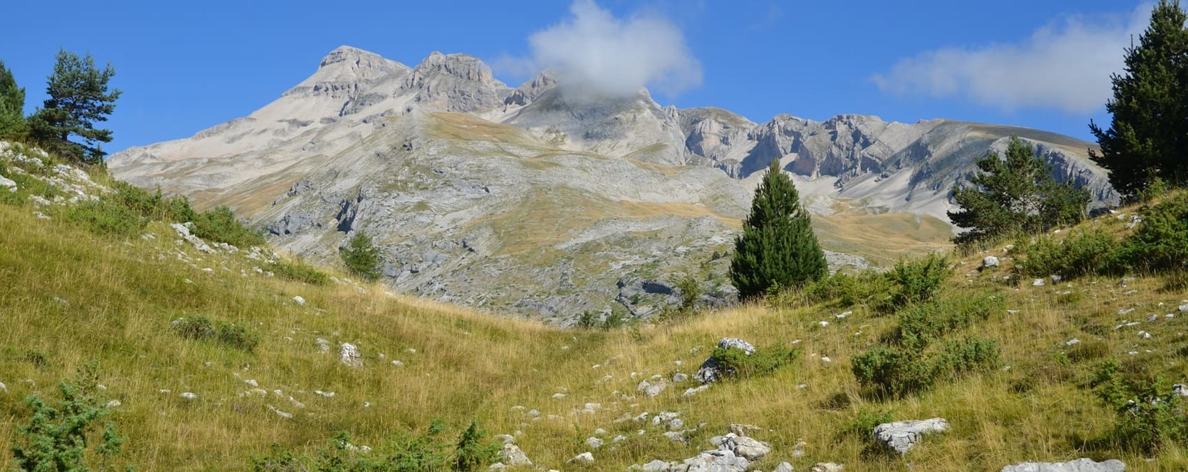
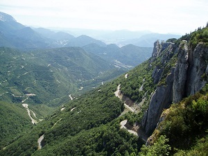
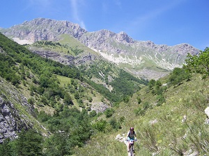
The Vercors is a spectacular limestone massif covering approximately 2,500 square kilometers, reaching an altitude of 2,341 meters at the summit of Grand Veymont. Bordered by the Drôme Valley to the east and the Isère Valley to the west, it features an incredible variety of landscapes, including vast plateaus, steep cliffs, dramatic gorges, and hidden valleys. The Vercors is a true sanctuary for biodiversity: its coniferous forests, alpine meadows, and rocky terrains provide vital refuge for species such as chamois, ibex, lynx, and birds of prey like the bearded vulture and golden eagle. The diverse flora includes endemic alpine plants and a striking array of wildflowers that bloom beautifully in spring and summer. The Vercors Regional Natural Park is crucial in preserving this pristine environment, making the GR®93 an unforgettable journey for nature lovers.
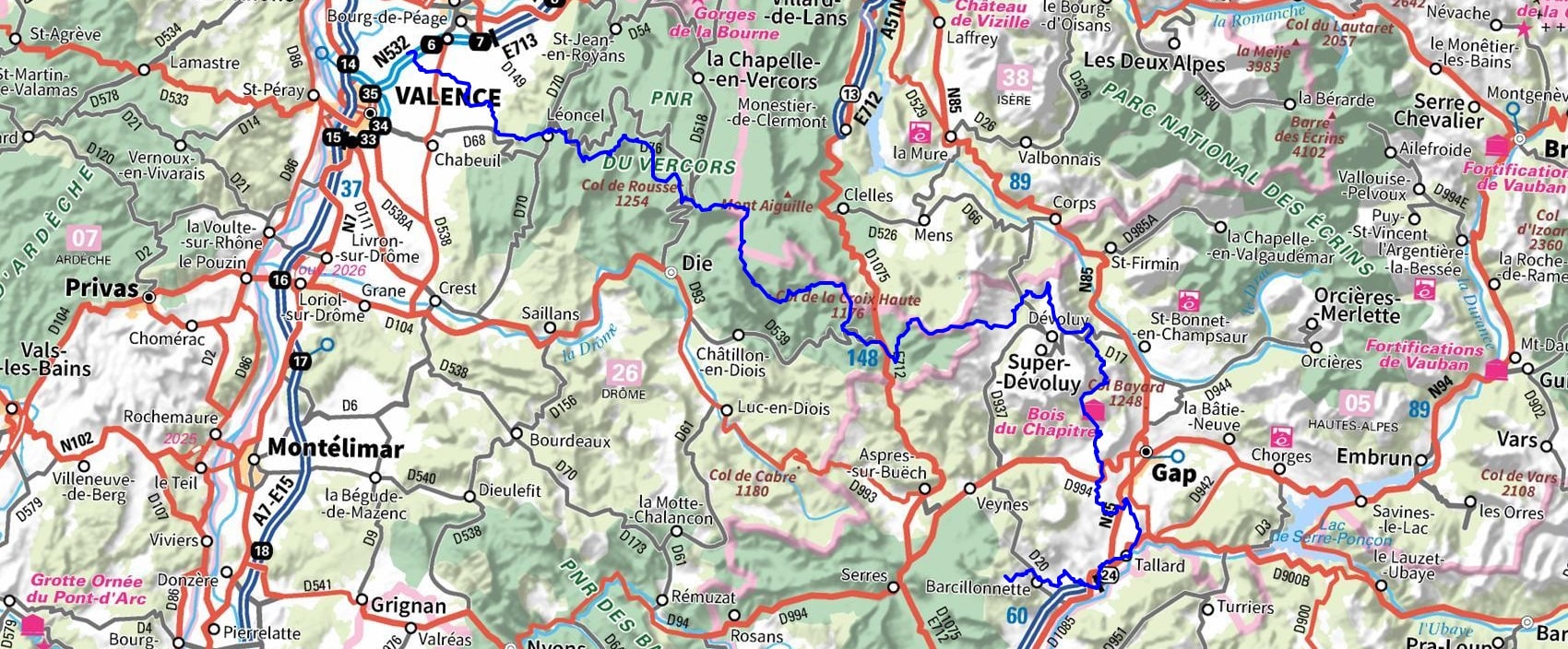
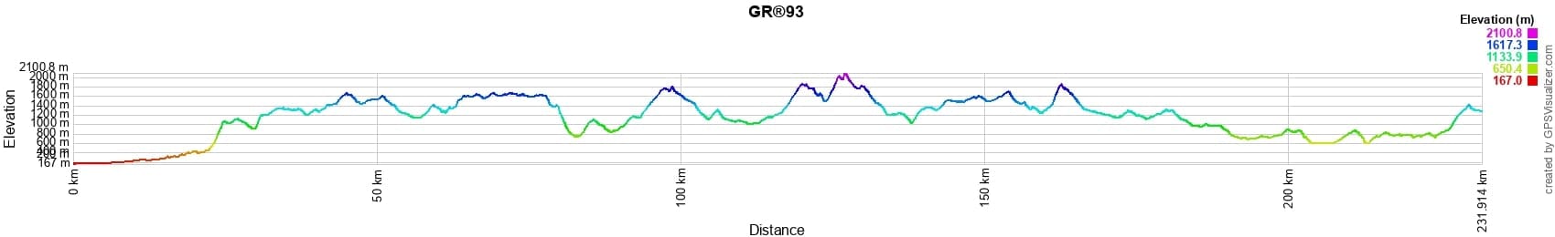
 Distance: 231km, Elevation maximum: 2101m, Elevation minimum: 167m, Elevation gain uphill: 10480m
IGN Maps: 3135SB - ROMANS-SUR-ISÈRE SAINT-MARCELLIN. 3136ET - COMBE LAVAL. 3136SB - BOURG-DE-PEAGE CHABEUIL. 3137OT - DIE CREST PNR DU VERCORS. 3236OT - VILLARD-DE-LANS MONT AIGUILLE PNR DU VERCORS. 3237OT - GLANDASSE COL DE LA CROIX-HAUTE PNR DU VERCORS. 3337OT - DEVOLUY OBIOU PIC DE BURE. 3338ET - GAP MONTAGNE DE CEUSE. 3338OT - SERRES VEYNES HAUT Buëch BOCHAINE. 3437OT - CHAMPSAUR VIEUX CHAILLOL PARC NATIONAL DES ECRINS.
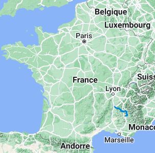
Nearby paths:
![]() It is advisable to follow the beacons all along your hike and to bring the FFRandonnee topo-guide. You will also find information on MonGR.fr.
It is advisable to follow the beacons all along your hike and to bring the FFRandonnee topo-guide. You will also find information on MonGR.fr.
GR®, PR®, GRP®, and the corresponding signs of markings (white/red, yellow and yellow/red) are trademarks of the French Federation of Hiking. They may not be reproduced without permission. The French Federation of Hiking, state-approved, includes organizations that create and maintain hiking routes on GR®, PR® and GRP®. It publishes guides for these topo hiking routes. With your donations, support the actions of the thousands of volunteer markers of the FFRandonnee.
GR-Infos.com is an editorial partner of MonGR.fr.
| Return |

Former holiday hotel with a garden along the Allier, L'Etoile Guest House is located in La Bastide-Puylaurent between Lozere, Ardeche, and the Cevennes in the mountains of Southern France. At the crossroads of GR®7, GR®70 Stevenson Path, GR®72, GR®700 Regordane Way, GR®470 Allier River springs and gorges, GRP® Cevenol, Ardechoise Mountains, Margeride. Numerous loop trails for hiking and one-day biking excursions. Ideal for a relaxing and hiking getaway.
Copyright©gr-infos.com (Authorization for private use only)
To help us maintain and improve GR-Infos.com, a contribution of 2€ is desired via Wero or bank transfer. Thank you!