
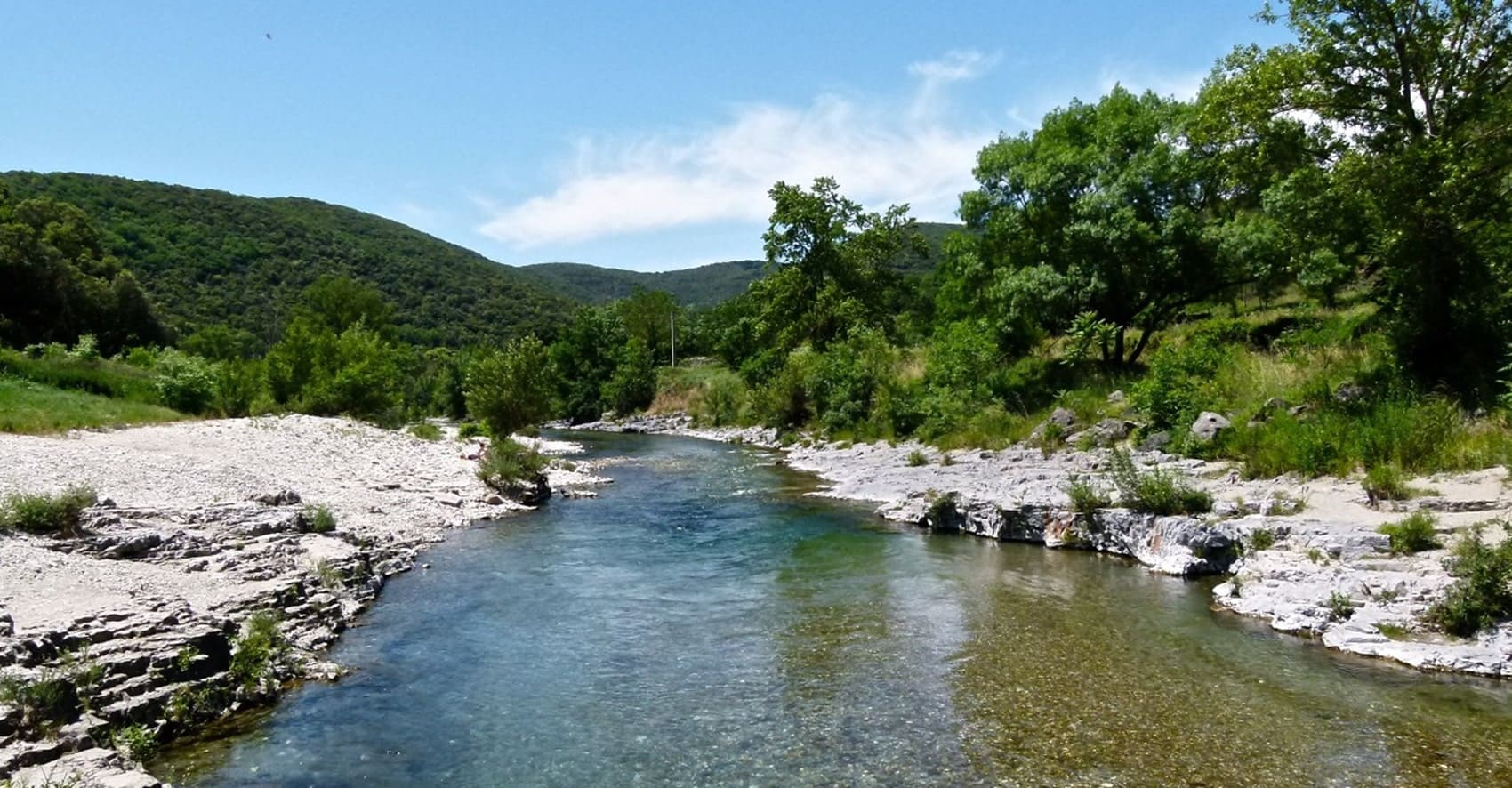
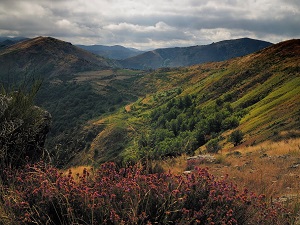
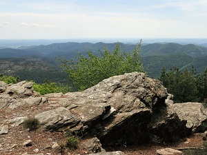
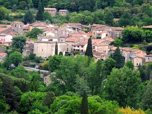
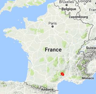
The Cévennes offer wild landscapes sculpted by deep valleys and limestone plateaux. This region is marked by a turbulent history, notably that of the Camisards, linked to a deeply rooted Protestantism that still defines the local identity today. Its built heritage, constructed of dry stone and terraces, bears witness to a millennia-old adaptation to the mountain environment. The biodiversity is exceptional: chestnut forests, heaths and garrigue succeed one another, sheltering a rich fauna including mouflons, otters and Bonelli's eagles. The GR®67 offers an authentic immersion in the heart of a UNESCO World Biosphere Reserve, far from tourist crowds.
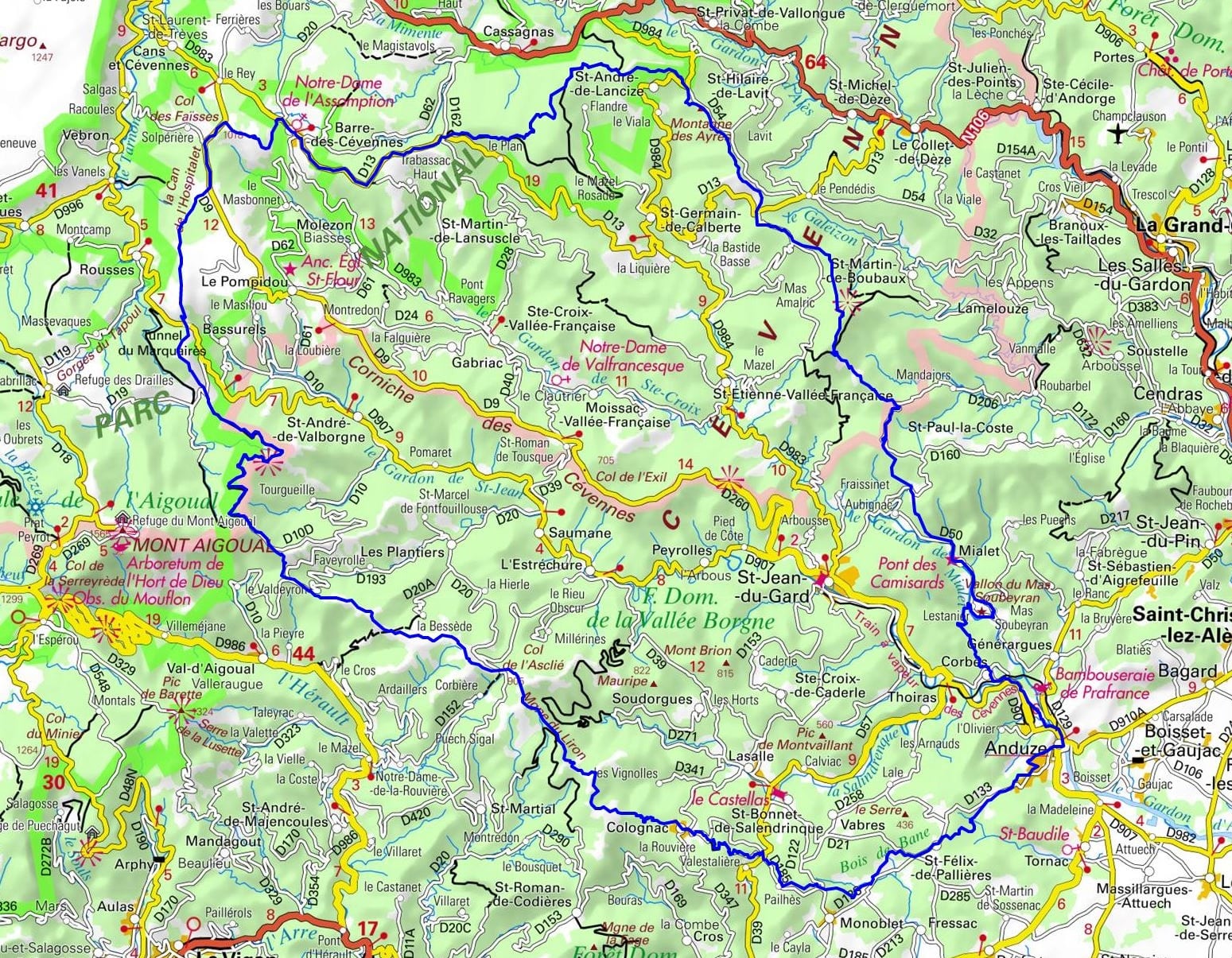
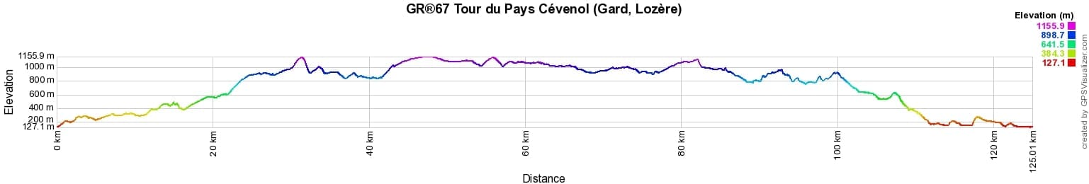
 Distance: 125km, Elevation maximum: 1168m, Elevation minimum: 129m, Elevation gain uphill: 3690m
Nearby paths:
![]() It is advisable to follow the beacons all along your hike and to bring the FFRandonnée topo-guide. You will also find information on MonGR.fr.
It is advisable to follow the beacons all along your hike and to bring the FFRandonnée topo-guide. You will also find information on MonGR.fr.
GR®, PR®, GRP®, and the corresponding signs of markings (white/red, yellow and yellow/red) are trademarks of the French Federation of Hiking. They may not be reproduced without permission. The French Federation of Hiking, state-approved, includes organizations that create and maintain hiking routes on GR®, PR® and GRP®. It publishes topo-guides for these hiking routes. With your donations, support the actions of the thousands of volunteer markers of the FFRandonnée.
GR-Infos.com is an editorial partner of MonGR.fr.
| Return |

Former holiday hotel with a garden along the Allier, L'Etoile Guest House is located in La Bastide-Puylaurent between Lozere, Ardeche, and the Cevennes in the mountains of Southern France. At the crossroads of GR®7, GR®70 Stevenson Path, GR®72, GR®700 Regordane Way, GR®470 Allier River springs and gorges, GRP® Cevenol, Ardechoise Mountains, Margeride. Numerous loop trails for hiking and one-day biking excursions. Ideal for a relaxing and hiking getaway.
Copyright©gr-infos.com (Authorization for private use only)
To help us maintain and improve GR-Infos.com, a contribution of 2€ is desired via Wero or bank transfer. Thank you!