
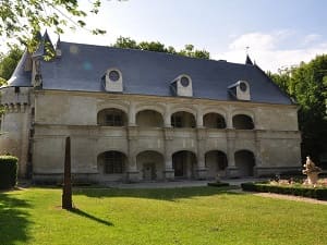
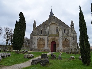
In the heart of the former royal forest, the trail winds its way into this biological reserve where ancient oaks and beeches protect exceptional forest biodiversity. Following the Boutonne Valley towards Saint-Séverin and Dampierre, hikers discover a remarkable heritage, dominated by the Renaissance château of Dampierre-sur-Boutonne and its sculpted galleries. The route then branches off towards Aulnay-de-Saintonge, a major stop on the Via Turonensis, famous for its Romanesque church. The trail continues under the canopy towards Saint-Mandé-sur-Brédoire and Contre, where the tranquility of the undergrowth invites contemplation. Between wetlands and hidden clearings, this wild crossing ends in Saleignes, a testament to the perfect harmony between the history of the great forest estates and the preservation of ecosystems.
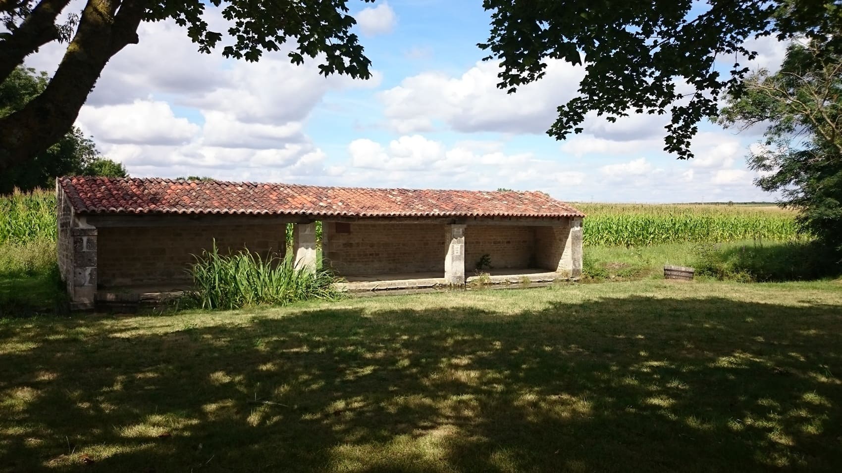
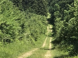
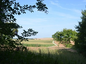
The Argenson Forest Crossing, from Rimbault to Saleignes, traverses the remains of a vast, ancient medieval forest straddling the Deux-Sèvres and Charente-Maritime departments. The landscape is characterized by dense hedgerows interspersed with preserved woodland, remnants of this historic forest. The region's history is that of a wooded territory, linked to royal hunts and the lords of the former province of Poitou. The forest, now fragmented, is rich in flora typical of limestone lowland forests, dominated by oak and beech. The fauna is that of the Atlantic hedgerow landscape, including roe deer, wild boar, and a wide variety of birds nesting in the hedges and woods, making this route a peaceful experience in the hinterland.
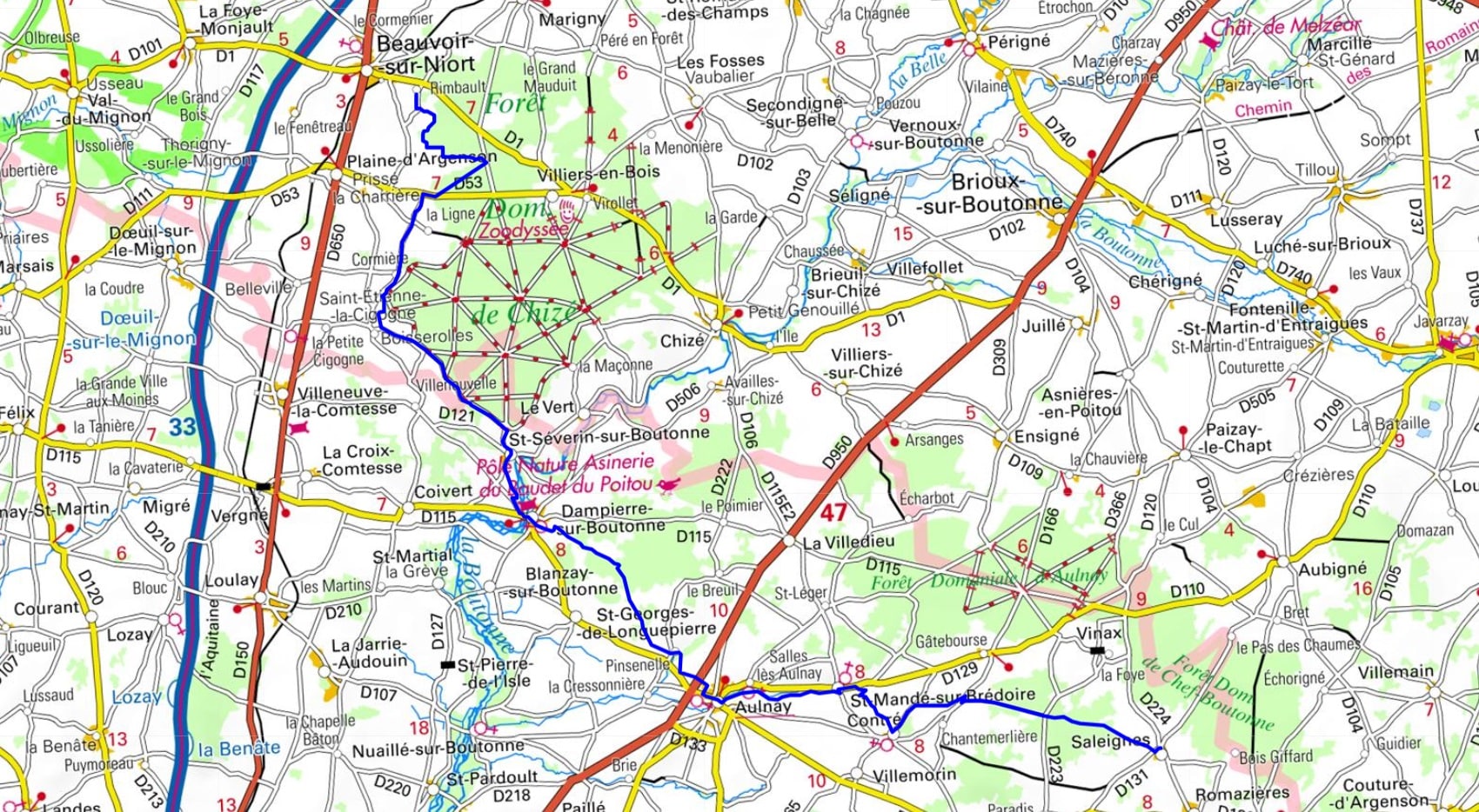
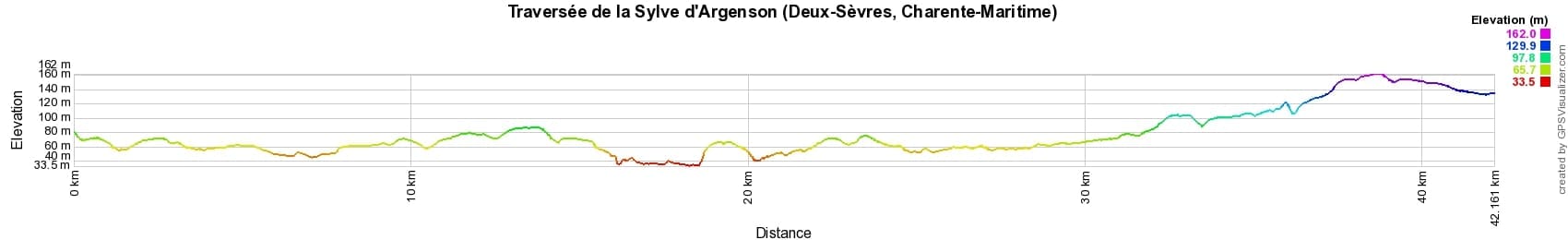
 Distance: 42km, Maximum elevation: 162m, Minimum elevation: 34m, Total ascent: 279m
IGN Maps: 1529SB - FRONTENAY-ROHAN-ROHAN FORÊT DE CHIZÉ MAUZÉ-SUR-LE-MIGNON. 1530SB - SAINT-JEAN-D'ANGÉLY TONNAY-BOUTONNE. 1630SB - AULNAY COUTURE-D'ARGENSON.

Nearby paths:
![]() It is advisable to follow the beacons all along your hike and to bring the FFRandonnée topo-guide. You will also find information on MonGR.fr.
It is advisable to follow the beacons all along your hike and to bring the FFRandonnée topo-guide. You will also find information on MonGR.fr.
GR®, PR®, GRP® and the corresponding markings are trademarks of the French Federation of Hiking. They may not be reproduced without permission. The French Federation of Hiking, state-approved, includes organizations that maintain hiking routes. It publishes guides for these routes. With your donations, support the actions of the thousands of volunteer markers of the FFRandonnée.
GR-Infos.com is an editorial partner of MonGR.fr.
| Return |

Former holiday hotel with a garden along the Allier, L'Etoile Guest House is located in La Bastide-Puylaurent between Lozere, Ardeche, and the Cevennes in the mountains of Southern France. At the crossroads of GR®7, GR®70 Stevenson Path, GR®72, GR®700 Regordane Way, GR®470 Allier River springs and gorges, GRP® Cevenol, Ardechoise Mountains, Margeride. Numerous loop trails for hiking and one-day biking excursions. Ideal for a relaxing and hiking getaway.
Copyright©gr-infos.com (Authorization for private use only)
To help us maintain and improve GR-Infos.com, a contribution of 2€ is desired via Wero or bank transfer. Thank you!