
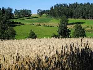
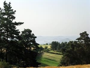
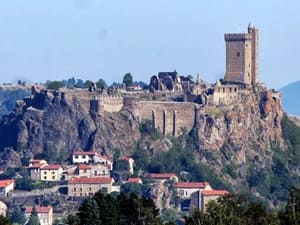
The GR®765 West, an historic trail linked to the paths of Santiago de Compostela, first crosses Usson-en-Forez, steeped in rural traditions and Auvergne legends. Plunging towards Chomelix and Bellevue-la-Montagne, hikers meander through the dense fir forests of the Livradois-Forez, where one can catch sight of the flight of a red kite or cross paths with a doe at the bend of a path. The landscape then opens up onto large basaltic plateaus and rich valleys, witnesses to a tumultuous volcanic past. Approaching Saint-Paulien, ancient Gallo-Roman capital, history can be read in the stone with remarkable Romanesque churches and ancient remains. On the flora side, the route is a changing festival, alternating carpets of daffodils in spring, golden broom, and high-altitude undergrowth rich in ferns. Finally, the arrival on the Puy-en-Velay basin offers a spectacular panorama, crowned by the impregnable dyke of Polignac.
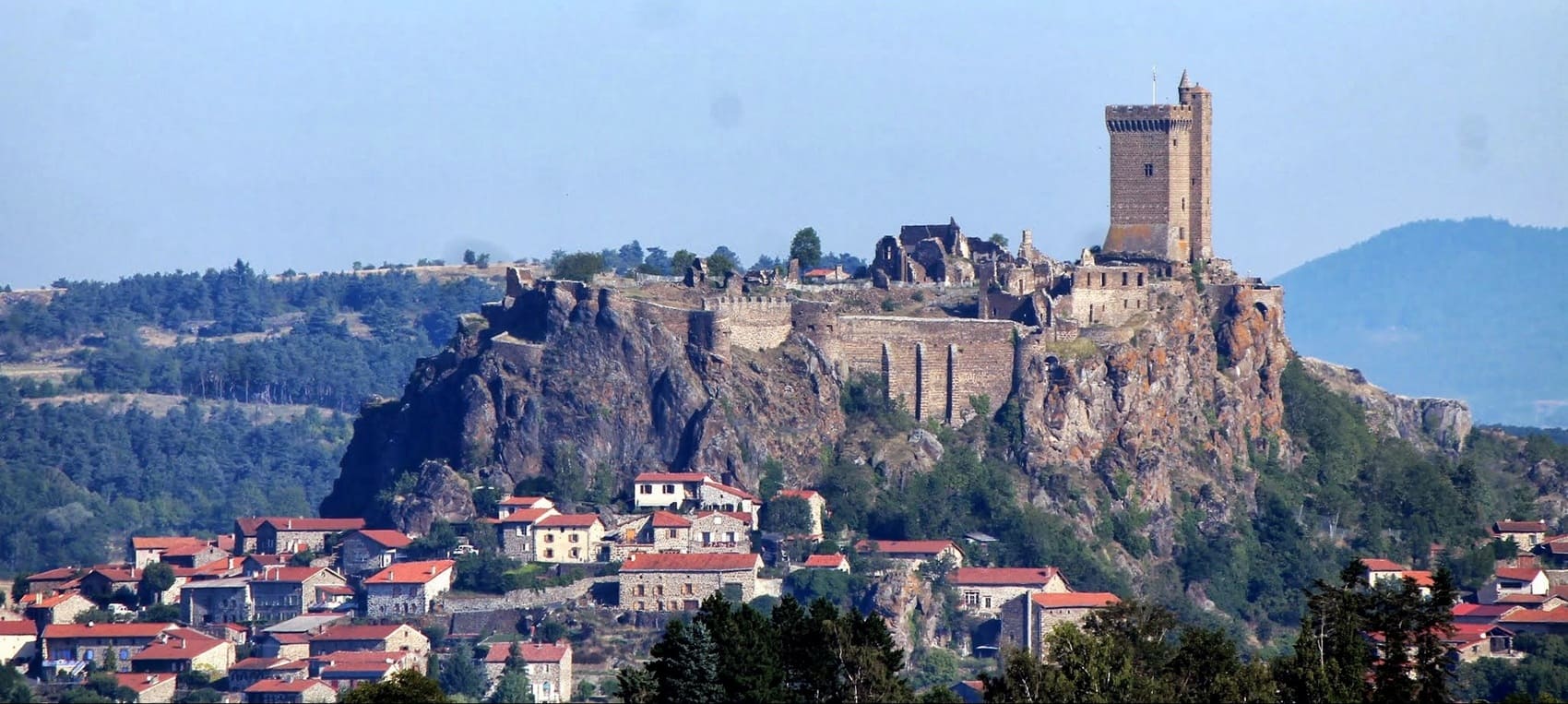
The Puy-en-Velay basin and its surrounding volcanic plateaus offer a landscape unique in the world, sculpted by intense ancient volcanic activity. This relief is characterized by spectacular "sucs" and rocky dykes, including the famous rock of Polignac, which emerge amidst fertile plains and green valleys. Nature here displays a remarkable biodiversity, influenced by a climate that is both mountainous and southern. The wooded areas and wild gorges shelter a rich fauna, where the red kite and the short-toed snake eagle soar, while the peregrine falcon nests on the steep cliffs. The flora of the basaltic soils is equally fascinating, adorned with wild orchids and flowered meadows in spring. History has deeply marked this land, a strategic and spiritual crossroads since Antiquity and the Middle Ages. The heritage here is exceptional, dominated by the majestic fortress of Polignac, a true sentinel of a flamboyant feudal past.
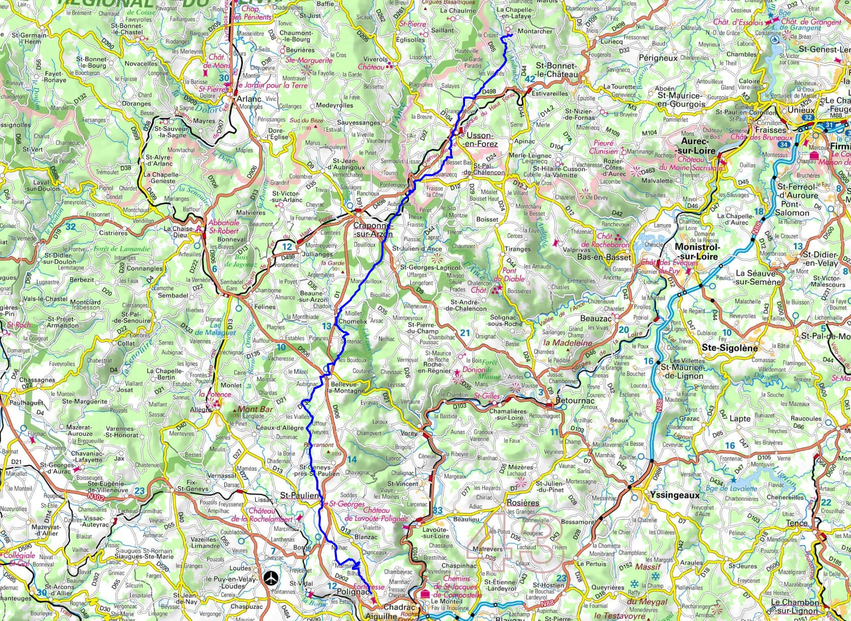

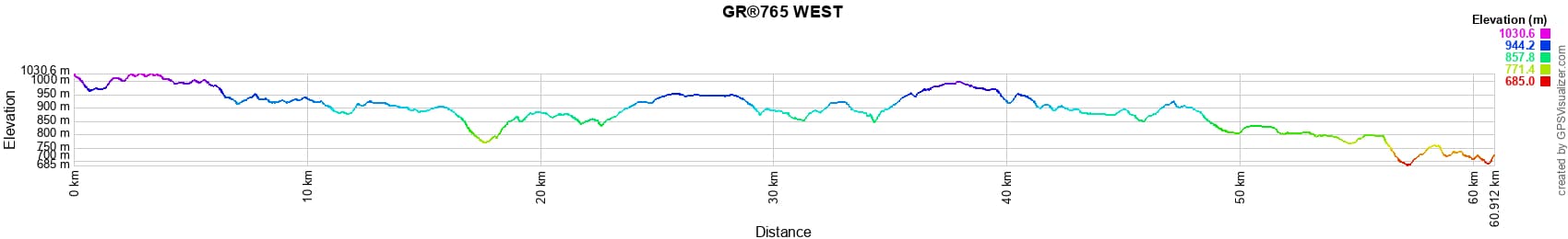
 Distance: 61km, Maximum altitude: 1028m, Minimum altitude: 686m, Total ascent: 1070m
Nearby trails:
![]() It is advisable to follow the beacons all along your hike and to bring the FFRandonnee topo-guide with you. You will also find information on MonGR.fr.
It is advisable to follow the beacons all along your hike and to bring the FFRandonnee topo-guide with you. You will also find information on MonGR.fr.
GR®, PR®, GRP®, and the corresponding signs of markings (white / red, yellow and yellow / red) are trademarks of the French Federation of Hiking. They may not be reproduced without permission. The French Federation of Hiking, state-approved, includes organizations that create and maintain hiking routes on GR®, PR® and GRP®. It publishes guides for these topo hiking routes. With your donations, you support the actions of the thousands of volunteer markers of the FFRandonnee.
GR-Infos.com is an editorial partner of MonGR.fr.
| Return |

Former holiday hotel with a garden along the Allier, L'Etoile Guest House is located in La Bastide-Puylaurent between Lozere, Ardeche, and the Cevennes in the mountains of Southern France. At the crossroads of GR®7, GR®70 Stevenson Path, GR®72, GR®700 Regordane Way, GR®470 Allier River springs and gorges, GRP® Cevenol, Ardechoise Mountains, Margeride. Numerous loop trails for hiking and one-day biking excursions. Ideal for a relaxing and hiking getaway.
Copyright©gr-infos.com (Authorization for private use only)
To help us maintain and improve GR-Infos.com, a contribution of 2€ is desired via Wero or bank transfer. Thank you!