|
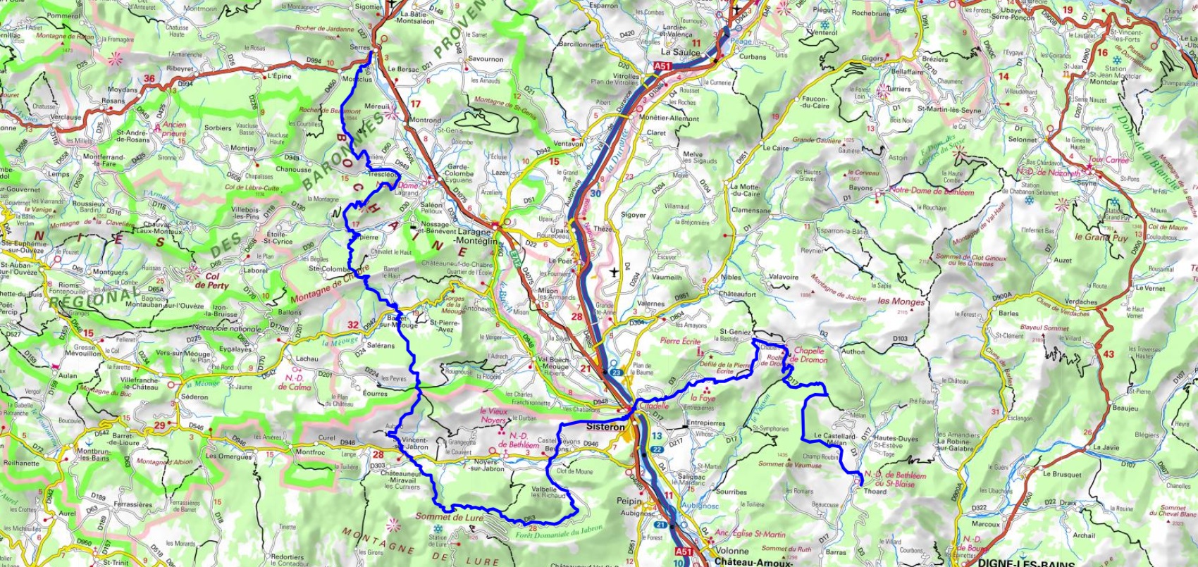
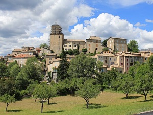
Hike through Alpes-de-Haute-Provence and Hautes-Alpes department on Pre-Alps Great Crossing from Thoard to Serres via Saint-Geniez, Sisteron, Bevons, Saint-Vincent-sur-Jabron, Barret-sur-Meouge, Orpierre and Trescleoux. Guest House, Bed and Breakfast, Hotel, Camping, Shelter, Inn, Shops.
|

|

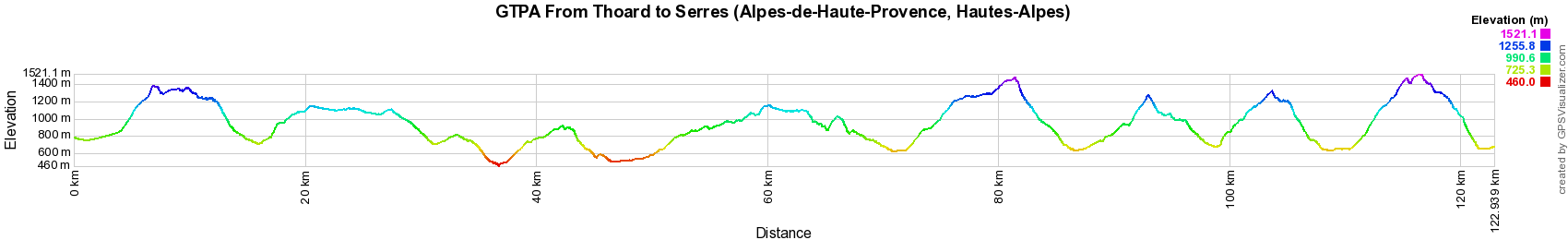
GTPA From Thoard to Serres (Alpes-de-Haute-Provence, Hautes-Alpes)
Pre-Alps Great Crossing
123km
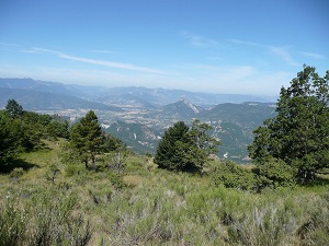
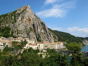
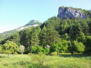
In France, the Pre-Alps extend over approximately 100,000 km², from the Mediterranean to Alsace. They are divided into several massifs, the most important of which are: The Southern Prealps, which extend from the Côte d'Azur to the Alpes-de-Haute-Provence. They include in particular the Mercantour, Écrins and Vercors massifs. The Northern Prealps, which extend from Isère to Alsace. They include in particular the Jura, Vercors and Vosges massifs. The Pre-Alps are characterized by varied relief, with peaks reaching 3,000 meters above sea level, deep valleys and plateaus. They are made up of limestone, schistose and granite rocks. The vegetation of the Pre-Alps is varied, depending on the altitude. There are deciduous, coniferous and maritime pine forests. The Prealps are also an important place of passage for migratory birds. The Prealps are a region rich in natural resources, notably water, wood and minerals.
Google Maps - Google Earth

© GPX Private use only |
Distance: 123km, Elevation maximum: 1521m, Elevation minimum: 460m, Elevation gain uphill: 5999m
IGN Maps: 3239OT - ROSANS ORPIERRE BARONNIES ORIENTALES. 3339ET - LA MOTTE-DU-CAIRE VALLEE DU SASSE. 3339OT - SISTERON LARAGNE-MONTEGLIN MONTAGNE DE CHABRE. 3340ET - DIGNE-LES-BAINS SISTERON LES MÉES. 3341OT - MONTAGNE DE LURE LES MÉES CHÂTEAU-ARNOUX-SAINT-AUBAN. 3338OT - SERRES VEYNES HAUT BUËCH BOCHAINE.

Registration
Accommodation or business owner on or near a GR®, you can appear on GR-INFOS
For your registration, you can send me by email (papadimitriou4@gmail.com): your address and phone number, your website (Facebook page), a brief description with 5 beautiful photos of your establishment.
Registration price : 100€/5 years per GR® or GRP®. Renewable. |
Pre-Alps Great Crossing (Alpes-de-Haute-Provence, Hautes-Alpes)
GTPA From Entrevaux to Thoard (Alpes-de-Haute-Provence)
GTPA From Thoard to Serres (Alpes-de-Haute-Provence, Hautes-Alpes)
Nearby paths:
Around Buech (Hautes-Alpes, Drome)
Around Buech and Meouge Valley (Drome, Hautes-Alpes)
Around Provencal Baronnies (Drome)
GR®4 Atlantic to Mediterranean sea
GR®6 From Gironde to Alpes-de-Haute-Provence
GR®69 La Routo
GR®91 Crossing Vercors highlands
GR®93 Crossing Vercors
GR®94 From Vaunieres to Praux Pass (Hautes-Alpes)
GR®406 Napoleon Way
GR®510 8 Valleys trail
GR®653D Via Domitia
 It is advisable to follow the beacons all along your hike and to bring you the FFRandonnee topo-guide. You
will also find information on MonGR.fr.
It is advisable to follow the beacons all along your hike and to bring you the FFRandonnee topo-guide. You
will also find information on MonGR.fr.
GR®, PR®, GRP®, and the corresponding signs of markings (white / red, yellow and yellow / red) are trademarks of the French
Federation of Hiking. They may not be reproduced without permission. The French Federation of Hiking, state-approved, includes organizations that create and maintain hiking routes on GR®, PR® and
GRP®. It publishes guides these topo hiking routes.
With your donations, support the actions of the thousands of volunteer markers of the FFRandonnee.
GR-Infos.com is an editorial partner of MonGR.fr.

Old romantic Hotel, L'Etoile Guest-House is a mountain retreat in the South of France. With a beautiful park along the Allier River, L'Etoile Guesthouse is located in La Bastide-Puylaurent between Lozere, Ardeche and Cevennes. Many hiking trails like GR®7, GR®70 Stevenson trail, GR®72, GR®700 Regordane way, Cevenol, GR®470 Allier River Springs and Gorges, Margeride, Ardechoise. Many hiking loops. The right place to relax.
Copyright©gr-infos.com (Authorization for private use only)