
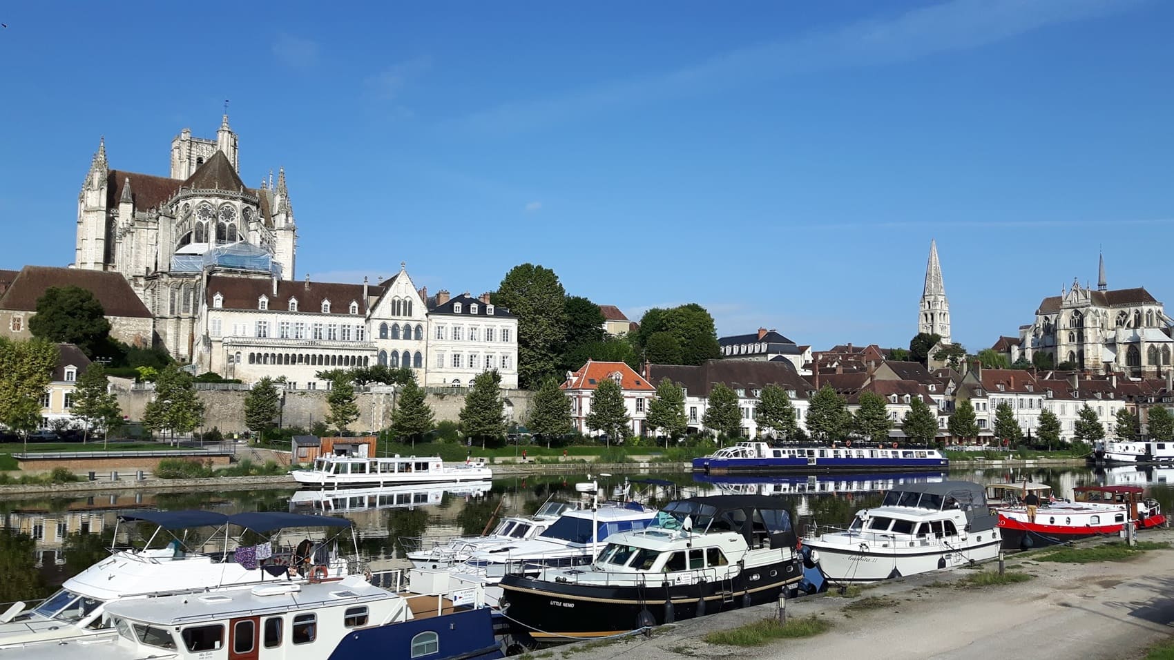
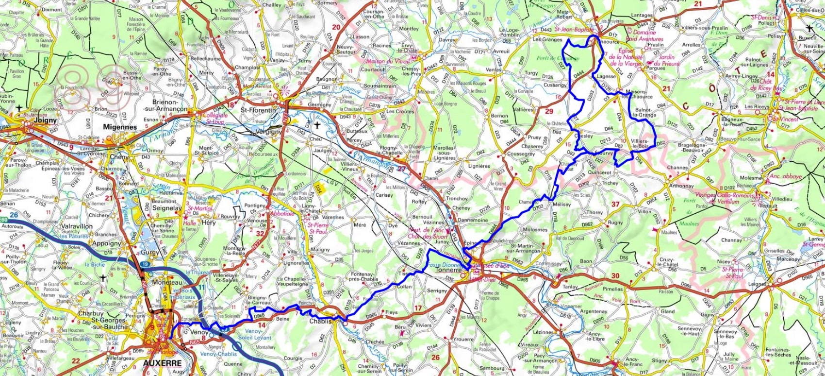
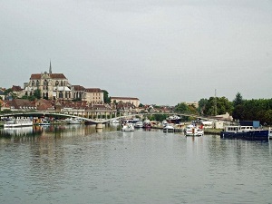
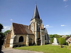
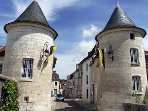
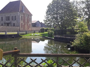
Starting in Auxerre, a city of art and history on the banks of the Yonne River, this journey crosses the prestigious terroirs of Burgundy and Champagne. The trail first climbs towards Chablis, where limestone hills create a landscape of geometric vineyards renowned for their mineral white wines. Walking towards Tonnerre, the heritage unfolds with the Fosse Dionne, a Vaucluse spring with turquoise waters, and the vineyards of Épineuil. The route continues towards the Aube region, offering dense forests and peaceful valleys between Étourvy and Balnot-la-Grange, where the limestone gives way to the first sparkling wines of the Aube. In Chaource, birthplace of the famous creamy cheese, the church houses a monumental Entombment of Christ, a masterpiece of 16th-century sculpture. The route then winds through unspoiled countryside and charming villages, reaching Chesley before returning to Étourvy.
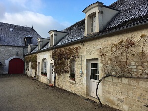
The Wines and Cheeses region stretches across a historical transition zone between the Yonne and Aube departments, marking the meeting point of the Burgundy and Champagne terroirs. The landscape is characterized by limestone hillsides dedicated to prestigious vineyards such as Chablis and Côte des Bar, contrasting with the plains and hedged farmland where livestock farming is practiced. The history of this region is closely linked to the Cistercian abbeys, which developed and structured agricultural expertise, notably the production of Chaource and Soumaintrain cheeses. The flora is dominated by vineyards on the exposed slopes and vast deciduous forests on the plateaus. The fauna is typical of the hedged farmland and woodlands, including roe deer, wild boar, and a rich birdlife along the Seine and Yonne rivers.
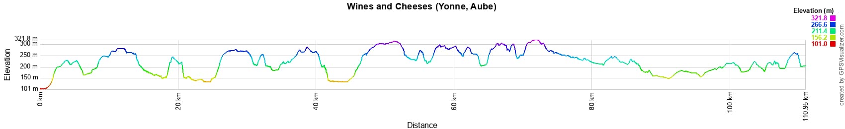
 Distance: 111km, Maximum elevation: 322m, Minimum elevation: 101m, Total ascent: 1506m
IGN Maps: 2620SB - AUXERRE TOUCY. 2719SB - SAINT-FLORENTIN FLOGNY-LA-CHAPELLE. 2720SB - CHABLIS CHAMPS-SUR-YONNE. 2818SB - BOUILLY CLEREY. 2819SB - CHAOURCE CHESLEY. 2820SB - TONNERRE ANCY-LE-FRANC.

Nearby paths:
![]() It is advisable to follow the beacons all along your hike and to bring the FFRandonnée topo-guide. You will also find information on MonGR.fr.
It is advisable to follow the beacons all along your hike and to bring the FFRandonnée topo-guide. You will also find information on MonGR.fr.
GR®, PR®, GRP® and the corresponding markings are trademarks of the French Federation of Hiking. They may not be reproduced without permission. The French Federation of Hiking, state-approved, includes organizations that maintain hiking routes. It publishes guides for these routes. With your donations, support the actions of the thousands of volunteer markers of the FFRandonnée.
GR-Infos.com is an editorial partner of MonGR.fr.
| Return |

Former holiday hotel with a garden along the Allier, L'Etoile Guest House is located in La Bastide-Puylaurent between Lozere, Ardeche, and the Cevennes in the mountains of Southern France. At the crossroads of GR®7, GR®70 Stevenson Path, GR®72, GR®700 Regordane Way, GR®470 Allier River springs and gorges, GRP® Cevenol, Ardechoise Mountains, Margeride. Numerous loop trails for hiking and one-day biking excursions. Ideal for a relaxing and hiking getaway.
Copyright©gr-infos.com (Authorization for private use only)
To help us maintain and improve GR-Infos.com, a contribution of 2€ is desired via Wero or bank transfer. Thank you!